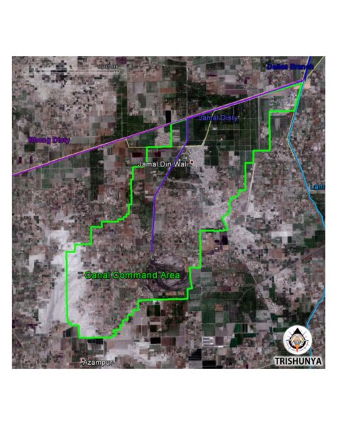
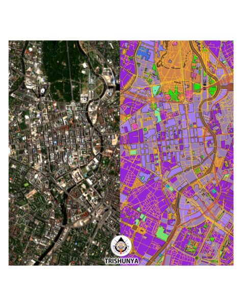
🛰️ 2D Geometrical Data Extraction from Satellite Images
📋 2D Geometrical Data Extraction service provides precise data from public satellite images.
💰 Rates are determined on a lump-sum basis, reflecting the scope and complexity of the data extraction and GIS conversion requirements.
📐 Our 2D Geometrical Data Extraction from Satellite Images service offers clients the ability to gather accurate geographical data without the need for on-site surveying.
🔍 By utilizing high-resolution public satellite imagery, we extract two-dimensional geometrical data that can be used for various applications, such as land assessment, environmental monitoring, and urban planning.
🏗️ This service is particularly useful for large or inaccessible areas where traditional surveying methods are impractical or time-consuming. Additionally, we offer GIS data conversion to provide clients with easily interpretable map data.
💼 Our team of experts ensures the extraction process is accurate and efficient, providing clients with reliable data for decision-making and analysis.
🌍 With our data extraction services, clients can efficiently manage projects and make informed decisions, even in challenging or remote locations.


📥 Input Required from Client:
📋 Details of the area of interest, including specific coordinates or boundaries.
📐 Requirements for data extraction, such as specific features or objects to identify.
🏗️ Information on the intended use of the extracted data or GIS maps.
📅 Project timeline, including any critical deadlines for data delivery.
💡 Additional instructions or preferences regarding data format or GIS conversion.
🗃 Scope of Work:
🔍 Initial consultation to understand the client's data needs and project objectives.
📐 Analysis of satellite imagery to identify and extract relevant geometrical data.
🖥️ Conversion of extracted data into GIS formats for easy analysis and visualization.
🔧 Verification and quality checks to ensure data accuracy and alignment with client specifications.
📊 Regular updates and communication with the client to provide progress reports and incorporate feedback.
📅 Timely delivery of complete data sets and GIS maps in accordance with the project schedule.
💼 Final review and handover of all data, ready for use in planning, analysis, and decision-making.
📡 Service Location:
📌 Availability: Our 2D Geometrical Data Extraction from Satellite Images services are available globally, As it does not require our physical presense to serve. For more information, please contact us directly.
Contact
-
Ahmedabad Branch :-
GF- 1,Ram krupa complex , Ambawadi, Ahmedabad, -
Gujarat 380006 -
Bhavanagr Branch :-
109, Eva Complex, Opposite Gulista Ground, Waghawadi Road, Bhavnagar - 364002. - 9510 785 007
- info@trishunya.com

