Trishunya Consultancy & Infrastructure is an advanced surveying company providing cutting-edge geospatial solutions across India. We specialize in Land Surveying, Bathymetry, and Drone Survey; delivering precision-grade data that powers infrastructure, construction, and environmental projects from conception to completion.
Our team deploys a comprehensive arsenal of survey technologies Total Station, DGPS/RTK, Drone (UAV), Auto-level, Bathymetry (SBES Sonar), GPR, LiDAR, 360° Camera, and Thermal Camera to deliver survey data that meets the highest engineering and regulatory standards.
From the remotest corridors of transmission line projects to the depths of river beds, we combine technological excellence with field expertise to map it all.
🗺️ PAN INDIA
Wall of Work
A glimpse into projects delivered across India
Our Services
Click any service to explore details, scope of work, and project gallery
Power Transmission Line Project
Telemetry VideoDEMDTMORTHOTopography+4 more
Power Transmission Line Project
We facilitate optimal routing and execution of transmission line projects through high-precision corridor mapping, ROW estimation, tower spotting, and tree enumeration.
📋 Scope of Work
Telemetry Video
High-definition aerial and ground video for corridor reconnaissance.
Drone360° Cam
📹 Video with Chainage, GPS, Markups
DEM, DTM & ORTHO
Digital Elevation/Terrain Models and Orthomosaic for terrain analysis.
Drone
🗺️ GeoTiff - DEM / DTM / Orthomosaic
Topography
Detailed mapping of natural and man-made features along the corridor.
DroneDGPS
🏞️ Topography Drawing
Tree Enumeration
Accurate counting and classification of vegetation within the ROW.
GPS
🌳 Geotagged tree data-sheet
Stakeout
Physical marking of tower foundation points with millimeter-level accuracy.
DGPSTotal Station
🚩 Field Work - Marking
Land Acquisition
Detailed land parcel maps and documentation for legal acquisition process.
AnalysisDocumentation
🏘️ Village map based acquisition drawing
Feature Geo Tagging
Digital tagging of critical assets and obstacles with precise coordinates.
DroneDGPS
📍 Geotagged Drawing or Feature File
✅ Why Choose Us
Rapid corridor mapping over difficult terrain.
Proven experience with industry leaders.
Comprehensive ROW documentation for faster clearances.
Village map and land cutting documentation for land acquisition.
Linear Project (Pipeline, Road, Railway, Corridor)
Telemetry VideoDEMDTMORTHOTopography+6 more
Linear Project (Pipeline, Road, Railway, Corridor)
Geospatial solutions for linear infrastructure: efficient alignment planning and earthwork optimization for highways, railways, pipelines, and metro corridors.
📋 Scope of Work
Telemetry Video
Visual documentation of entire route alignment.
Drone360° Cam
📹 Video with Chainage, GPS, Markups
DEM, DTM & ORTHO
3D terrain models to calculate gradients for alignment.
Drone
🗺️ GeoTiff DEM / DTM / Orthomosaic
Topography
Full-scale topographical mapping of existing ground features.
DroneDGPS
🏞️ Topography Drawing
Ground Subsurface Scan
Non-destructive detection of underground utilities.
GPR
📑 Drawing and Scan Report
Quantity Takeoff
Precise volumetric calculations for earthworks.
AnalysisDocumentation
🧮 Bill of Quantities, Cut/Fill Data
Hydrological Analysis
Water flow and catchment analysis for drainage design.
AnalysisDocumentation
📊 Analysis Report
Land Acquisition
Mapping affected plots for legal land transfer.
AnalysisDocumentation
🏘️ Village map based acquisition drawing
✅ Why Choose Us
High-speed data acquisition for long-distance corridors.
Integration of subsurface GPR data with surface maps.
Phase-wise video telemetry progress documentation.
Accurate contour and L/S preparation with cut/fill calculations.
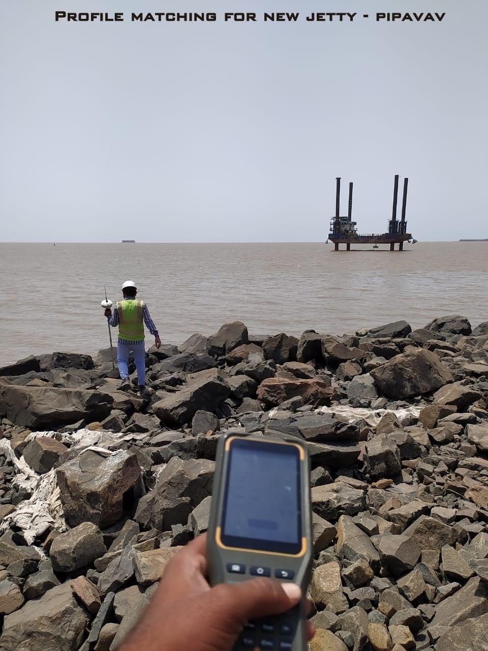
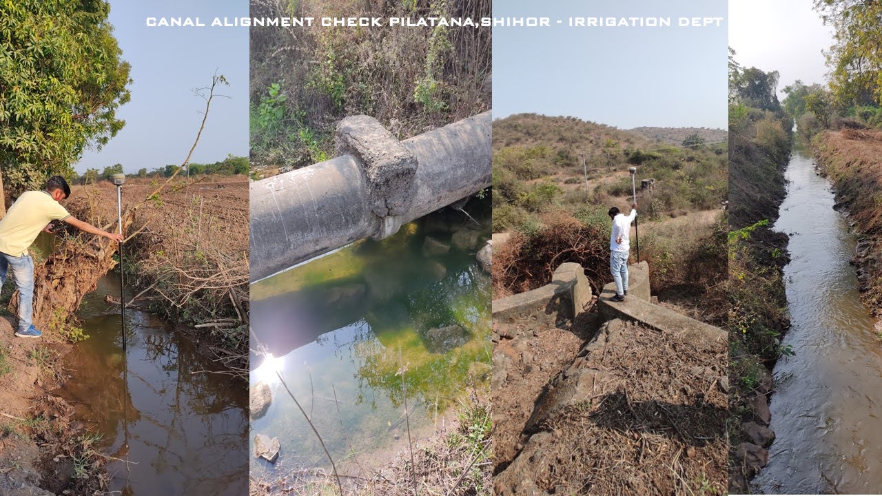
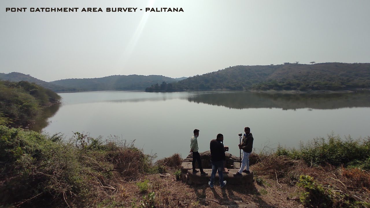
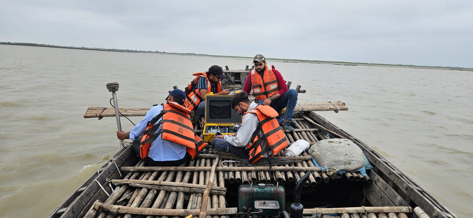
Hydrographic Project (Canal, Pond, River, Lake, Seashore)
Specialized surveying for water bodies: irrigation planning, dredging, capacity estimation, flood analysis using bathymetric data combined with shoreline mapping.
📋 Scope of Work
Underwater Survey
Bathymetric mapping to measure depth and map bed profile of water bodies.
Sonar (SBES)
🌊 Level Drawing, L/S Sheet, Tidal level data
Quantity Takeoff
Calculation of water holding capacity or silt volume.
AnalysisDocumentation
🧮 Bill of Quantities, Cut/Fill Data
Hydrological Analysis
Study of water flow patterns, catchment areas, and flood risks.
AnalysisDocumentation
📊 Analysis Report
✅ Why Choose Us
Combined above-water and underwater mapping capabilities.
Accurate sedimentation and silt volume analysis.
Equipment adaptable for shallow creeks and deep reservoirs.
Construction Project (Infrastructure, Industrial, Commercial)
From excavation to handover, we act as precision partner for construction sites — verifying structural alignments and tracking progress to prevent costly rework.
📋 Scope of Work
Telemetry Video
Periodic aerial video feeds to monitor site progress.
Drone360° Cam
📹 Video with Chainage, GPS, Markups
Stakeout
Precision layout of building corners, column centers, and grid lines from CAD drawings.
DGPSTotal Station
🚩 Field Work - Marking
Structural Alignment Check
Verification of verticality and horizontal alignment of structures.
Total Station
📏 Field Work - Marking / Checking
Ground Alignment Check
Ensuring road, curb, ROW alignment matches the master plan coordinates.
DGPSTotal Station
🧭 Field Work - Marking / Checking
Quantity Takeoff
Verification of material stockpiles and excavated volumes for billing.
AnalysisDocumentation
🧮 Bill of Quantities, Cut/Fill Data
✅ Why Choose Us
Drastic reduction in construction layout errors.
Independent third-party verification of contractor work.
Scanning or Inspection Work (Building, Bridge, Industry, Tower)
RGB ScanLiDAR ScanThermal ScanGround Subsurface ScanStructural Alignment Check+1 more
Scanning or Inspection Work (Building, Bridge, Industry, Tower)
Advanced scanning and aerial sensing to inspect complex structures — creating digital twins of bridges, mobile towers, buildings, and mines without human risk.
📋 Scope of Work
RGB Scan
High-resolution photogrammetry for realistic 3D models.
DroneHandheld RGB Cam
📸 RGB Images or 3D Mesh Model
LiDAR Scan
Laser scanning to penetrate vegetation or capture complex geometries.
DroneHandheld LiDAR
☁️ Point Cloud File
Thermal Scan
Infrared imaging to detect heat leaks and overheating components.
Drone (Thermal)
🌡️ Thermal Images
Ground Subsurface Scan
Detection of underground voids, pipelines, or rebar inside concrete.
GPR
📑 Drawing and Scan Report
Structural Alignment Check
Monitoring deformation or shifts in critical infrastructure.
Total Station
📏 Field Work - Marking / Checking
360° Imagery
Immersive panoramic views for virtual walkthroughs and remote asset management.
ORTHOTopographyFeature Geo TaggingStakeoutThermal Scan+1 more
Solar Park Project
Our surveys maximize solar energy efficiency — contour survey for levels, geotagging of site features, hydrological flood-risk analysis, and thermal scan for post-installation health checks.
📋 Scope of Work
Topography & ORTHO
Contour mapping and orthomosaic for site planning and level data.
DroneDGPS
🏞️ Topography Drawing / Orthomosaic
Feature Geo Tagging
Geotagging of site boundaries, roads, and utilities.
DroneDGPS
📍 Geotagged Feature File
Stakeout
Panel row and inverter layout marking from design coordinates.
DGPSTotal Station
🚩 Field Work - Marking
Thermal Scan
Infrared inspection of installed panels to detect malfunctioning cells.
Drone (Thermal)
🌡️ Thermal Images
Hydrological Analysis
Flood risk and drainage analysis for site safety.
AnalysisDocumentation
📊 Analysis Report
✅ Why Choose Us
Precise slope analysis for optimal panel placement.
Hydrological study to prevent waterlogging.
Post-installation thermal inspection for fault detection.
We support urban development authorities and smart city missions with large-scale geospatial data, base maps, and asset documentation for planning and infrastructure.
📋 Scope of Work
Base Map & ORTHO
High-resolution aerial base maps for urban planning.
Drone
🛰️ Orthomosaic GeoTiff
DEM / Topography
Elevation data for drainage and infrastructure planning.
DroneDGPS
🏞️ Topography Drawing / DEM
Feature Geo Tagging
Digital documentation of utilities, roads, and civic assets.
DroneDGPS
📍 Geotagged Feature File
360° Imagery
Street-level panoramic documentation for virtual city tours.
360° Cam
🔄 360 Video / Image
✅ Why Choose Us
Large area coverage with drone-based mapping.
High-resolution orthomosaics for planning overlays.
Feature geo-tagging of all urban assets.
📂 Project photos coming soon. Upload images to Projects/Urban Planning and Smart City Project/ to display them here.
We develop GIS databases, custom dashboards, and spatial analysis outputs from multi-sensor surveys — enabling data-driven decisions for infrastructure, environment, and urban projects.
📋 Scope of Work
GIS Database Creation
Structured spatial database from survey data.
AnalysisGIS
📈 GIS Layer Files / Geodatabase
Orthomosaic & DEM
Georeferenced rasters as GIS input layers.
Drone
🛰️ GeoTiff Rasters
Custom Dashboard
Web or desktop GIS dashboard for project monitoring.
DocumentationGIS
📈 Custom Dashboard
Feature Geo Tagging
Attributed point/line/polygon layers from field surveys.
DroneDGPS
📍 Geotagged Feature Layers
✅ Why Choose Us
Integration of drone, DGPS, and satellite data layers.
Custom GIS dashboards and attribute tables.
Compatible with ArcGIS, QGIS, and web mapping platforms.
Rapid response mapping for disaster assessment, flood zone delineation, and emergency infrastructure planning using drone and satellite-integrated surveys.
📋 Scope of Work
Rapid Aerial Assessment
Immediate drone deployment for disaster area documentation.
Drone
📹 Video / Orthomosaic
DEM & Flood Analysis
Elevation data for flood inundation modelling.
Drone
🗺️ DEM / Flood Zone Map
Affected Area Mapping
Geo-tagged documentation of damaged infrastructure.
DroneDGPS
📍 Geotagged Feature File
✅ Why Choose Us
Rapid mobilization within 24–48 hours.
Real-time video for situation assessment.
Flood risk modelling and affected area mapping.
📂 Project photos coming soon. Upload images to Projects/Disaster Management & Emergency Mapping Services/ to display them here.
For large-scale projects exceeding 50 km², we deploy multi-drone operations with systematic flight planning and ground control networks for seamless, accurate coverage.
📋 Scope of Work
Large Area Orthomosaic
Seamless high-resolution mosaic of vast areas.
Drone
🛰️ GeoTiff Orthomosaic
DEM / DTM
Corridor-scale or nationwide terrain models.
Drone
🗺️ GeoTiff DEM / DTM
Topography
Full topographic mapping including contours and features.
DroneDGPS
🏞️ Topography Drawing
✅ Why Choose Us
Multi-drone fleet for parallel coverage.
Systematic GCP network for mosaic accuracy.
Experience with 500+ km² area projects.
📂 Project photos coming soon. Upload images to Projects/Mega Aerial Survey/ to display them here.
Telemetry VideoDEMORTHOTopographyLiDAR Scan+1 more
Defense Project
We support defense and strategic infrastructure projects with high-accuracy spatial data, terrain analysis, and deliverables compliant with applicable guidelines.
📋 Scope of Work
Terrain Mapping
High-accuracy DEM and topography for strategic terrain analysis.
DroneDGPS
🗺️ DEM / Topography Drawing
Video Surveillance
Telemetry video for perimeter and area reconnaissance.
Drone360° Cam
📹 Video with GPS Overlay
LiDAR Scan
Dense point cloud for precise structural and terrain data.
DroneHandheld LiDAR
☁️ Point Cloud File
✅ Why Choose Us
High security data handling protocols.
Precise terrain data for strategic planning.
Experience with restricted-area survey coordination.
📂 Project photos coming soon. Upload images to Projects/Defense Project/ to display them here.
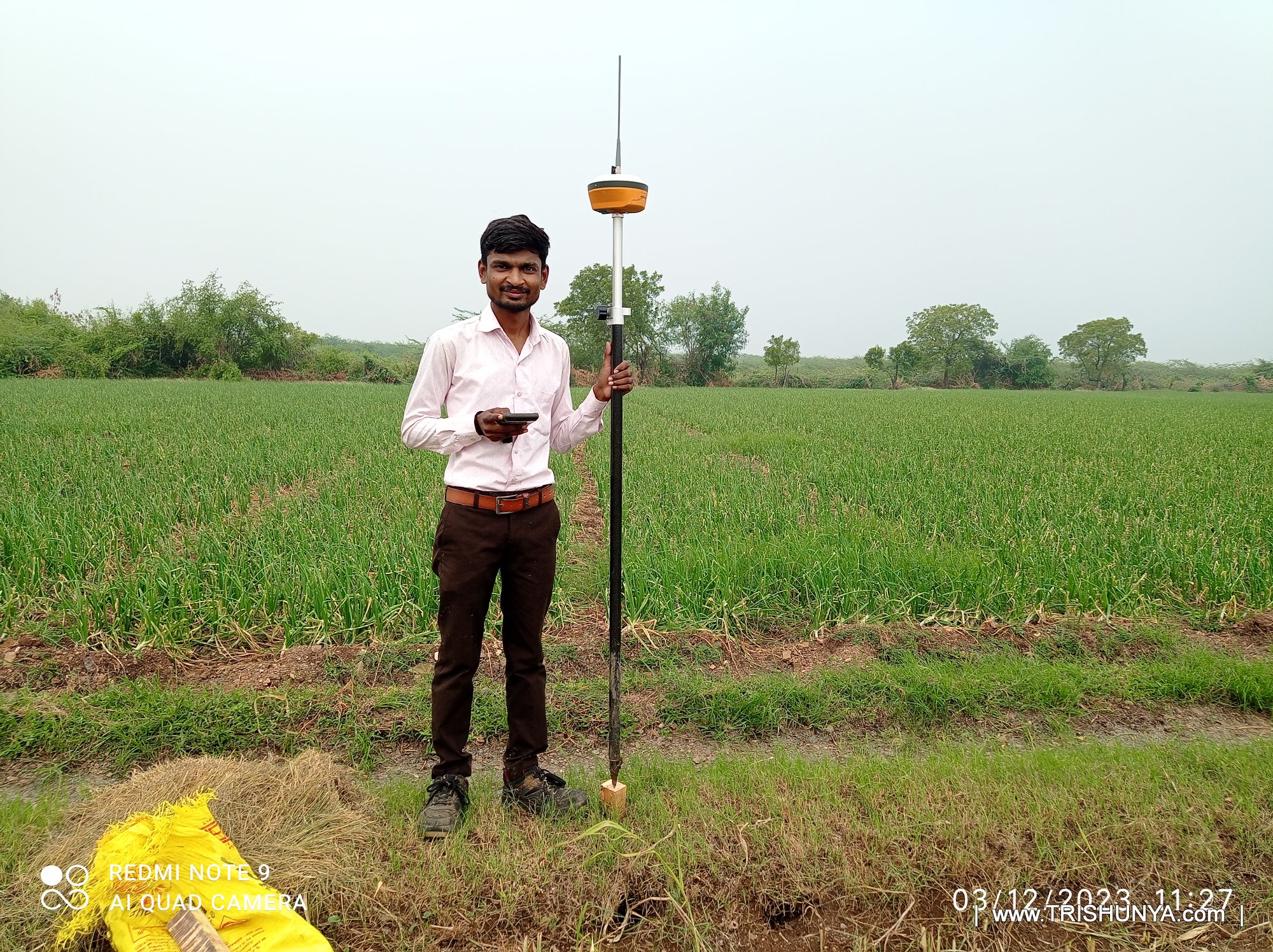
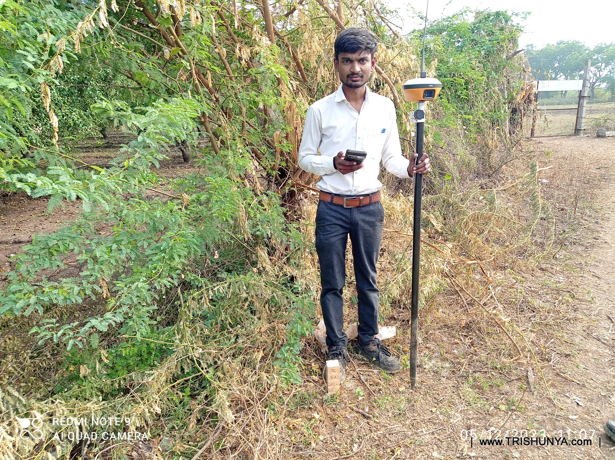
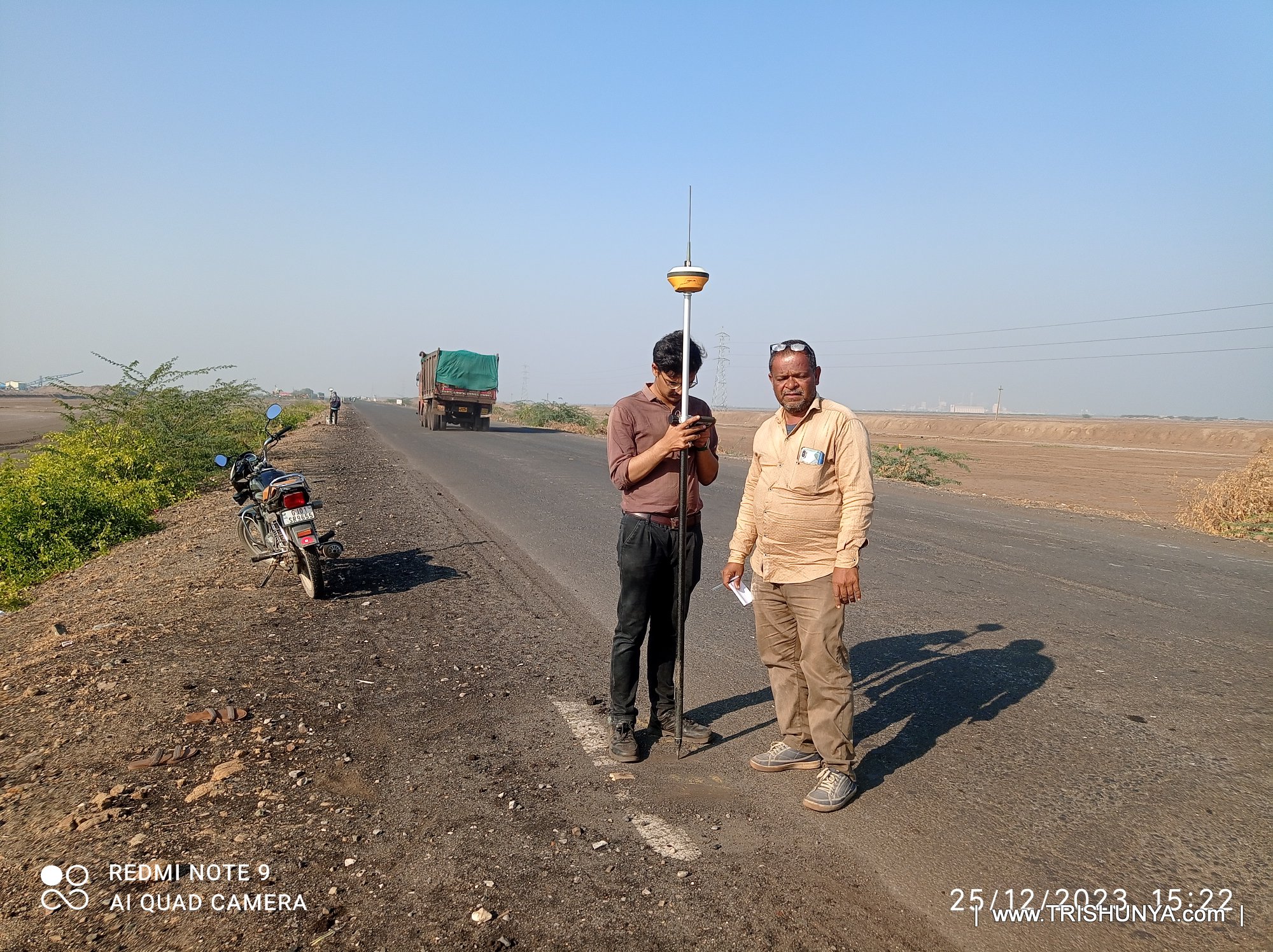
DGPS/RTK surveys deliver centimeter-level positional accuracy for control point establishment, stakeout, topographic surveys, and land boundary delineation.
📋 Scope of Work
Control Point Establishment
High-accuracy GCPs for photogrammetry and topographic surveys.
DGPSRTK
📍 Coordinate Database
Topographic Survey
Detailed ground survey for contour and feature mapping.
DGPSTotal Station
🏞️ Topography Drawing
Stakeout
Setting out design coordinates on ground for construction.
DGPSTotal Station
🚩 Field Work - Marking
Land Boundary Survey
Accurate delineation of land parcels for legal and planning purposes.
Complete reference of our 24 work types, equipment used, and deliverable formats
Frequently Asked Questions
Common questions about our surveying services
How quickly can you deliver a survey quotation?
We deliver quotations on the same day for most standard projects. Once you share your project location, area coverage, and type of survey required via WhatsApp or our enquiry form - our team prepares a detailed quotation within hours. Complex multi-technology projects may require one business day.
Which states / regions do you cover in India?
Trishunya operates PAN INDIA. We have offices in Bhavnagar (Gujarat HQ), Delhi NCR, Ahmedabad, and Surat, allowing us to mobilize rapidly to any state. We have successfully executed projects in Gujarat, Rajasthan, Maharashtra, Madhya Pradesh, Uttar Pradesh, Delhi, Haryana, and more.
What accuracy does your DGPS / RTK survey achieve?
Our DGPS/RTK equipment achieves centimeter-level horizontal accuracy (±1–3 cm RMS) and ±2–5 cm vertical accuracy under open-sky conditions. For Total Station work, we achieve sub-centimeter accuracy. All control points use network RTK corrections or post-processed baseline adjustments.
How does Bathymetric / Underwater survey work?
We use Single Beam Echo Sounder (SBES) Sonar mounted on a survey boat with integrated DGPS positioning to map the underwater bed profile of rivers, canals, ponds, lakes, and reservoirs. The system records depth at every GPS position, producing underwater contour drawings, capacity calculations, silt volume estimates, and L/S profile sheets.
What data formats and deliverables do you provide?
Drone surveys: GeoTIFF DEM/DTM/Orthomosaics, LAS/LAZ point clouds (LiDAR), AutoCAD DWG drawings. DGPS/Total Station: DWG/DXF drawings and coordinate CSV sheets. Bathymetry: depth contour drawings and volume reports. GPR: scan reports and subsurface drawings. We also provide KMZ/GeoJSON layers for GIS integration.
Do you work with government / PSU clients?
Yes. We have experience working with government bodies, PSUs, and large EPC contractors across power transmission, irrigation, road, railway, and solar sectors. We are familiar with regulatory requirements, quality documentation standards, and reporting formats expected by government and infrastructure clients.
How long does a typical drone survey take?
For a typical 5–10 km² area, field data acquisition takes 1-2 days. For linear corridor surveys (e.g., 50 km transmission line), our teams cover 15–20 km/day. Data processing and delivery of orthomosaic/DEM/DWG outputs typically takes 3–5 working days after field work.
What is Ground Penetrating Radar (GPR) used for?
GPR is used for non-destructive detection of underground utilities, voids, rebar inside concrete, and subsurface anomalies — without excavation. Common applications: utility mapping before road/pipeline construction, detecting hidden rebar and post-tension cables in bridges/buildings, locating underground tanks or voids, and pavement layer thickness analysis.
Downloads & Portfolio
Explore our project portfolios and capability documents
Get In Touch
Reach out for surveying consultations, project quotes, or partnership enquiries
.jpg)
2.jpg)
.jpg)
.jpg)
.jpg)
.jpg)
.jpg)
1.jpg)
.jpg)
.jpg)
.jpg)
.jpg)
.jpg)
.jpg)
.jpg)
.jpg)
.jpg)
.jpg)
.jpg)
.jpg)
.jpg)
.jpg)
.jpg)
.jpg)
.jpg)
.jpg)
.jpg)
.jpg)

.JPG)
.jpg)
.JPG)
.jpg)
.jpg)
.jpg)
.jpg)