በህንድ ውስጥ ለ2026 ምርጥ የቅየሳ ደረጃ LiDAR ድሮኖች
በ2026 የLiDAR ድሮን መድረክን መምረጥ በመግለጫ ወረቀት ላይ ከፍተኛውን ቁጥር ከማሳደድ ይልቅ የሴንሰር ዝርዝሮችን ከትክክለኛው የፕሮጀክት ፍላጎትዎ ጋር ማዛመድን ይጠይቃል። ጫካን፣ የመተላለፊያ መስመርን ወይም የግንባታ ቦታን እየቀየሱ እንደሆነ ላይ በመመስረት የርቀት ወሰን፣ የነጥብ ፍጥነት እና ትክክለኛነት እያንዳንዳቸው የተለያየ ጠቀሜታ አላቸው።
የተቀናጁ የLiDAR ጭነቶች አሁን ውድ በሆኑ ልዩ መድረኮች ላይ ብቻ ከመገኘት ይልቅ በመካከለኛ ደረጃ የቅየሳ ድሮኖች ላይ የተለመዱ በመሆናቸው ገበያው በከፍተኛ ሁኔታ አድጓል። ይህ ለውጥ በህንድ ውስጥ ላሉ የማንኛውም መጠን የቅየሳ ድርጅቶች ትክክለኛ የመሬት ገጽታ መረጃ በቀላሉ ተደራሽ እንዲሆን አድርጓል።
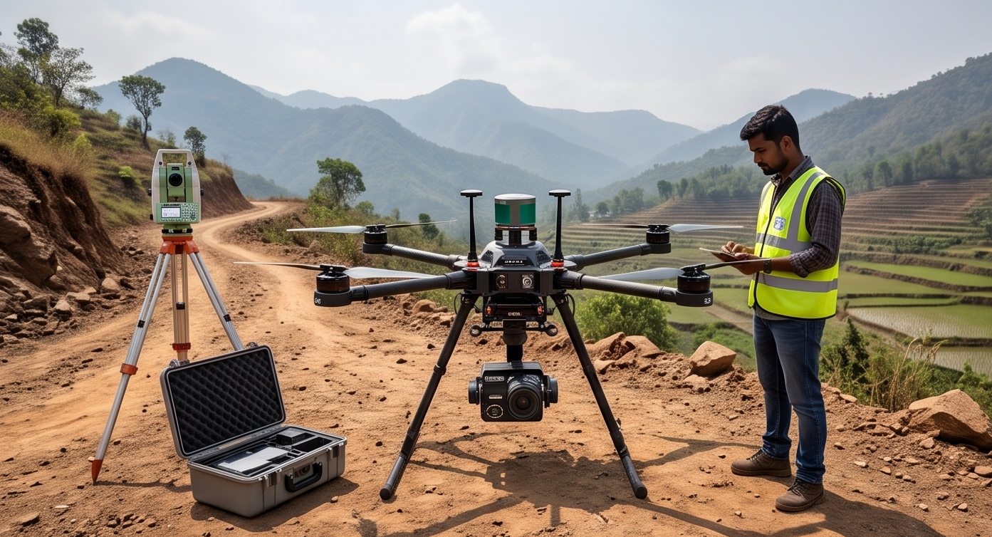
ዝርዝሮችን በቀጥታ የራዳር ገበታ ላይ ያነጻጽሩ
ተዘዋዋሪ የዝርዝሮች ንጽጽር
የበጀት እና የትክክለኛነት ተስማሚ ሚዛንዎን ያግኙ
በይነተገናኝ የበጀት እና የውጤት መርማሪ
ለፕሮጀክትዎ የትኛው የድሮን ክፍል ተስማሚ ነው?
የፕሮጀክትዎን ዓይነት ይጫኑ
በእርግጥ ሊነጻጸሩ የሚገባቸው ነገሮች
የሴንሰር የርቀት ወሰን እና የእይታ መስክ
ረጅም የርቀት ወሰን እና ሰፊ የእይታ መስክ በእያንዳንዱ በረራ ተጨማሪ መሬት እንዲሸፍኑ ያስችሉዎታል፣ ነገር ግን ብዙውን ጊዜ የነጥብ ጥግግትን ሊቀንስ ይችላል።
የነጥብ ፍጥነት እና ጥግግት
በሰከንድ ተጨማሪ የብርሃን ምቶች ማለት ይበልጥ ጥቅጥቅ ያለ የነጥብ ደመና ማለት ነው፣ ይህም ለዝርዝር የደን ወይም የምህንድስና ሥራ ወሳኝ ነው።
የአቀማመጥ ትክክለኛነት
የተቀናጀው ጂፒኤስ እና የእንቅስቃሴ መለኪያ ክፍል (IMU) ጥራት የመጨረሻውን የነጥብ ደመና ትክክለኛነት በቀጥታ ይወስናል።
የጭነት ክብደት እና የበረራ ጊዜ
ከባድ የLiDAR ሴንሰር ጭነቶች የበረራ ቆይታን ይቀንሳሉ፣ ይህም አንድ ባትሪ ሊሸፍነው የሚችለውን የመሬት ስፋት ይነካል።
የሶፍትዌር ሥነ-ምህዳር
የመረጃ ማቀነባበሪያ ሶፍትዌር ተኳኋኝነት እና የሥራ ፍሰት ድጋፍ ልክ እንደ ሃርድዌሩ ራሱ አስፈላጊ ናቸው።
| የድሮን ክፍል | ይበልጥ ተስማሚ ለ | የተለመደ ትክክለኛነት |
|---|---|---|
| አነስተኛ መልቲሮተር LiDAR | አነስተኛ ቦታዎች፣ የከተማ ቅየሳዎች | 3-5 ሳ.ሜ |
| መካከለኛ ደረጃ የቅየሳ LiDAR | አጠቃላይ የመሬት አቀማመጥ፣ የመተላለፊያ መስመሮች | 2-4 ሳ.ሜ |
| ከባድ ጭነት የረጅም ርቀት LiDAR | የደን ልማት፣ ረጅም የመተላለፊያ ኮሪደሮች | 2-3 ሳ.ሜ |
ከፍተኛ ዋጋ በቀጥታ ለተወሰነ ፕሮጀክትዎ የተሻለ ውጤት ማለት አይደለም። ጥሩ የጂፒኤስ ውህደት ያለው አነስተኛ ድሮን በዝርዝር የከተማ ቦታ ላይ ውድ ከሆነው የረጅም ርቀት መድረክ የተሻለ አፈጻጸም ሊኖረው ይችላል።
ምርጡ የLiDAR ድሮን ምርጥ የዝርዝር መግለጫ ወረቀት ያለው አይደለም። ከመሬት አቀማመጥዎ እና ከሚፈልጉት ውጤት ጋር በትክክል የተዛመደው ነው።
ለፕሮጀክትዎ ትክክለኛውን መድረክ መምረጥ
የሴንሰር ዝርዝሮችን ከትክክለኛ የፕሮጀክት መስፈርቶች ጋር ማዛመድ ልምድ ያላቸው ባለሙያዎች ከሃርድዌሩ ባለፈ እውነተኛ እሴት የሚጨምሩበት ነው። የእኛ የድሮን ቅየሳ ቡድን የሚፈልጉትን ትክክለኛነት የሚያቀርበውን የLiDAR ስካን መድረክ ከመምከሩ በፊት የቦታዎን ሁኔታ ይገመግማል።
የትኛው የLiDAR መድረክ ለፕሮጀክትዎ እንደሚስማማ እርግጠኛ አይደሉም?
የመሬት አቀማመጥዎን እና የሚፈልጉትን የውጤት መስፈርቶች ይንገሩን እና ትክክለኛውን አቀራረብ እንመክራለን።
ተደጋግመው የሚጠየቁ ጥያቄዎች
ከተቀናጀው ጂፒኤስ እና የእንቅስቃሴ መለኪያ ክፍል (IMU) የሚገኘው የአቀማመጥ ትክክለኛነት የመጨረሻውን የነጥብ ደመና ትክክለኛነት በቀጥታ ስለሚወስን በጣም ወሳኝ ነው።
አዎ፣ ከባድ የLiDAR ሴንሰር ጭነቶች በአጠቃላይ የበረራ ቆይታን ይቀንሳሉ፣ ይህም አንድ የባትሪ ኃይል ሊሸፍነው የሚችለውን የመሬት ስፋት ይነካል።
በጭራሽ፣ በጥሩ ሁኔታ የተስተካከለ አነስተኛ መድረክ በትንንሽ ወይም ዝርዝር የፕሮጀክት ቦታዎች ላይ ውድ ከሆነው የረጅም ርቀት ድሮን የተሻለ አፈጻጸም ሊኖረው ይችላል።
የደን ቅየሳዎች የዛፍ ቅርንጫፎችን መዋቅር በትክክል ለመያዝ እና ከዛፎች በታች አስተማማኝ የመሬት ምደባ ለማድረግ ከፍተኛ የነጥብ ጥግግት ይጠቀማሉ።
ብዙ የቅየሳ ድሮን መድረኮች ተለዋዋጭ ጭነቶችን ይደግፋሉ፣ ይህም አንድ ዓይነት አካል የLiDAR ሴንሰር ወይም የፎቶግራሜትሪ ካሜራ እንዲሸከም ያስችለዋል።
ዘመናዊ የቅየሳ ደረጃ LiDAR ድሮኖች እንደ ሴንሰር ጥራት፣ የበረራ ከፍታ እና የመሬት መቆጣጠሪያ ነጥቦች (GCPs) አጠቃቀም ላይ በመመስረት ከሁለት እስከ አምስት ሴንቲሜትር ትክክለኛነት ያስመዘግባሉ።
ሰፊ የእይታ መስክ ነጠላ የበረራ መስመር ተጨማሪ መሬት እንዲሸፍን ያስችለዋል፣ ይህም የሚያስፈልገውን የበረራ ምልልስ በመቀነስ አጠቃላይ የቅየሳ ቅልጥፍናን ያሻሽላል።
ከጥሬ የLiDAR መረጃ የመሬት ገጽታ ሞዴሎችን ለመገንባት እና የመጨረሻ ሪፖርቶችን ለማውጣት ልዩ የነጥብ ደመና ማቀነባበሪያ ሶፍትዌር ያስፈልጋል።
LiDAR የተገጠመላቸው ድሮኖች በክብደት ምድባቸው መሠረት በመደበኛ የDGCA ድሮን ደንቦች ሥር ይወድቃሉ፣ ይህም ተገቢውን ምዝገባ እና የአብራሪ ፈቃድ ያስፈልጋቸዋል።
ለነጠላ ፕሮጀክቶች፣ ነባር የLiDAR መሣሪያዎች ካለው የቅየሳ ድርጅት አገልግሎት መከራየት ልዩ ሃርድዌር በቀጥታ ከመግዛት የበለጠ ወጪ ቆጣቢ ነው።
ይህ መስመር ለፕሮጀክት ደንበኞች ብቻ የተከለለ ነው። እባክዎ ለትምህርት፣ ለሥልጠና ወይም ለሥራ ጥያቄዎች አያነጋግሩን።