የካዳስተር ቅየሳ vs የቶፖግራፊ ቅየሳ፡ ትክክለኛው ልዩነት ምንድን ነው?
አንድ አርክቴክት ለአንድ ቦታ 'የቅየሳ ሪፖርት' ጠይቆን ነበር፣ አንድ ሰነድ ሁለቱንም ሕጋዊ ወሰን እና ለዲዛይኑ የሚያስፈልጉትን የመሬት ከፍታዎች ያካትታል ብሎ በማሰብ። ነገር ግን በተግባር እንደዚያ አይሰራም። የካዳስተር ቅየሳ እና የቶፖግራፊ ቅየሳ ለሁለት ፍጹም የተለያዩ ጥያቄዎች መልስ ይሰጣሉ፣ እና እነዚህን ማደባለቅ ፕሮጀክቶችን ሳያስፈልግ ያዘገያል።
የካዳስተር ቅየሳ የሕጋዊ የይዞታ ወሰን መስመር በትክክል የት እንደሚገኝ ያረጋግጣል። በሌላ በኩል፣ የቶፖግራፊ ቅየሳ በመሬቱ ላይ ያለውን ትክክለኛ አካላዊ ሁኔታ ያሳያል፡ የመሬት ከፍታ፣ ተዳፋት፣ የፍሳሽ ማስወገጃ መስመሮች፣ ዛፎች እና ነባር ሕንፃዎች። አንዱ የባለቤትነት አለመግባባቶችን ይፈታል፣ ሌላኛው ደግሞ ለኢንጂነሪንግ እና ዲዛይን ውሳኔዎች መረጃ ይሰጣል። አብዛኛዎቹ ትልልቅ ፕሮጀክቶች ሁለቱንም ይፈልጋሉ።
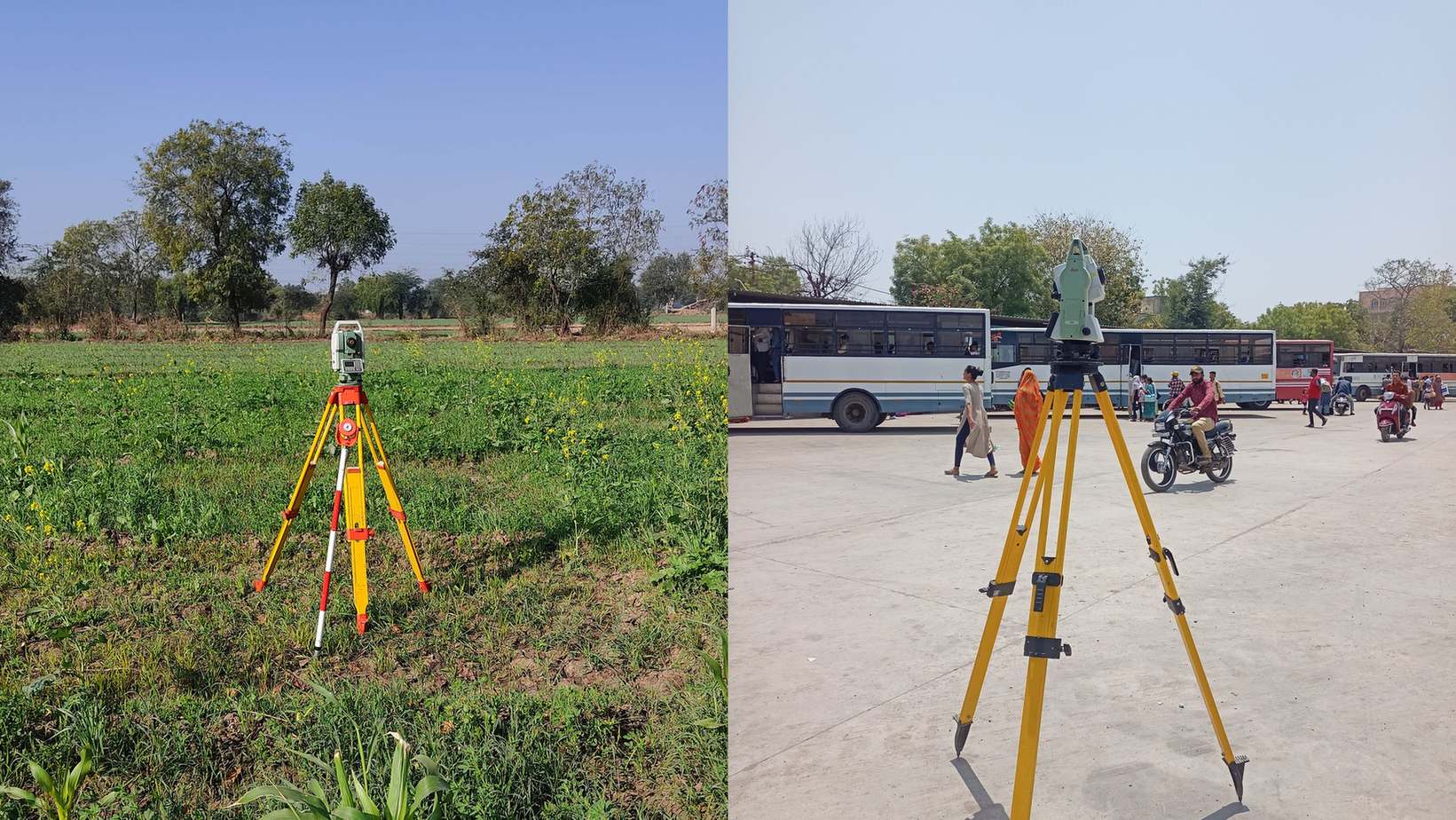
የካዳስተር ቅየሳ የሚያረጋግጠው እና የሕግ ተቀባይነቱ
የካዳስተር ቅየሳ (የወሰን ቅየሳ) የንብረቱን ሕጋዊ ወሰኖች ይወስናል እንዲሁም ይመዘግባል። ለግዢ እና ሽያጭ፣ መሬት ለመከፋፈል እና የወሰን አለመግባባቶችን ለመፍታት የሚያገለግል ይፋዊ መዝገብ ነው። ፍርድ ቤት ወይም የመሬት ምዝገባ ቢሮ ወሰንን ማረጋገጥ ሲያስፈልጋቸው፣ ፈቃድ ያለው የቅየሳ ባለሙያ የካዳስተር ሥራ ብቻ ሕጋዊ ተቀባይነት ይኖረዋል።
በቶፖግራፊ ቅየሳ ውስጥ ምን ይመዘገባል
የቶፖግራፊ ቅየሳ የመሬቱን ባለ 3D ቅርጽ እና አካላዊ ባህሪያት ይመዘግባል፡ የከፍታ መስመሮች (ኮንቱር)፣ ተዳፋት፣ ነባር ሕንፃዎች፣ ዛፎች፣ የተፈጥሮ የውሃ ፍሳሽ መስመሮች እና በመሬት ላይ የሚታዩ መሠረተ ልማቶች። በባለቤትነት ላይ ምንም ዓይነት ሕጋዊ ሥልጣን የለውም፣ ነገር ግን ማንኛውም ሲቪል መሐንዲስ ወይም አርክቴክት ያለዚህ መረጃ የመሠረት ዲዛይን ወይም የመንገድ አሰላለፍ መሥራት አይችልም።
የካዳስተር ቅየሳ (Cadastral)
- የይዞታውን ሕጋዊ ወሰኖች እና ትክክለኛ ስፋት በግልጽ ይገልጻል
- ለመሬት ሽያጭ፣ ቦታ ለመከፋፈል እና ለይዞታ ማረጋገጫ ካርታ ምዝገባ ያገለግላል
- ፈቃድ ባለው ባለሙያ ሲሠራ በፍርድ ቤት ሕጋዊ አስገዳጅነት አለው
- ውጤት፡ ይፋዊ ኮኦርዲኔት እና ሕጋዊ ስፋት ያለው የወሰን ፕላን
የቶፖግራፊ ቅየሳ (Topographic)
- የመሬት ከፍታ፣ ተዳፋት እና ሁሉንም አካላዊ ገጽታዎች ካርታ ያዘጋጃል
- ለሕንፃ ዲዛይን፣ የመሬት ቁፋሮ ስሌት እና የውሃ ፍሳሽ ማስተካከያ አስፈላጊ ነው
- በባለቤትነት መብት ላይ ምንም ዓይነት ሕጋዊ ማስረጃነት የለውም
- ውጤት፡ የኮንቱር ካርታ፣ የDTM ሞዴል፣ የCAD ንድፎች እና የመሬት ገጽታዎች
የሚቀርቡ ሰነዶች ንጽጽር
| መስፈርት | የካዳስተር ቅየሳ | የቶፖግራፊ ቅየሳ |
|---|---|---|
| ዋና ውጤት | ሕጋዊ ኮኦርዲኔት ያለው የወሰን ፕላን | የኮንቱር ካርታ፣ DTM፣ ዝርዝር የCAD ንድፍ |
| ሕጋዊ ጥቅም | የመሬት ግብይት፣ ምዝገባ፣ የወሰን ክርክር | ለኢንጂነሪንግ ዲዛይን እና ግንባታ ብቻ |
| የሜዳ ዘዴ | በወሰን ምልክቶች ላይ DGPS ወይም Total Station | ድሮን፣ DGPS ወይም በጠቅላላው ቦታ ላይ Total Station |
| የሚያስፈልግበት ጊዜ | መሬት ሲገዙ፣ ሲሸጡ ወይም ሲከፋፍሉ | የሕንፃ፣ የመንገድ ወይም የፍሳሽ ዲዛይን ከመጀመሩ በፊት |
ሁለቱም ቅየሳዎች መቼ ያስፈልጋሉ
ወሰኖቹ በቅርቡ በይፋ ላልተረጋገጡ ለማንኛውም የግንባታ ፕሮጀክት ሁለቱም ቅየሳዎች ወሳኝ ናቸው፡ የካዳስተር ቅየሳ በራስዎ ሕጋዊ መሬት ውስጥ እየገነቡ መሆንዎን ያረጋግጣል፣ የቶፖግራፊ ቅየሳ ደግሞ ለዲዛይን ቡድኑ የመሬቱን ትክክለኛ ገጽታ ይሰጣል። ሁለቱንም በአንድ የመስክ ጉብኝት ማከናወን ጊዜንና ወጪን ይቆጥባል።
በቅድሚያ ሕጋዊ ወሰንን ያረጋግጡ
በቦታው ላይ ማንኛውም የዲዛይን ሥራ ከመጀመሩ በፊት የካዳስተር ቅየሳ ሕጋዊ ወሰንን ያረጋግጣል።
በወሰኑ ውስጥ ያለውን የመሬት ገጽታ ካርታ ያዘጋጁ
የቶፖግራፊ ቅየሳ በተረጋገጠው ወሰን ውስጥ ከፍታዎችን እና አካላዊ ነገሮችን ይመዘግባል።
ሁለቱንም መረጃዎች ለዲዛይን ቡድኑ ያስረክቡ
መሐንዲሶች መረጃውን ለዲዛይን ይጠቀማሉ፣ የካዳስተር ፕላኑ ደግሞ ሕጋዊ ገደቦችን ያረጋግጣል።
የቶፖግራፊ ፕላንን እንደ ወሰን ማረጋገጫ በመቁጠር ምክንያት የመሠረት ዲዛይኖች እንደገና እንዲሠሩ የተገደዱባቸውን በርካታ አጋጣሚዎች አይተናል። እነዚህ ሁለት ሰነዶች የተለያዩ ዓላማዎችን ያገለግላሉ።
አንዱ ቅየሳ በሕግ ምን እንደያዙ ይነግርዎታል፤ ሌላኛው ደግሞ በእሱ ላይ እንዴት በትክክል መገንባት እንዳለብዎ ያሳያል።
የእኛ የቶፖግራፊ ቅየሳ አገልግሎት በየDGPS እና RTK ቅየሳ በኩል በDGPS ከተረጋገጠ የወሰን መረጃ ጋር የተጣመረ በመሆኑ ለገንቢዎች በአንድ ጉብኝት የተሟላ መረጃ ይሰጣል።
የወሰን ቅየሳ፣ የቶፖግራፊ ቅየሳ ወይም ሁለቱንም ይፈልጋሉ?
የፕሮጀክትዎን ዝርዝር ይንገሩን፣ እኛም ተገቢውን የቅየሳ ዕቅድ እናዘጋጅልዎታለን።
ተደጋግመው የሚጠየቁ ጥያቄዎች (FAQ)
የካዳስተር ቅየሳ ሕጋዊ ወሰንን ይወስናል፣ የቶፖግራፊ ቅየሳ ደግሞ ለዲዛይን የሚሆን የመሬት ከፍታ እና ተዳፋት ካርታ ያዘጋጃል።
አዎ፣ በተለይም የቦታው ወሰን በቅርብ ጊዜ ካልተረጋገጠ ትክክለኛው ስፋት ከሰነዱ ጋር መመሳሰሉን ለማረጋገጥ አስፈላጊ ነው።
አይቻልም። ቶፖግራፊ ነባር አጥሮችን ብቻ ያሳያል እንጂ ባለቤትነትን አያረጋግጥም። ለክርክር የካዳስተር ቅየሳ ያስፈልጋል።
የመሬቱ ከፍታና ዝቅታ የመሠረት ጥልቀትን፣ የመሬት ቁፋሮን እና የዝናብ ውሃ ፍሳሽን በቀጥታ ስለሚወስኑ ነው።
ከመንግሥት የመሬት ኮድ ጋር የተያያዘው ይፋዊ የካዳስተር ወሰን ቅየሳ ፕላን።
አዎ። DGPS እና ድሮን ቴክኖሎጂን በመጠቀም ወሰኖችን እና የመሬት ገጽታን በአንድ ጊዜ በትክክል መመዝገብ ይቻላል።
የAutoCAD (DWG) ንድፎች፣ ዲጂታል የመሬት ሞዴል (DTM)፣ የኮንቱር መስመሮች እና የመሬት ገጽታዎች ይሰጣሉ።
አዎ። ፈቃድ ባለው ባለሙያ የተዘጋጀ ሪፖርት ብቻ በፍርድ ቤት እና በመንግሥት መሥሪያ ቤቶች ተቀባይነት አለው።
ካዳስተር የጎረቤት ወሰን የመጣስ አደጋን ያስቀራል፣ ቶፖግራፊ ደግሞ ለኢንጂነሪንግ ስሌት ትክክለኛ መረጃ ይሰጣል።
በመሬት ላይ የሚታዩ ምልክቶችን ብቻ ያሳያል። ሙሉ የመሬት ውስጥ መሠረተ ልማቶችን ለማወቅ የጂኦራዳር (GPR) ቅኝት ያስፈልጋል።
ይህ መስመር ለቴክኒካል ፕሮጀክት ጥያቄዎች ብቻ የተመደበ ነው። እባክዎ ለሥራ ወይም ለስልጠና ጥያቄ አይገናኙ።