የኮንቱር ቅየሳ (Contour Survey)፡ ዋጋ እና ለግንባታ ባለሙያዎች ያለው ጥቅም
አንድ ጊዜ አንድ ግንበኛ ምንም ዓይነት የመሬት ከፍታና ዝቅታ (Elevation) መረጃ ሳይኖረው የተዘጋጀ የመሠረት ዲዛይን ይዞልን መጣ። በቦታው ላይ በተደረገው ልኬት ግን የግቢው ግማሽ ከአንዱ ማዕዘን ወደ ሌላው ወደ ሁለት ሜትር የሚጠጋ ቁልቁለት እንዳለው ታወቀ። በዚህም ምክንያት የፍሳሽ ማስወገጃ ፕላኑ እና የጠቅላላ ፕሮጀክቱ የወጪ ግምት ከመነሻው እንደገና መሠራት ነበረበት። የኮንቱር ቅየሳ (Contour Survey) የሚካሄደው እንዲህ ያሉ ከፍተኛ ኪሳራዎችን እና መዘግየቶችን ለመከላከል ነው።
የኮንቱር ቅየሳ የመሬትን የከፍታና ዝቅታ ለውጦች እኩል ከፍታ ያላቸውን ነጥቦች በሚያገናኙ መስመሮች (ኮንቱር መስመሮች) ካርታ ይሠራል። ግንበኞች እና አርክቴክቶች የመሠረት ዲዛይን ከመጀመራቸው በፊት የመሬቱን ቁልቁለት፣ የውሃ ፍሰት አቅጣጫ እና የቁፋሮና ሙሌት (Cut-Fill) መጠን ለመረዳት ይጠቀሙበታል። ይህንን ደረጃ መዝለል ቁልቁለቱን አያስቀረውም፣ ይልቁንም ችግሩን ግንባታው እስኪጀመር ድረስ ያዘገየዋል እንጂ።
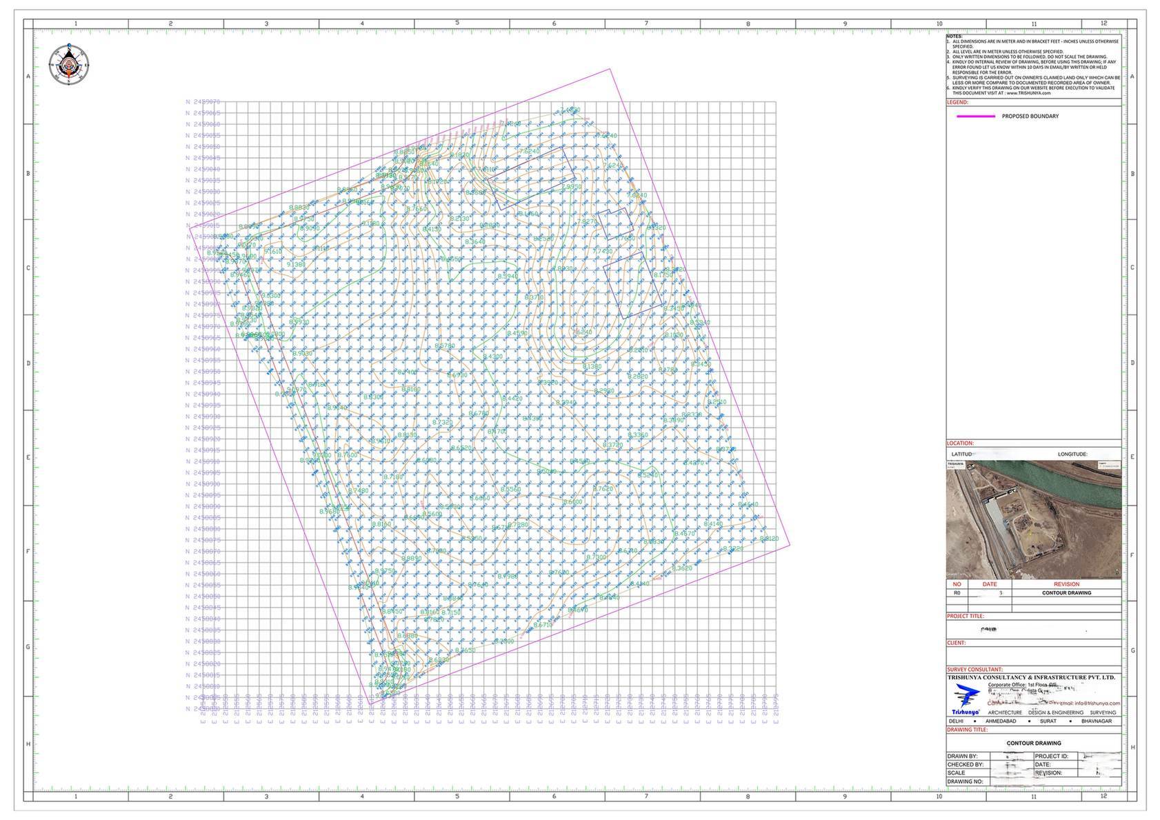
ከኮንቱር ቅየሳ የሚገኙ ዋና ዋና ውጤቶች (Deliverables)
የተሟላ የኮንቱር ቅየሳ ፓኬጅ የዲጂታል የመሬት አቀማመጥ ሞዴል (DTM)፣ ከፍተኛ ጥራት ያለው የኦርቶሞዛይክ ፎቶ፣ በተፈለገው እርቀት የተቀመጡ የኮንቱር መስመሮች እና ዝርዝር የጎንዮሽ ገጽታዎችን (cross-sections) ያካተተ ሪፖርት ያካትታል። ለትላልቅ ፕሮጀክቶች የመሬት ቁፋሮና ሙሌት ስሌቶች እና የ3D ፖይንት ክላውድ ዳታ ይሰጣል።
ዲጂታል የመሬት ሞዴል (DTM)
ተክሎች እና ሕንፃዎች የተወገዱበት የትክክለኛው መሬት ከፍታ ሞዴል፣ በቀጥታ በዲዛይን ሶፍትዌሮች ውስጥ ጥቅም ላይ ይውላል።
የኮንቱር መስመሮች (Contour Lines)
እርስዎ በመረጡት የከፍታ ልዩነት የተቀመጡ መስመሮች፤ ለዝርዝር ዲዛይን ጠበብ ያሉ እና ለአጠቃላይ ፕላን ሰፋ ያሉ መስመሮች።
የኦርቶሞዛይክ ፎቶ (Orthomosaic)
በትክክለኛ ስኬል የተስተካከለ የአየር ላይ ፎቶ፣ ከቴክኒካል መረጃዎች ጋር እንደ ጥሩ የእይታ ማመሳከሪያ ያገለግላል።
የጎንዮሽ ገጽታዎች (Cross-Sections)
በዋና ዋና አቅጣጫዎች የመሬቱ ቀጥተኛ ቁመታዊ ገጽታዎች፣ ለመንገድ እና ፍሳሽ ማስወገጃ ዲዛይን በስፋት ይረዳሉ።
በህንድ የኮንቱር ቅየሳ ዋጋ ዝርዝር
| የፓኬጅ ደረጃ | የተለመደው የዋጋ መጠን |
|---|---|
| መሠረታዊ ኦርቶሞዛይክ + የኮንቱር ካርታ | በአንድ ኤከር ከ ₹500 እስከ ₹1,000 |
| ሙሉ ፓኬጅ፡ DTM, DSM, ኮንቱር, ፖይንት ክላውድ | በአንድ ኤከር ከ ₹1,000 እስከ ₹1,500 |
| የተቀራረበ የኮንቱር ልዩነት (0.25ሜ) ከ መደበኛ (1ሜ) | በጣም ለተቀራረቡ መስመሮች የዳታ ማቀነባበሪያ ወጪው ይጨምራል |
| በዓመታዊ ውል የሚደረግ ተደጋጋሚ ቅየሳ | በእያንዳንዱ ቅየሳ ከ25% እስከ 40% ቅናሽ |
የኦርቶሞዛይክ ፎቶ ብቻ የያዘ ዋጋ እና ሙሉ DTM፣ የኮንቱር መስመሮች እና ፖይንት ክላውድ የያዘ ዋጋ በአንድ ኤከር ተቀራራቢ ቢመስልም ፈጽሞ እኩል አይደሉም። ዋጋዎችን ከማወዳደርዎ በፊት የሚሰጡትን ውጤቶች ያረጋግጡ።
ግንበኞች ይህንን ደረጃ መዝለል የሌለባቸው ለምንድን ነው
የመሠረት ጥልቀት፣ የፍሳሽ መስመሮች፣ የመደገፊያ ግንቦች አቀማመጥ እና የመሬት ቁፋሮ በጀት በሙሉ ከዲዛይን በፊት ባለው ትክክለኛ የመሬት ከፍታ ላይ የተመሠረቱ ናቸው። ቀደም ብሎ የሚደረግ የኮንቱር ቅየሳ በኋላ ላይ የሚመጣን ውድ የዲዛይን ለውጥ ያስቀራል፣ እንዲሁም የድንበር ልኬት ሲያስፈልግ ከየድሮን ቅየሳ ጋር በቀላሉ ይጣመራል።
ላልለኩት የመሬት ቁልቁለት ትክክለኛ የፍሳሽ ማስወገጃ ሥርዓት ፈጽሞ መንደፍ አይችሉም።
ትክክለኛውን የኮንቱር መስመር ልዩነት (Interval) እንዴት መምረጥ ይቻላል
መጠነኛ ቁልቁለት ላላቸው መሬቶች የ1 ሜትር ልዩነት በቂ ነው። ከፍተኛ ቁልቁለት ወይም ውስብስብ የፍሳሽ መስፈርት ላላቸው ቦታዎች መሐንድሶች በትክክል እንዲሠሩ ከ0.25 እስከ 0.5 ሜትር ልዩነት ያስፈልጋል። ርካሽ የሆነውን ብቻ ከመምረጥ ይልቅ የመሐندسዎን ፍላጎት የሚያሟላውን ልዩነት ይምረጡ።
መሐንድስዎ ካዘዘው የከፍታ ልዩነት የበለጠ ሰፊ ክፍተት ባለው የኮንቱር መረጃ የመሠረት ወይም የፍሳሽ ዲዛይን አያጽድቁ።
አዲስ ግንባታ እያቀዱ ነው እና ትክክለኛ የመሬት ከፍታ መረጃ ይፈልጋሉ?
የቦታዎን ስፋት እና የፕሮጀክትዎን ደረጃ ይንገሩን፣ እኛ በጣም ተስማሚ የሆነውን የኮንቱር ፓኬጅ እንመክራለን።
ተደጋግመው የሚጠየቁ ጥያቄዎች (FAQ)
ከግንባታ በፊት ለመሠረት ዲዛይን፣ ለፍሳሽ ማስወገጃ፣ ለመንገድ አሰላለፍ እና ለቁፋሮና ሙሌት ስሌት የመሬት ከፍታዎችን ለማወቅ ይጠቅማል።
የድሮን ቅየሳ እንደየሚያስፈልጉት ውጤቶች እና የኮንቱር ልዩነት በአንድ ኤከር ከ ₹500 እስከ ₹1,500 ይደርሳል።
ለሜዳማ መሬት 1 ሜትር፣ ለዳገታማ ወይም ለፍሳሽ አስቸጋሪ ለሆኑ ቦታዎች ደግሞ ከ0.25 እስከ 0.5 ሜትር ይመረጣል።
መደበኛ ፓኬጅ DTM፣ ኦርቶሞዛይክ ፎቶ እና የኮንቱር መስመሮችን ያካትታል፤ ሙሉ ፓኬጅ ደግሞ የጎንዮሽ ገጽታዎችን እና የቁፋሮ ስሌቶችን ይጨምራል።
የኮንቱር ቅየሳ የቶፖግራፊክ ቅየሳ አንድ አካል ሲሆን ቶፖግራፊ ዛፎችን፣ ሕንፃዎችን እና ነባር ግንባታዎችንም ይመዘግባል።
የድሮን የመስክ በረራ ከ1 እስከ 2 ቀናት ይወስዳል፣ የዳታ ማቀነባበሪያው ደግሞ ጥቂት ተጨማሪ ቀናትን ይፈጃል።
አዎ፣ በፓኬጁ ውስጥ ፖይንት ክላውድ እና DTM ሲኖር የቁፋሮና ሙሌት መጠኖችን በቀጥታ በትክክል ማስላት ይቻላል።
የጉዞ እና የበረራ ዝግጅት ወጪዎች ቋሚ በመሆናቸው በትልቅ ስፋት ሲካፈሉ የአንድ ኤከር ዋጋ ይቀንሳል።
አዎ፣ ተራራማ ወይም ጥቅጥቅ ያለ ዛፍ ያለበት ቦታ የቀን ስራን ስለሚቀንስ ዋጋውን ከ30% እስከ 50% ሊጨምር ይችላል።
የቁፋሮ ስራዎችን ሂደት ለመከታተል በዓመታዊ ውል መደበኛ ቅየሳዎችን ማድረግ በአንድ ቅየሳ ከ25% እስከ 40% ወጪ ይቆጥባል።
ይህ ስልክ መስመር ለፕሮጀክት ጥያቄዎች ብቻ የተመደበ ነው። እባክዎ ለስራ ወይም ለስልጠና ጥያቄዎች አይጠቀሙበት።