From Field to Map: The Complete GIS Survey Workflow
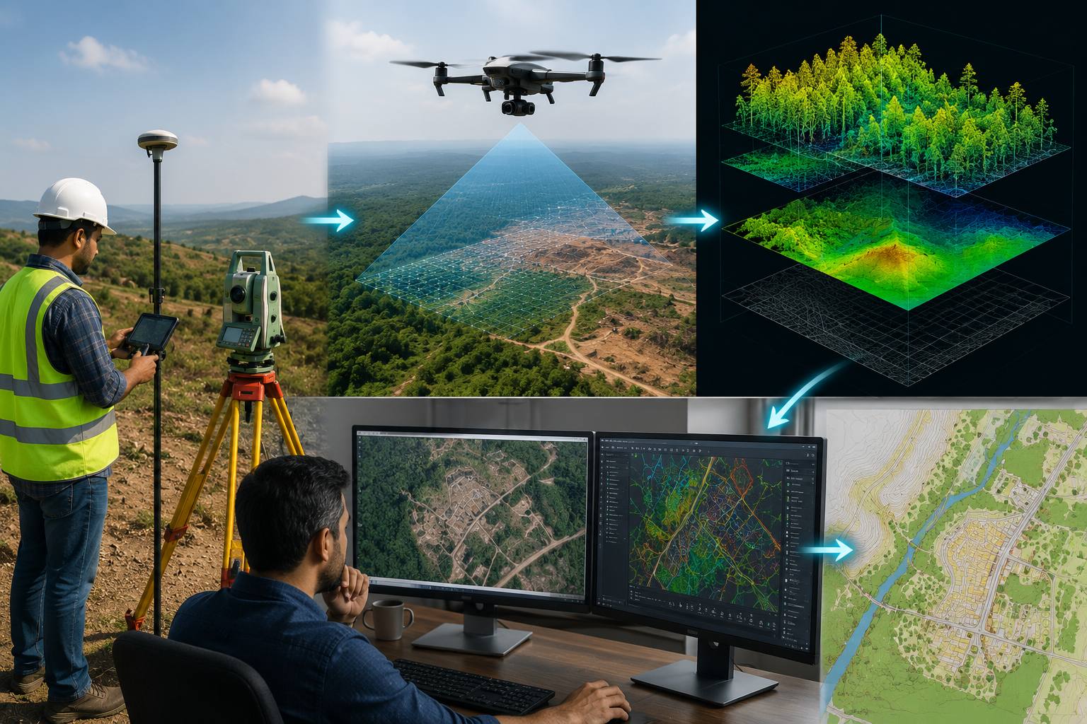
Raw field data does not become a usable map on its own. Between the moment a surveyor captures a point in the field and the moment a finished GIS map reaches a client, the data passes through several distinct processing stages that determine its final accuracy and usefulness.
Understanding this workflow helps clients set realistic expectations about timelines, and it explains why skipping steps under time pressure tends to show up as errors later.
Watch Data Flow Through the Pipeline
Field to Map Pipeline Animation
Step Through the Workflow Yourself
Interactive Workflow Stages
See How Data Quality Affects the Result
Data Quality Impact Simulator
The Five Stages of a GIS Survey Workflow
Field data capture
Surveyors collect raw coordinates, attributes, and photos using GNSS receivers, total stations, drones, or mobile GIS apps.
Data download and quality check
Raw field data is downloaded and checked for gaps, outliers, and inconsistencies before any further processing begins.
Processing and correction
Post-processing applies coordinate corrections, filters noise, and classifies points based on survey type and sensor used.
GIS integration and modeling
Cleaned data is imported into GIS software, structured into layers, and modeled into maps, contours, or 3D surfaces.
Review and delivery
A final quality review confirms accuracy against project specifications before the finished map or dataset is delivered.
Rushing the quality check stage is one of the most common ways survey errors slip through into a finished deliverable. Each stage exists specifically to catch a different type of error.
A map is only as reliable as the workflow that built it. Every stage exists to protect the accuracy of the next one.
A Workflow Built for Consistency
Consistent results come from a consistent process, not from any single tool or technology. Our GIS mapping team follows this structured workflow on every GIS mapping project, regardless of size or complexity.
Need a complete GIS survey workflow?
Tell us about your project and we will walk you through our process.
Frequently Asked Questions
The main stages are field data capture, download and quality check, processing and correction, GIS integration and modeling, and final review and delivery.
An early quality check catches gaps, outliers, and inconsistencies before they propagate through later processing stages and become harder to fix.
Timelines vary significantly by project scope and area, though office processing generally takes as long or longer than the field data capture itself.
Raw data receives coordinate corrections, noise filtering, and point classification based on the specific survey type and sensor used in the field.
Some errors can be corrected during processing, but others, like missed coverage areas, generally require returning to the field for additional capture.
Common GIS software platforms structure cleaned survey data into layers and generate maps, contours, or 3D surface models for delivery.
Poor field data quality tends to compound through later processing stages, meaning the finished map can only be as accurate as the original capture.
Yes, a final review against project specifications is a standard step to confirm accuracy before any GIS deliverable reaches the client.
Drone data follows the same general five-stage workflow, though photogrammetry or LiDAR processing adds additional steps within the correction stage.
Skipping stages under time pressure is one of the most common ways survey errors slip through undetected into a finished deliverable.
This line is reserved for project leads. Please do not contact for learning, training, or job inquiries.