Home Blog GIS for Utility Mapping: Water, Power, and Gas Networks
🔧 Network Explorer

GIS for Utility Mapping: Water, Power, and Gas Networks

🧮 1  |  🟢 1
19 Feb 2026 Trishunya Team
GIS for Utility Mapping: Water, Power, and Gas Networks
GIS · Utility Infrastructure Mapping

GIS for Utility Mapping: Water, Power, and Gas Networks

📅 19 Feb 2026 ⏱ 4 min read 🏷 Utility Mapping TI Trishunya India

Water pipelines, power cables, and gas lines usually get mapped by different departments using different tools and different accuracy standards. GIS utility mapping brings these separate networks into one coordinated digital system that everyone can actually trust and use together.

This matters most the moment excavation is planned near existing infrastructure, when uncertainty about what lies underground turns a routine dig into a safety and cost risk.

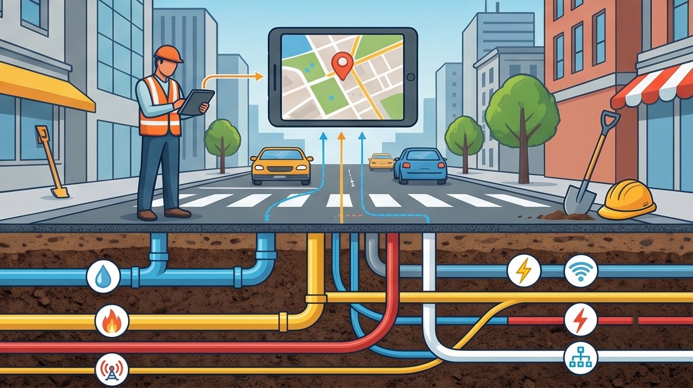
GIS utility mapping for water power and gas networks
Combining water, power, and gas networks in one GIS reduces excavation risk significantly.
3 Networks
Water, power, gas unified
1 System
Single source of truth
Fewer Strikes
Reduced excavation risk

Watch the Networks Come Together

Layered Utility Mapping Animation

Three separate utility networks draw in sequence, then merge into a single coordinated GIS layer.
Each network is captured and georeferenced independently, then unified for shared use.

Check for Underground Conflicts

Interactive Conflict Checker

Click anywhere along the corridor to check whether utility lines are too close together at that point.

Explore Utility Depth Layers

Depth Cross-Section Explorer

Drag the slider to scan through depth and see which utility type typically occupies each level.
0.6 m depth

Building a Reliable Utility GIS

1

Survey existing utility records

Gather as-built drawings, department records, and prior survey data as a starting reference, however incomplete.

2

Field-verify with GPR and GNSS

Ground-penetrating radar locates buried lines physically, while GNSS captures their exact coordinate position.

3

Digitize into a unified GIS layer

Each utility type becomes its own attributed layer, sharing a common coordinate system across all networks.

4

Cross-check for conflicts and clearances

Overlaying all networks reveals proximity issues between lines that were previously invisible to any single department.

5

Maintain with ongoing updates

New installations and repairs get logged into the same system, keeping the utility map current over time.

Utility strikes during excavation are frequently caused by inaccurate or missing records rather than careless digging. A verified GIS utility map addresses the root cause directly.

You cannot protect what you cannot see. Mapping underground utilities makes the invisible manageable.

Coordinating Utility Data Across Departments

Getting water, power, and gas departments to share one accurate map takes both technical work and coordination. Our GIS mapping team handles the underground survey and GIS mapping integration so utility data becomes genuinely shared infrastructure.

Need underground utility mapping?

Tell us about your utility network and coverage area for a tailored approach.

Frequently Asked Questions

GIS utility mapping combines water, power, gas, and other underground networks into one digital system so excavation and planning decisions can be made safely.

Ground-penetrating radar detects buried lines physically, while GNSS surveying captures their precise coordinate position for the GIS map.

Separate department records often use different accuracy standards, a shared GIS map ensures everyone works from the same verified data.

An accurate, verified utility map significantly reduces the risk of striking buried lines during excavation, though it does not eliminate every risk.

Centimeter-level horizontal and depth accuracy is generally recommended for utility mapping intended to support excavation safety decisions.

Yes, depth is a critical attribute for underground utility mapping since different utility types are typically buried at different levels.

Ongoing updates are recommended whenever new installations or repairs occur, keeping the utility map accurate rather than a one-time snapshot.

As-built drawings provide a useful starting reference, but field verification is generally needed since older records are often incomplete or inaccurate.

GPR is valuable for detecting non-metallic or unmapped lines, though its usefulness depends on soil conditions and utility material type.

The biggest benefit is visibility into conflicts and clearances between different utility networks that separate department records would otherwise hide.

Back to all articles