የድሮን የመሬት ቅየሳ እንዴት ይሰራል፡ ከበረራ ዕቅድ እስከ መጨረሻው ካርታ
ደንበኞች ብዙውን ጊዜ የድሮን ቅየሳ ማለት አንዴ ብቻ በረራ ተደርጎ ወዲያውኑ የተጠናቀቀ ካርታ የሚያስገኝ ቀላል ተግባር አድርገው ያስባሉ። በተግባር ግን፣ ማንኛውንም እርምጃ መዝለል ወይም በችኮላ መስራት የመጨረሻውን ትክክለኛነት በድብቅ ሊያበላሽ የሚችል ስድስት የተለያዩ ቴክኒካዊ ደረጃዎችን የያዘ ነው። ከበረራ መነሳት ጀምሮ እስከ ተጠናቀቀው የኦርቶሞዛይክ ካርታ ድረስ ምን እንደሚከናወን መረዳት በአንድ መሬት ላይ የሚደረጉ ሁለት የተለያዩ የድሮን ቅየሳዎች ለምን ከፍተኛ የጥራት ልዩነት እንደሚኖራቸው ያብራራል።
ሙያዊ የድሮን የመሬት ቅየሳ የበረራ ዕቅድ ማውጣት፣ የመሬት መቆጣጠሪያ ነጥቦችን (GCP) ማዘጋጀት፣ የአየር ላይ ፎቶዎችን ወይም LiDAR ዳታዎችን መሰብሰብ፣ ዳታ ማቀናበር፣ የጥራት ማረጋገጫ እና የመጨረሻ ካርታዎችን ማመንጨት ደረጃዎችን ያልፋል። እያንዳንዱ ደረጃ በቀደመው ላይ ሙሉ በሙሉ ጥገኛ ነው። ለምሳሌ በበረራ ዕቅድ ላይ የተሳሳተ የፎቶ መደራረብ (overlap) መቶኛ ከተዘጋጀ በኋላ በኮምፒውተር ሂደት ወቅት ሊስተካከል አይችልም።
ስድስቱ የድሮን የመሬት ቅየሳ ዋና ደረጃዎች
የበረራ ዕቅድ ማውጣት (Flight Planning)
የቦታው ወሰን፣ የሚፈለገው ጥራት (GSD)፣ የበረራ ከፍታ እና የፎቶ መደራረብ መቶኛ በሶፍትዌሩ ውስጥ ይዘጋጃል።
የመሬት መቆጣጠሪያ ነጥቦች (GCP) ማዘጋጀት
ከበረራ በፊት በDGPS የተለኩ መለያ ምልክቶች በመሬቱ ላይ ይቀመጣሉ፣ ይህም የአየር ላይ መረጃን ከትክክለኛው የመሬት መጋጠሚያዎች ጋር ያገናኛል።
የአየር ላይ መረጃዎችን መሰብሰብ
ድሮኑ በተዘጋጀው የፍርግርግ መስመር ላይ በረራ በማድረግ ተደራራቢ ፎቶዎችን ወይም የLiDAR ነጥቦችን በሙሉ ቦታው ላይ ይሰበስባል።
ዳታዎችን ማቀናበር (Data Processing)
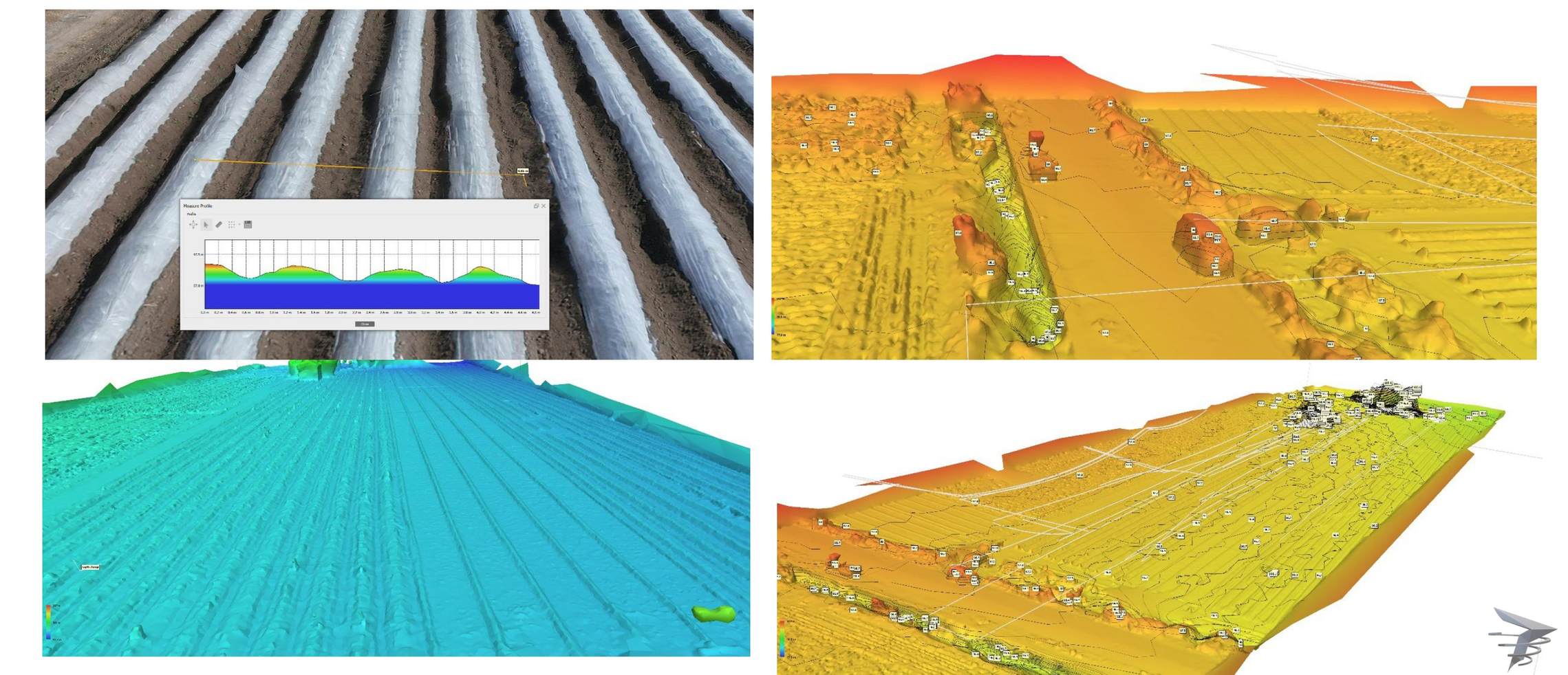
ልዩ ሶፍትዌር በሺዎች የሚቆጠሩ ፎቶዎችን በማጣመር አንድ ወጥ የሆነ ኦርቶሞዛይክ ካርታ፣ የ3D ነጥቦች ስብስብ እና የዲጂታል መሬት ሞዴል (DTM) ይፈጥራል።
የጥራት እና የትክክለኛነት ማረጋገጫ
የተቀናበረው መረጃ ከፕሮጀክቱ የኢንጂነሪንግ መስፈርቶች ጋር የሚስማማ መሆኑን ለማረጋገጥ ከመሬት መቆጣጠሪያ ነጥቦች ጋር ይነጻጸራል።
የመጨረሻ ፕላኖችን ማዘጋጀት
የኮንቱር ካርታዎች፣ የCAD ንድፎች፣ የDTM ሞዴሎች እና ቴክኒካዊ ሪፖርቶች ደንበኛው በሚፈልገው ፎርማት ተዘጋጅተው ይላካሉ።
የመሬት መቆጣጠሪያ ነጥቦች (GCP) ለምን ይህን ያህል ወሳኝ ሆኑ?
በDGPS የተለኩ የመሬት መቆጣጠሪያ ነጥቦች ከሌሉ የድሮን ቅየሳ በዕይታ ውብ የሆነ ካርታ ሊያወጣ ይችላል ነገር ግን በእውነተኛው መሬት ላይ በብዙ ሜትሮች የተዛባ ሊሆን ይችላል። GCPs የአየር ላይ ዳታውን በትክክለኛ መጋጠሚያዎች ላይ ያቆራኙታል፣ ይህም በተራ የአየር ላይ ፎቶ እና በእውነተኛ የኢንጂነሪንግ ደረጃ ካርታ መካከል ያለው ዋና ልዩነት ነው።
| ደረጃ | በችኮላ ከተሰራ ሊከሰት የሚችል ችግር |
|---|---|
| የበረራ ዕቅድ | ያልተሟላ የፎቶ መደራረብ በካርታ ማቀናበር ላይ ክፍተቶችን ወይም የስፌት ስህተቶችን ያስከትላል |
| የGCP ዝግጅት | አነስተኛ ወይም ያልተመጣጠነ የGCP ስርጭት አጠቃላይ ካርታው ቦታውን እንዲስት ያደርጋል |
| ዳታ መሰብሰብ | ደካማ ብርሃን ወይም ኃይለኛ ንፋስ የምስል ጥራትን እና የልኬት ትክክለኛነትን ይቀንሳል |
| ዳታ ማቀናበር | የጥራት ቁጥጥርን መዝለል ስህተቶች ሳይታወቁ ወደ መጨረሻው ሪፖርት እንዲገቡ ያደርጋል |
በዕይታ ጥርት ብሎ የታየ የኦርቶሞዛይክ ምስል ብቻውን የኢንጂነሪንግ ትክክለኛነት ማረጋገጫ አይሆንም። ሁልጊዜ የተሰጠው ውጤት በመሬት መቆጣጠሪያ ነጥቦች መረጋገጡን ያረጋግጡ እንጂ በምስሉ ውበት ብቻ አይመኑ።
ድሮኑን ማብረር የቀዶ ጥገናው ቀላሉ ክፍል ነው። ከበረራ በፊት እና በኋላ የሚሰሩ ሙያዊ ስራዎች ናቸው ካርታው አስተማማኝ መሆኑን የሚወስኑት።
የመጨረሻውን ትክክለኛነት የሚወስኑት ምክንያቶች
የበረራ ከፍታ፣ የፎቶ መደራረብ፣ የካሜራ ጥራት እና የGCP ስርጭት ጥግግት ተደምረው የመጨረሻውን ትክክለኛነት ይወስናሉ። የእኛ የ የድሮን ቅየሳ ሂደት የGCP ዝግጅትን እንደ ግዴታ የሚወስድ ሲሆን እያንዳንዱ ፕሮጀክት ከመሰጠቱ በፊት የ ቶፖግራፊ የጥራት ማረጋገጫን ያካትታል።
በድሮን ቅየሳ ሪፖርትዎ ውስጥ ምን መካተት እንዳለበት ማወቅ ይፈልጋሉ?
የእርስዎ የተወሰነ ቦታ እንዴት እንደሚለካ እና እንደሚዘጋጅ ከባለሙያዎቻችን ጋር ለመወያየት ያነጋግሩን።
ተደጋግመው የሚጠየቁ ጥያቄዎች
የበረራ ዕቅድ፣ የGCP ዝግጅት፣ የአየር ላይ ዳታ መሰብሰብ፣ ማቀናበር፣ ትክክለኛነት ማረጋገጥ እና ፕላኖችን ማዘጋጀት ናቸው።
GCPs የአየር ላይ ፎቶዎችን ከትክክለኛ የDGPS መጋጠሚያዎች ጋር በማሰር ካርታው በሜትሮች እንዳይዛባ ይከላከላሉ።
ለትክክለኛ ስራ በተከታታይ ፎቶዎች መካከል ከ70 እስከ 80 በመቶ መደራረብ መኖር አለበት።
እንደ ቦታው ስፋት ይወሰናል፤ ለአነስተኛ ቦታዎች ከ1 ቀን ጀምሮ ለትላልቅ ወይም LiDAR ፕሮጀክቶች ጥቂት ቀናት ሊወስድ ይችላል።
ኦርቶሞዛይክ በሺዎች የሚቆጠሩ የድሮን ፎቶዎችን የቅርጽ ስህተቶች በማረም ወደ አንድ ወጥ ትክክለኛ ካርታ የተቀየረ ጥራት ያለው ምስል ነው።
ለመካከለኛ ቦታ አብዛኛውን ጊዜ ከ4 እስከ 6 GCPs ያስፈልጋሉ፣ ሰፊ ወይም ተራራማ ቦታዎች ተጨማሪ ነጥቦችን ይፈልጋሉ።
አዎ፣ ኃይለኛ ንፋስ፣ ደካማ ብርሃን እና የደመና ጥላ የምስል ጥራትን ስለሚቀንሱ በረራዎች ምቹ በሆነ አየር ሁኔታ ይካሄዳሉ።
የኦርቶሞዛይክ ምስል፣ የዲጂታል መሬት ሞዴል (DTM)፣ የኮንቱር ካርታዎች፣ የCAD ንድፎች እና የ3D ነጥቦች ስብስብ ይሰጣሉ።
በሞዴሉ ላይ ያሉ መጋጠሚያዎች በመስክ ላይ ለብቻቸው ከተለኩ የፍተሻ ነጥቦች ጋር በስታቲስቲክስ ይነጻጸራሉ።
አዎ፣ የቦታው መጠን ምንም ይሁን ምን መሰረታዊ ስድስቱ ደረጃዎች አይለወጡም፤ የስራው መጠን እና ጊዜ ብቻ ይለያያል።
ይህ መስመር ለፕሮጀክት ጥያቄዎች ብቻ የተመደበ ነው። እባክዎን ለስልጠና ወይም ለስራ ፍለጋ አይጠቀሙበት።