Home Blog How LiDAR Sees Through Trees to Map the Ground

How LiDAR Sees Through Trees to Map the Ground

🧮 2  |  🟢 2
24 Jan 2026 Trishunya Team
How LiDAR Sees Through Trees to Map the Ground
Drone LiDAR · Forestry & Canopy Mapping

How LiDAR Sees Through Trees to Map the Ground

📅 24 Jan 2026 ⏱ 3 min read 🏷 Forestry Mapping TI Trishunya India

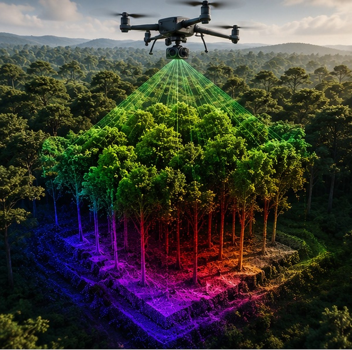
A forest canopy looks solid from above, but it is full of tiny gaps between leaves, branches, and needles. Drone LiDAR exploits exactly those gaps, firing enough laser pulses that some inevitably slip through to strike the ground beneath, even under dense tree cover.

This is the single biggest reason LiDAR outperforms photogrammetry in vegetated terrain. A camera only records what it can see from above. LiDAR keeps every pulse's return data, including the ones that traveled all the way to bare earth.

How LiDAR sees through trees to map ground terrain
Laser pulses slip through canopy gaps to register ground-level returns beneath trees.
Multi
Returns recorded per pulse
cm-level
Ground accuracy under canopy
0%
Canopy penetration for cameras

Watch Canopy Penetration in Action

Live Penetration Simulation

Green pulses represent LiDAR laser shots finding gaps through canopy to reach the ground, while red rays show a camera stopping at the treetop.
LiDAR keeps every return, camera imagery keeps only the top surface.

Adjust Canopy Density

Interactive Canopy Density Test

Drag the slider to see how canopy density changes the number of pulses that successfully reach the ground.
50% canopy cover

Test Your Own Pulse

Click to Fire Through the Canopy

Click anywhere in the canopy zone to fire a simulated pulse and see whether it reaches the ground.
Try several spots. Real LiDAR relies on firing enough pulses that gaps get found statistically.

How Canopy Penetration Actually Works

1

Dense pulse firing

The sensor fires hundreds of thousands of pulses per second, ensuring statistical odds that many find gaps in the canopy.

2

Multiple return capture

Each pulse can register several returns, from the treetop, mid-canopy branches, and the ground beneath, all as separate data points.

3

Last return isolation

Software isolates the final return of each pulse, which is statistically most likely to represent the ground surface.

4

Ground classification algorithm

Automated filtering algorithms separate true ground points from low vegetation and noise using elevation patterns.

5

Bare earth model output

The final digital terrain model represents the ground as if the vegetation were never there.

Even in very dense forest with 90 percent canopy cover, a sufficiently high pulse density can still register enough ground hits to build an accurate bare earth model, simply due to the sheer number of pulses fired.

The forest never fully closes. LiDAR just needs enough shots to find where it opens.

Where This Matters Most

Forestry volume studies, terrain mapping under tree cover, and infrastructure corridor surveys through wooded land all depend on this canopy-penetration capability. Our drone survey team applies dense-pulse LiDAR scan techniques specifically for these vegetated and forested project sites.

Have a wooded or vegetated site to map?

Tell us about your terrain and we will explain exactly how a LiDAR survey would handle it.

Frequently Asked Questions

LiDAR fires hundreds of thousands of laser pulses per second, and enough of them find small gaps in the canopy to reach and reflect off the ground beneath.

A multiple return happens when a single laser pulse reflects off several surfaces at different heights, such as treetop, branches, and ground, each recorded separately.

No, camera-based photogrammetry only captures what is visible from above and cannot penetrate canopy the way laser pulses can.

A bare earth model is the digital terrain surface generated after filtering out vegetation and structure returns, representing the ground as if unobstructed.

Dense forest reduces the percentage of pulses reaching the ground, but sufficiently high pulse density still typically yields an accurate terrain model.

Ground classification is the algorithmic process of separating true ground-level laser returns from vegetation, structures, and noise in the point cloud.

The last return of a pulse is statistically most likely to represent the deepest point the laser reached, often the ground surface beneath vegetation.

Yes, by capturing both canopy height and ground elevation, LiDAR enables accurate calculation of forest canopy volume and biomass estimates.

Yes, since LiDAR generates its own laser light rather than relying on sunlight, canopy penetration works regardless of ambient light conditions.

Forestry management, powerline corridor inspection through wooded areas, and infrastructure surveys crossing vegetated terrain rely heavily on this capability.

Back to all articles