Home Blog LiDAR Point Cloud Classification Explained Simply

LiDAR Point Cloud Classification Explained Simply

🧮 2  |  🟢 2
25 Jan 2026 Trishunya Team
LiDAR Point Cloud Classification Explained Simply
Drone LiDAR · Point Cloud Processing

LiDAR Point Cloud Classification Explained Simply

📅 25 Jan 2026 ⏱ 3 min read 🏷 Point Cloud TI Trishunya India

A raw LiDAR point cloud is just millions of dots in space, each with an x, y, z coordinate and no idea what it represents. Classification is the process that turns that undifferentiated mass into meaningful categories: ground, vegetation, buildings, powerlines, and more.

Without classification, a point cloud is nearly unusable for engineering work. You cannot build a terrain model, calculate volumes, or generate contours until the software knows which points are actually the ground.

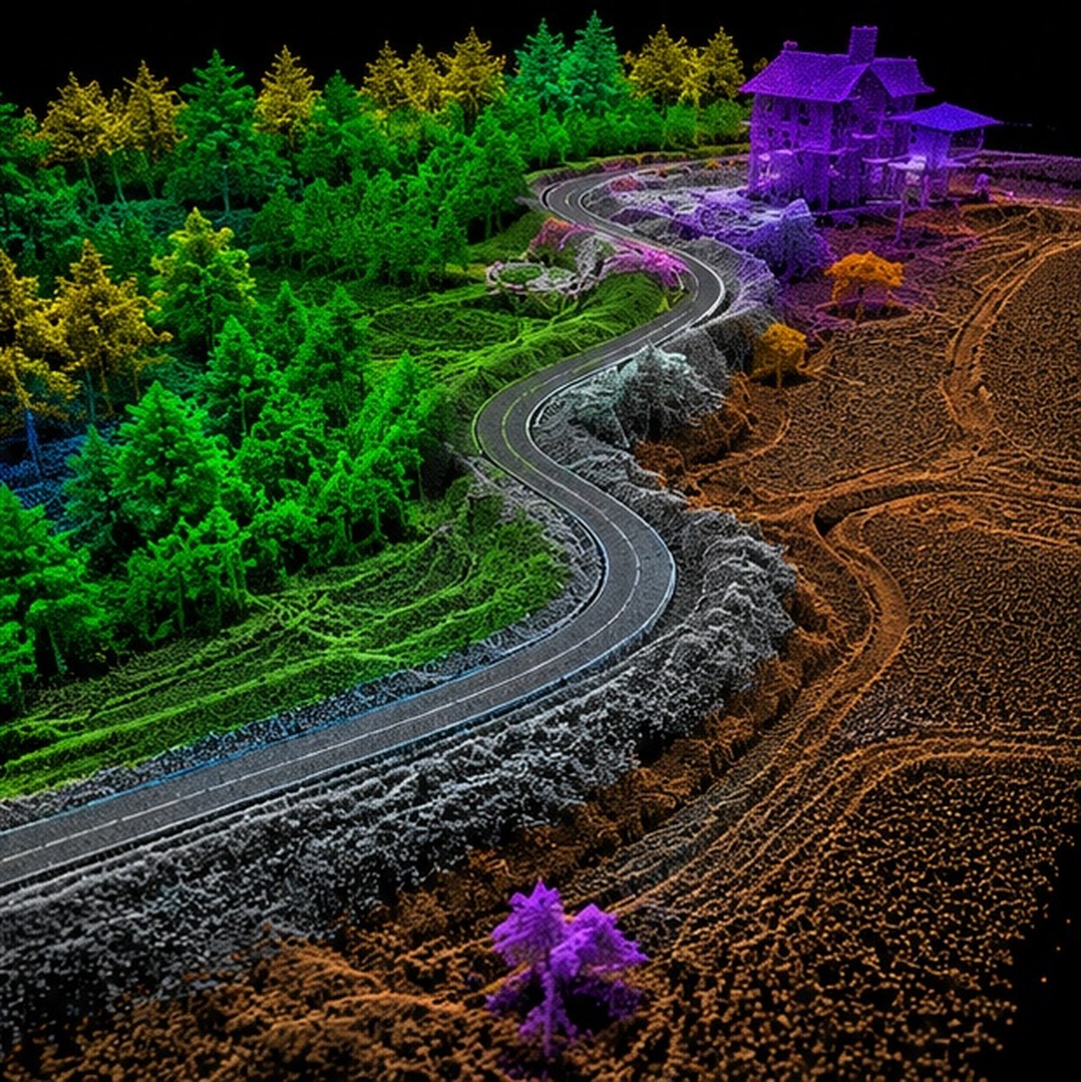
LiDAR point cloud classification ground vegetation structures
Classification sorts raw LiDAR points into ground, vegetation, and structure categories.
Millions
Raw points per survey
5-8
Typical classification categories
Auto+Manual
Typical workflow blend

Watch Classification Happen Live

Live Classification Sweep

A sweeping algorithm colors raw white points as it identifies ground, vegetation, and structure classes.
Real classification uses elevation, return count, and intensity, not just position.

Try Classifying Points Yourself

Point Classification Game

Click each colored dot and assign it to ground, vegetation, or structure. See how your instincts compare to elevation-based logic.
Ground Vegetation Structure
Click a point to begin.

Adjust the Ground Threshold

Elevation Threshold Filter

Drag the slider to change the elevation cutoff and watch how it changes what counts as ground versus vegetation.
30cm threshold

How Classification Actually Works

1

Raw point ingestion

The unclassified point cloud loads with only position, intensity, and return number for each point.

2

Ground filtering algorithm

Algorithms like progressive TIN densification identify the lowest consistent surface as probable ground.

3

Height above ground calculation

Every remaining point gets a calculated height above the identified ground surface.

4

Category assignment

Points get sorted into vegetation height bands, building footprints, or other classes based on height and pattern.

5

Manual quality review

An operator reviews and corrects misclassified points, especially at complex boundaries like building edges.

Standard LiDAR classification schemes use numeric class codes, where 2 typically represents ground, 3 to 5 represent low, medium, and high vegetation, and 6 represents buildings, following the widely used LAS file format specification.

A point cloud without classification is just noise with coordinates. Classification is what makes it a map.

Why This Step Matters for Your Project

Accurate classification directly determines the quality of every downstream deliverable, from contour maps to volumetric calculations. Our drone survey team combines automated and manual review in every LiDAR scan project to ensure classification accuracy before final delivery.

Need clean, classified LiDAR data?

Tell us your project type and we will explain our classification and quality review process.

Frequently Asked Questions

Classification is the process of sorting raw LiDAR points into categories like ground, vegetation, and structures, based on elevation and pattern analysis.

Without classification, software cannot distinguish ground from vegetation or structures, making terrain models and volume calculations impossible to generate accurately.

LAS is the standard binary file format for storing classified and unclassified LiDAR point cloud data, widely used across surveying and GIS software.

Most classification is automated through filtering algorithms, but manual review is typically needed to correct errors at complex boundaries like building edges.

It is the digital terrain surface built exclusively from points classified as ground, representing the land as if vegetation and structures were removed.

The elevation threshold determines the cutoff between ground and low vegetation, and setting it too high or low can misclassify short grass or uneven terrain.

Typical classes include ground, low vegetation, medium vegetation, high vegetation, buildings, and sometimes powerlines or water surfaces.

Yes, misclassified points can distort contour lines, volume calculations, and terrain models, which is why quality review is an essential processing step.

It is a common ground filtering algorithm that builds a triangulated surface iteratively, identifying the lowest consistent points as probable ground.

Processing time varies with area size and terrain complexity, but automated classification combined with manual review typically adds meaningful time to the overall project timeline.

Back to all articles