በህንድ ውስጥ ለሀይዌዮች እና ለባቡር ሀዲዶች የሞባይል LiDAR ዳሰሳ ጥናት
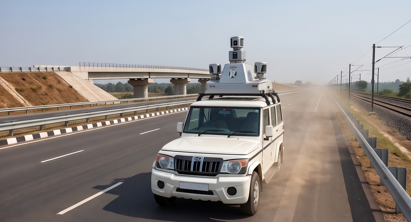
የሀይዌይ ወይም የባቡር ኮሪደር በመቶዎች ለሚቆጠሩ ኪሎሜትሮች ሊዘረጋ ይችላል, እና እያንዳንዱን ሜትር በባህላዊ የዳሰሳ ጥናት መሳሪያዎች በእግር መጓዝ ፈጽሞ ተግባራዊ አይደለም. በተሽከርካሪ ወይም በድሮን ላይ የተገጠመ የሞባይል LiDAR, በሚንቀሳቀስበት ጊዜ ሙሉውን ኮሪደር በተከታታይ ይቃኛል, ይህም የሳምንታት የመስክ ስራን ወደ ቀናት ይቀይረዋል.
ለመስመራዊ የመሰረተ ልማት ፕሮጀክቶች, ይህ የፍጥነት ጥቅም ከከፍተኛ ትክክለኛነት ጋር ይጣመራል. አንድ ተከታታይ ቅኝት የመንገድ ወይም የባቡር ወለልን, የጎን ግንቦችን, የፍሳሽ ማስወገጃዎችን እና በዙሪያው ያሉትን ገጽታዎች በአንድ ጊዜ, በመላው መስመር ላይ ወጥ በሆነ የአስተባባሪ ስርዓት ይይዛል.
የኮሪደር ቅኝቱን በእንቅስቃሴ ላይ ይመልከቱ
የቀጥታ የኮሪደር በረራ ቅኝት
የበረራ ፍጥነትን ከሽፋን መጠን ጋር ያስተካክሉ
የፍጥነት እና የነጥብ ጥግግት ንጽጽር
የመስቀለኛ ክፍልን (Cross Section) ይመርምሩ
በኮሪደሩ መስመር ላይ ጠቅ ያድርጉ
የኮሪደር ካርታ ስራ እንዴት እንደሚሰራ
የበረራ ወይም የማሽከርከር መስመር እቅድ ማውጣት
የኮሪደሩ መስመር ለፕሮጀክቱ የሚያስፈልገውን ሙሉ ስፋት የሚሸፍን አንድ ወይም ከዚያ በላይ ተከታታይ ማለፊያዎች ተደርጎ ታቅዷል።
ተከታታይ ቅኝት ማካሄድ
ፕላትፎርሙ በሚንቀሳቀስበት ጊዜ የLiDAR ዳሳሹ ያለማቋረጥ ይሰራል, በመላው መስመር ላይ ጥቅጥቅ ያለ መረጃ ይሰበስባል.
የGPS እና Inertial አቅጣጫ እርማት
ትክክለኛ የአቀማመጥ መረጃ የመድረኩን እንቅስቃሴ ያስተካክላል, የነጥብ ደመናው በኮሪደሩ ላይ በጂኦሜትሪ ትክክለኛ እንዲሆን ያደርጋል.
የመስቀለኛ ክፍሎችን ማውጣት
ሶፍትዌሩ ለኢንጂነሪንግ ዲዛይን መስቀለኛ ክፍሎችን ለማመንጨት ቀጣይነት ያለው የነጥብ ደመናን በመደበኛ ክፍተቶች ይቆርጣል.
የመጨረሻ ውጤቶች ማመንጨት
የመጨረሻ ውጤቶች የኮሪደር የመሬት አቀማመጥ ሞዴሎችን, መስቀለኛ ክፍሎችን እና ለዲዛይንና ክፍተት ትንተና ባህሪያትን ማውጣትን ያካትታሉ።
በድሮን ላይ የተመሰረተ ኮሪደር LiDAR እንደ ቁልቁል ገደሎች, ጥቅጥቅ ያሉ እፅዋት ወይም የመንገድ ተደራሽነት የሌላቸውን ቦታዎች መድረስ ይችላል, ይህም ለብዙ የገጠር ሀይዌይ መስመሮች ተመራጭ ዘዴ ያደርገዋል.
የኮሪደር ዳሰሳ ጥናት ማለት አንድ መስመር መለካት ብቻ አይደለም. መስመሩ የሚነካውን ሁሉ በተከታታይ እና በጥልቀት መለካት ነው.
ይህንን በመሰረተ ልማት ፕሮጀክትዎ ላይ መተግበር
የሀይዌይ እና የባቡር ፕሮጀክቶች ከተከታታይ የኮሪደር ቅኝት ፍጥነት እና ወጥነት በእጅጉ ይጠቀማሉ። የእኛ የ drone survey ቡድን ለመሰረተ ልማት ደንበኞች የበረራ መስመሮችን ያቅዳል, ለኢንጂነሪንግ ዲዛይን ዝግጁ የሆኑ የመስቀለኛ ክፍሎችን የያዘ የተሟላ የ LiDAR scan ሽፋን ያቀርባል.
የሀይዌይ ወይም የባቡር ኮሪደር ዳሰሳ ጥናት እያቀዱ ነው?
የመንገድዎን ርዝመት እና የመሬት አቀማመጥ ያጋሩን, እኛም ፈጣኑን እና ትክክለኛውን አካሄድ እናቀርብልዎታለን.
ተደጋግመው የሚጠየቁ ጥያቄዎች (FAQs)
በመስመራዊ የመሰረተ ልማት መስመር ላይ የነጥብ ደመና መረጃን ለመሰብሰብ ተንቀሳቃሽ መድረክን (ተሽከርካሪ ወይም ድሮን) በመጠቀም የሚከናወን ቀጣይነት ያለው የLiDAR ቅኝት ዘዴ ነው።
የድሮን LiDAR ተሽከርካሪዎች ሊደርሱባቸው የማይችሉትን እንደ ቁልቁል ገደሎች ወይም የመንገድ ተደራሽነት የሌላቸውን ቦታዎች መድረስ ይችላል, ይህም ለብዙ የገጠር መስመሮች ተመራጭ ያደርገዋል.
በባህላዊ የመሬት ዘዴዎች ሳምንታት የሚወስዱ የኮሪደር ዳሰሳ ጥናቶች ቀጣይነት ባለው የLiDAR ቅኝት ማለፊያዎች አማካኝነት ብዙ ጊዜ በጥቂት ቀናት ውስጥ ሊጠናቀቁ ይችላሉ.
አዎ, ፈጣን የበረራ ፍጥነት በአንድ ርዝመት ክፍል የነጥብ ጥግግትን ይቀንሳል, ስለዚህ ፍጥነት ከፕሮጀክቱ ከሚፈለገው ጥግግት ጋር ሚዛናዊ መሆን አለበት.
የተለመዱ ውጤቶች የኮሪደር የመሬት አቀማመጥ ሞዴል (DTM/DEM), መደበኛ መስቀለኛ ክፍሎች እና እንደ ፍሳሽ ማስወገጃ እና ያሉትን መሰረተ ልማቶች የወጡ ባህሪያትን ያካትታሉ።
አዎ, በኮሪደሩ ላይ የተያዘው ጥቅጥቅ ያለ የመሬት አቀማመጥ ሞዴል መሐንዲሶች የፍሳሽ ማስወገጃ ንድፎችን እና የጎን ግንብ ሁኔታን ከመረጃው እንዲለዩ ያስችላቸዋል.
በትክክለኛ የGPS እና Inertial እርማት አማካኝነት የኮሪደር LiDAR ጥናቶች ለኢንጂነሪንግ ዲዛይን ስራ ተስማሚ የሆነ የሴንቲሜትር ደረጃ ትክክለኛነት ያስመዘግባሉ።
መሰረታዊ የLiDAR ቅኝት ዘዴ ተመሳሳይ ነው, ምንም እንኳን የባቡር ፕሮጀክቶች በመንገዱ ጂኦሜትሪ እና በክሊራንስ ኤንቨሎፕ ዙሪያ ተጨማሪ ትክክለኛነት የሚጠይቁ ቢሆንም.
በኢንጂነሪንግ ዲዛይን ውስጥ ጥቅም ላይ የሚውሉ የመገለጫ እይታዎችን ለማመንጨት ቀጣይነት ያለው የነጥብ ደመናን በኮሪደሩ ላይ በመደበኛ ክፍተቶች የመቁረጥ ሂደት ነው።
አዎ, በመንገዱ ላይ የተቀመጡ የመሬት መቆጣጠሪያ ነጥቦች ቀጣይነት ያለው ቅኝትን ወደ ከፍተኛ የዳሰሳ ጥናት ደረጃ ትክክለኛነት ለማረጋገጥ እና ለማስተካከል ይረዳሉ።
ይህ መስመር ለፕሮጀክት ጥያቄዎች ብቻ የተጠበቀ ነው። እባክዎ ለትምህርት፣ ለስልጠና ወይም ለስራ ጥያቄዎች አይገናኙ።