2026 માં દરેક સર્વે ટીમ માટે જરૂરી ટોચના ફિલ્ડ સર્વે સાધનો
આજથી એક દાયકા પહેલાની સરખામણીમાં આધુનિક સર્વે ટીમની સાધનોની યાદી ઘણી બદલાઈ ગઈ છે. RTK GNSS રિસીવર, ડ્રોન અને મોબાઈલ ડેટા કલેક્શન ઉપકરણો હવે ટોટલ સ્ટેશન જેટલા જ પ્રમાણભૂત બની ગયા છે. 2026 ના ફિલ્ડ કિટમાં શું હોવું જોઈએ તે જાણવું નવી અને અનુભવી બંને ટીમો માટે મહત્વપૂર્ણ છે.
સાધનોની સાચી પસંદગી પ્રોજેક્ટના પ્રકાર પર આધાર રાખે છે, પરંતુ કેટલાક મુખ્ય સાધનો હવે દરેક ગંભીર સર્વે કામગીરીમાં જોવા મળે છે.
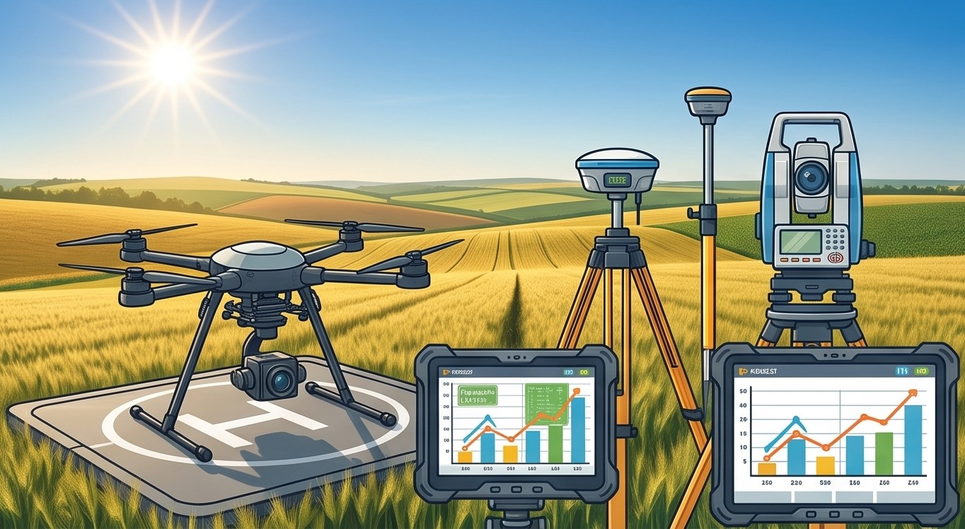
આધુનિક સર્વે કિટનું અન્વેષણ કરો
લાઇવ સાધનો શોકેસ
તમારી પોતાની ફિલ્ડ કિટ બનાવો
ઈન્ટરેક્ટિવ કિટ બિલ્ડર
બજેટને સાધનોની શ્રેણી સાથે સરખાવો
બજેટ શ્રેણી એક્સપ્લોરર
2026 ના આવશ્યક ફિલ્ડ સાધનો
RTK GNSS રિસીવર
કંટ્રોલ પોઈન્ટ્સ, સરહદના ખૂણાઓ અને સામાન્ય ફિલ્ડવર્ક માટે સેન્ટિમીટર-ચોક્કસ પોઝિશનિંગ પ્રદાન કરે છે.
સર્વે ડ્રોન પ્લેટફોર્મ
ટોપોગ્રાફિક મેપિંગ, વોલ્યુમેટ્રિક ગણતરીઓ અને એરિયલ દસ્તાવેજીકરણ માટે ઝડપી કવરેજ આપે છે.
મોબાઈલ GIS ડેટા કલેક્શન એપ
કસ્ટમ ફોર્મ્સ, ફોટા અને GPS જોડાણ સાથે ડેટા કેપ્ચરને ડિજિટલ બનાવે છે, કાગળની ફિલ્ડ બુકની જરૂરિયાત દૂર કરે છે.
ચોક્કસ કામગીરી માટે ટોટલ સ્ટેશન
ઉચ્ચ-ચોકસાઈ ધરાવતા બાંધકામ સ્ટેકઆઉટ અને કંટ્રોલ નેટવર્ક સ્થાપના માટે આજે પણ અતિ મહત્વનું છે.
વિશ્વસનીય ફિલ્ડ પાવર અને કનેક્ટિવિટી
બેટરી પેક, મોબાઈલ હોટસ્પોટ્સ અને મજબૂત ઉપકરણો દૂરના વિસ્તારોમાં પણ ડિજિટલ વર્કફ્લોને ચાલુ રાખે છે.
ટોટલ સ્ટેશન જેવા પરંપરાગત સાધનો અદ્રશ્ય થયા નથી, પરંતુ તેઓ વિશિષ્ટ કાર્યો માટે ઉપયોગી બન્યા છે. આધુનિક ટીમો ચોક્કસ કામગીરી માટે ટોટલ સ્ટેશન વાપરે છે જ્યારે વિશાળ કવરેજ માટે GNSS અને ડ્રોનનો ઉપયોગ કરે છે.
સૌથી શ્રેષ્ઠ સર્વે કિટ એ નથી જે સૌથી મોંઘી હોય. શ્રેષ્ઠ કિટ એ છે જે તમારા પ્રોજેક્ટની વાસ્તવિક જરૂરિયાતો સાથે સુસંગત હોય.
2026 ના પ્રોજેક્ટ્સ માટે તમારી ટીમને સજ્જ કરવી
માર્કેટમાં આવતી દરેક નવી ટેકનોલોજી પાછળ દોડવા કરતા પ્રોજેક્ટની વાસ્તવિક જરૂરિયાત મુજબ સાધનો રોકાણ કરવું વધુ યોગ્ય છે. અમારી GIS મેપિંગ ટીમ દરેક GIS મેપિંગ પ્રોજેક્ટ માટે યોગ્ય સાધનોનું સંયોજન તૈનાત કરે છે.
સર્વે સાધનો અંગે માર્ગદર્શન જોઈએ છે?
તમારા પ્રોજેક્ટ્સ વિશે અમને જણાવો અને અમે તમારા માટે સાધનોની શ્રેષ્ઠ પસંદગી સૂચવીશું.
વારંવાર પૂછાતા પ્રશ્નો
RTK GNSS રિસીવર, સર્વે ડ્રોન અને મોબાઈલ GIS એપ્સ પરંપરાગત ટોટલ સ્ટેશન સાથે મુખ્ય સાધનો બની ગયા છે.
હા, કન્સ્ટ્રક્શન સ્ટેકઆઉટ જેવા ઉચ્ચ-ચોકસાઈવાળા કાર્યો માટે ટોટલ સ્ટેશન આજે પણ અનિવાર્ય છે.
યોગ્ય બેઝ સ્ટેશન અથવા CORS નેટવર્ક સુધારા સાથે આધુનિક RTK GNSS રિસીવર સેન્ટિમીટર-સ્તરની ચોકસાઈ આપે છે.
હા, મોટાભાગની સર્વે કામગીરીમાં બંનેથી ફાયદો થાય છે કારણ કે ડ્રોન વિસ્તાર કવરેજમાં શ્રેષ્ઠ છે જ્યારે GNSS ચોક્કસ પોઇન્ટ આપે છે.
મોબાઈલ એપ્સ ડિજિટલ ફોર્મ્સ અને જીઓટેગ કરેલા ફોટા સાથે ડેટા કલેક્શન સરળ બનાવે છે.
ના, સૌથી મોંઘા સાધનો ખરીદવાને બદલે પ્રોજેક્ટની ચોકસાઈ અને જરૂરિયાત મુજબ સાધનો પસંદ કરવા વધુ યોગ્ય છે.
RTK સુધારાઓ, ક્લાઉડ ડેટા સિંક અને એપની કામગીરી માટે દૂરના વિસ્તારોમાં પણ કનેક્ટિવિટી મહત્વની છે.
ફટોગ્રામેટ્રી અથવા LiDAR સેન્સરવાળા સર્વે ડ્રોન મોટા વિસ્તારના ટોપોગ્રાફિક મેપિંગ માટે સૌથી કાર્યક્ષમ સાધન છે.
ના, નાની ટીમો ઘણીવાર આખી ઇન્વેન્ટરી રાખવાને બદલે સંતુલિત સાધનો સાથે અસરકારક રીતે કામ કરી શકે છે.
ક્યારેક અથવા વિશિષ્ટ જરૂરિયાતો માટે સાધનો ભાડે લેવા વધુ આર્થિક રીતે ફાયદાકારક હોઈ શકે છે.
આ વોટ્સએપ નંબર ફક્ત પ્રોજેક્ટ લીડ્સ માટે અનામત છે. મહેરબાની કરીને તાલીમ, શિક્ષણ અથવા નોકરીની માહિતી માટે સંપર્ક કરશો નહીં.