Tree Enumeration Survey Cost: What Drives the Rate by Tree Density
Tree enumeration is one of those survey types that sounds simple until you are standing in a forest patch trying to individually locate, measure, and log a thousand trees within a 50 metre corridor before the light runs out. The rate for this work is priced almost entirely by tree density, since density is what actually decides how many hours a crew spends per kilometre, far more than distance alone ever does.
Most tree enumeration work in India happens ahead of transmission line, road, or pipeline projects, where the client needs a defensible count and precise location of every tree that could affect the route before construction begins, and often before compensation to landowners can even be calculated. Here is how that pricing actually breaks down, by density tier, and what actually gets recorded once a crew is on the ground.
Why Tree Density Decides the Rate
A tree enumeration crew has to physically reach, identify, and measure every single tree within scope, and density is the single biggest variable in how long that actually takes per kilometre of corridor. A sparse corridor with under 500 trees per hectare moves relatively fast, since the crew can walk steadily between trees with only occasional stops. A forest patch with a thousand or more trees per hectare means constant stopping, measuring, marking, and logging, which is a completely different pace of work even over the exact same one kilometre stretch of ground.
That difference in pace is the entire logic behind the three tier rate structure used across this kind of work. It is not a markup applied for difficulty in some abstract sense, it reflects the actual crew hours a denser site genuinely demands, since every additional tree that falls within scope is additional field time on the ground, not a fixed cost that simply spreads thinner across more trees.
-
-
-
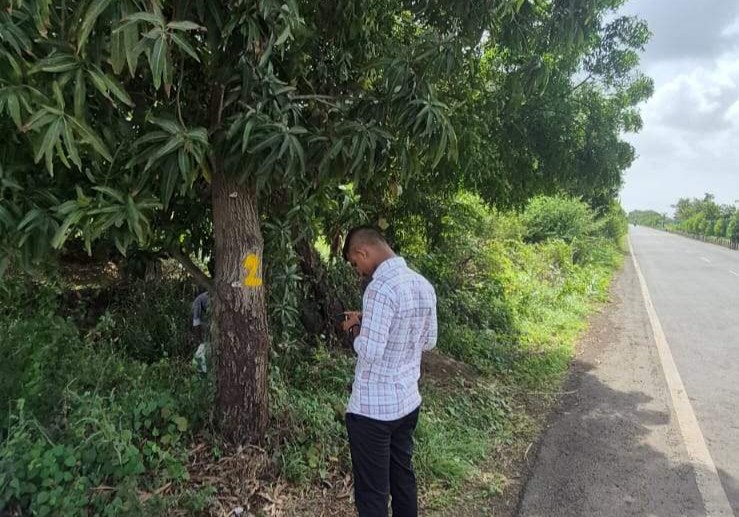
Tree Enumeration Rates by Density
All three rate tiers below assume a standard right of way of 50 metres, matching the corridor width typical of transmission line, road, and pipeline projects.
Density Based Pricing
Low density areas, under 500 trees per hectare, are priced at Rs.7,500 per kilometre. High density areas, under 1,000 trees per hectare, rise to Rs.12,000 per kilometre. True forest area, where density and terrain both add difficulty, runs Rs.20,000 per kilometre.
| Density Category | Rate |
|---|---|
| Low Density, under 500 trees/Ha | Rs.7,500 / km |
| High Density, under 1,000 trees/Ha | Rs.12,000 / km |
| Forest Area | Rs.20,000 / km |
| - | - |
| - | - |
All standard rates assume a 50 metre right of way. A wider corridor covers more ground per kilometre of route, which changes the actual tree count in scope and should be quoted against the real corridor width, not the linear distance alone.
Minimum Charge
Very short survey stretches fall under a flat Rs.15,000 minimum charge, covering the mobilisation and setup cost of getting a crew and equipment to a short segment regardless of its actual tree count.
-
-
"You cannot estimate tree count from a satellite image alone. Somebody has to walk the corridor and count what is actually there." Field practice note, tree enumeration operations
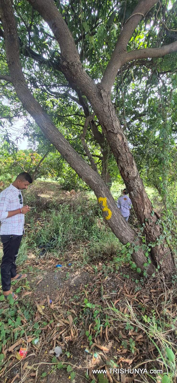
What Gets Recorded for Every Tree
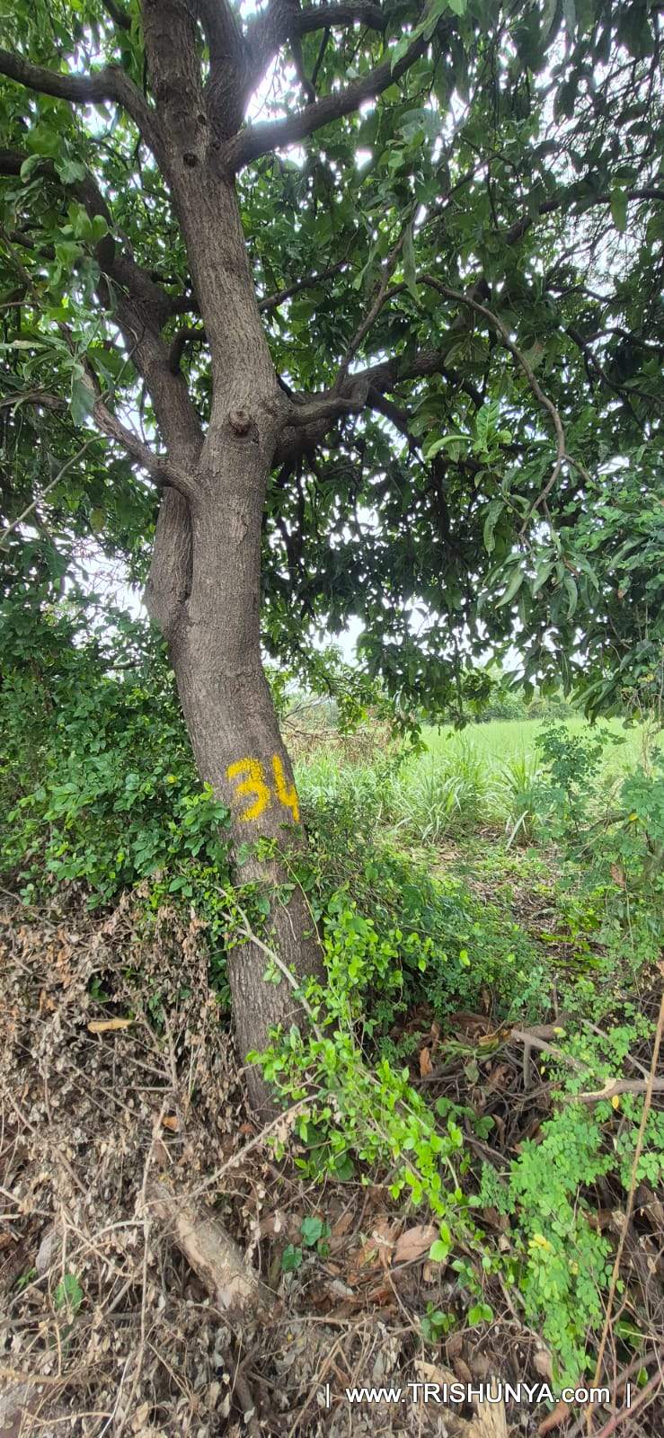
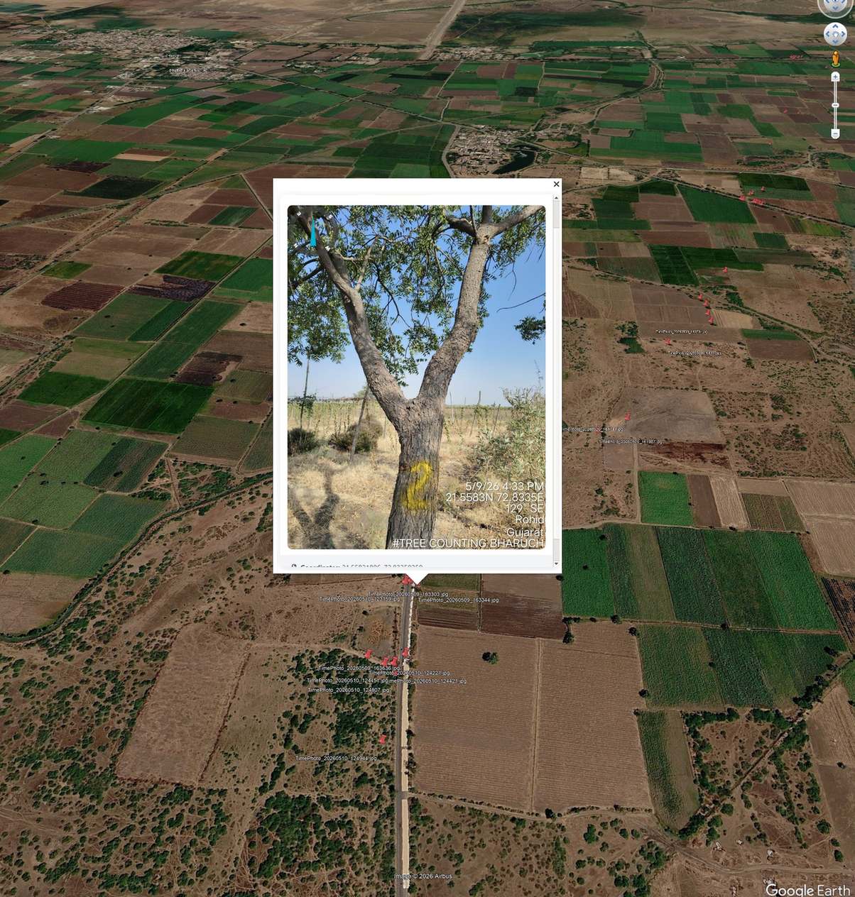
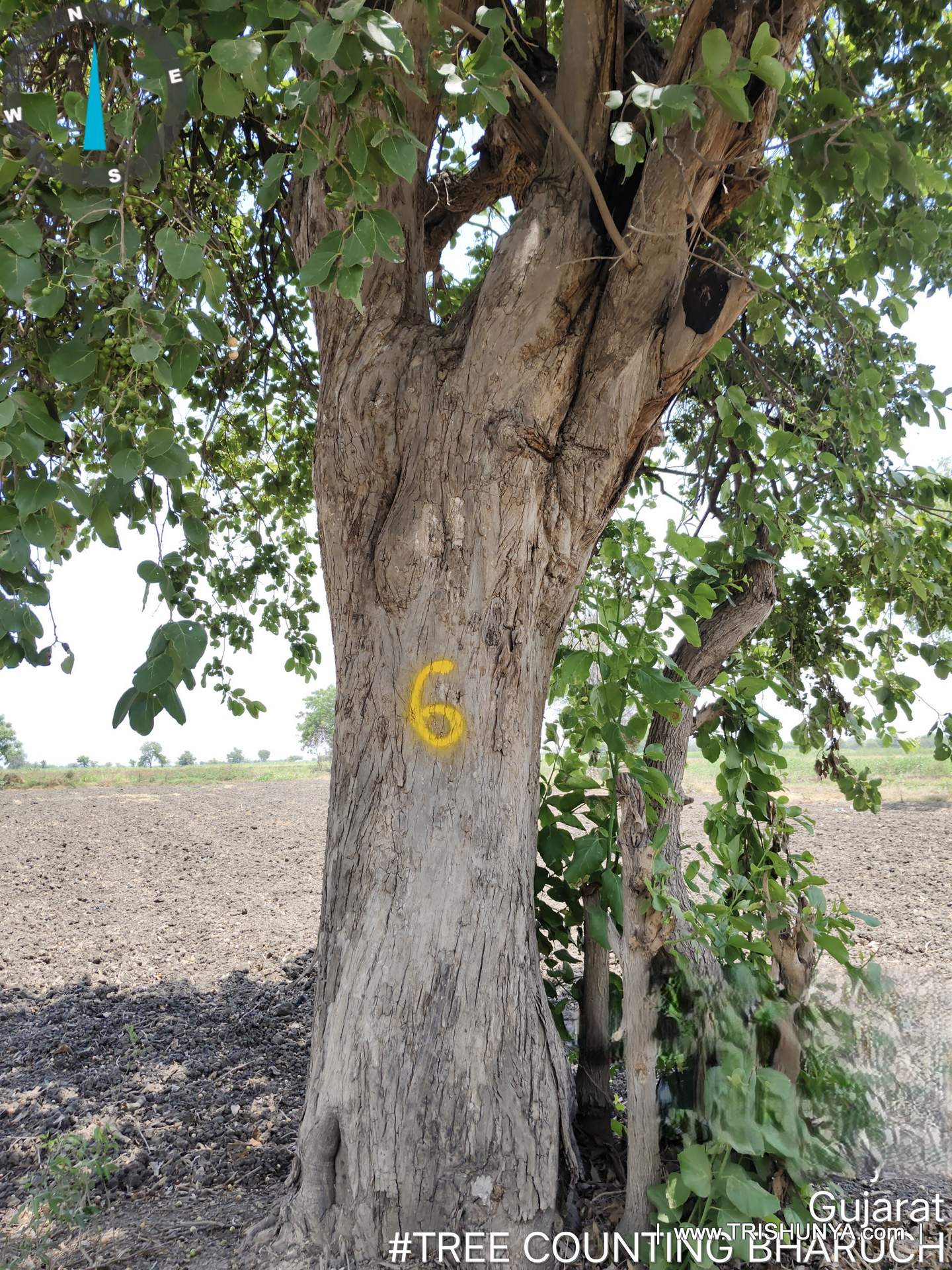
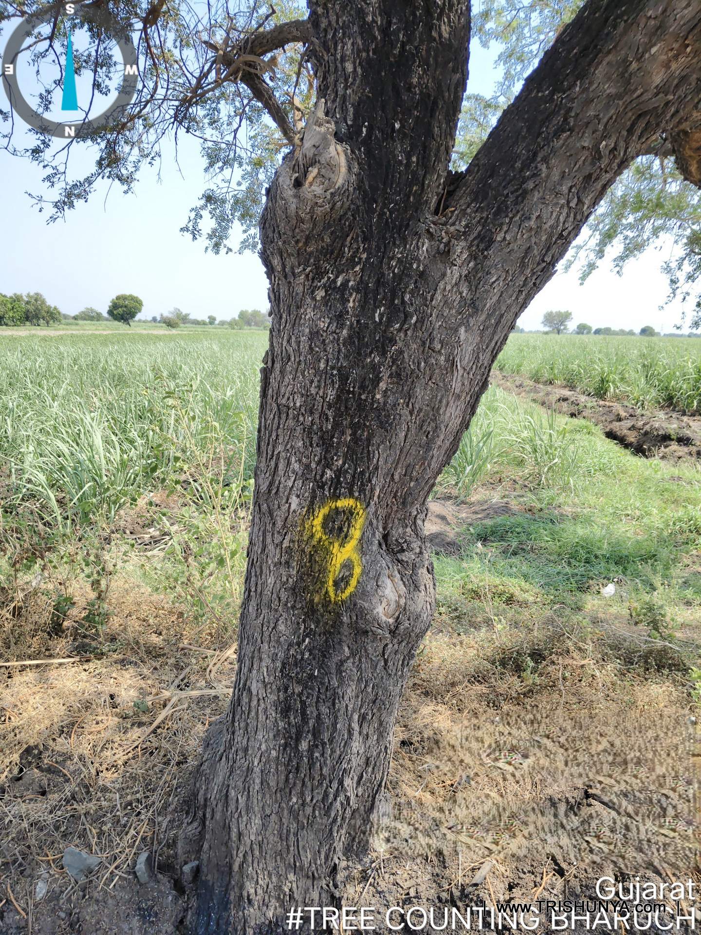
Tree enumeration is not a simple headcount. For every tree within the survey corridor, the crew logs species, exact location, approximate height, girth, and distance from the centerline, then applies a physical spray number on the trunk to match the field record with the final data sheet.
| Data Point | Purpose | Notes |
|---|---|---|
| Girth and Species | Used to assess compensation value and tree category for the project | - |
Density decides how many trees a crew has to individually locate, identify, and measure per kilometre. A denser site takes real additional field hours per kilometre covered, so the rate scales with density rather than staying flat.
Low density is under 500 trees per hectare. High density is under 1,000 trees per hectare. True forest area, where density and difficult terrain often combine, is priced separately at the highest tier.
All three density tiers assume a 50 metre right of way, matching typical transmission line, road, and pipeline corridor widths. A wider corridor changes the actual tree count in scope and needs a separate quote.
Species, exact location, approximate height, girth, and distance from the centerline are logged for every tree, along with a photograph and a physical spray number on the trunk matching the field record.
Compensation and permission requirements for tree removal in India often scale with a tree's girth and species, so accurate girth data has real downstream financial and regulatory weight.
A flat Rs.15,000 minimum applies to very short survey stretches, covering the mobilisation and setup cost of bringing a crew to a short segment regardless of tree count.
Collected data is run through an in house machine learning validation tool before the final data sheet is compiled, checking for inconsistencies before the output is delivered.
The spray number lets a reviewer physically match a specific tree back to its data sheet entry at any point later, which matters when the data feeds into compensation or permission processes.
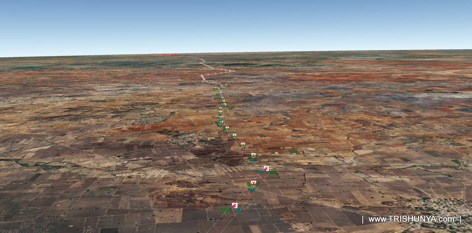
The transmission line, road, or pipeline project's corridor route file, often a KMZ, is used to define the exact stretch needing coverage and the right of way width, before the crew goes into the field.
Yes. Waterlogged ground, dense undergrowth, and steep terrain can slow a crew beyond what tree density alone would predict, and that field difficulty is assessed separately from the density based rate.
Why Girth and Spray Marking Matter
The physical spray number applied to each tree trunk is not decoration or a cosmetic field-work habit. It is what lets a reviewer, months later, and often far removed from the original field visit, walk back to that specific tree on site and confirm it directly against the data sheet entry. That verification step matters enormously when tree enumeration data feeds into compensation calculations for a transmission line, road, or pipeline project, since disputed numbers can otherwise stall a project for weeks.
Girth measurement in particular carries real weight in these projects, since compensation and permission requirements in India often scale with a tree's girth and species rather than treating every tree as equivalent.
Planning tree enumeration for a transmission line or road project?
Tree enumeration accuracy directly affects downstream compensation and permission timelines, so getting the density assessment right at the outset matters.
See Power Transmission LineTree enumeration crews often work through genuinely difficult terrain, waterlogged ground, dense undergrowth, steep slopes, and that field difficulty is a separate variable from tree density itself when a job runs slower than the standard rate would suggest.
Watch: Tree Enumeration Survey in the Field
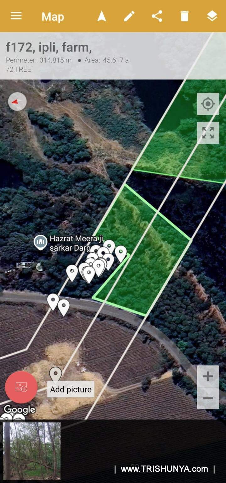
Planning Coverage Before the Crew Goes In
Before fieldwork starts, the survey area is planned carefully against the actual project route, typically using the transmission line, road, or pipeline corridor's KMZ or route file to define exactly which stretch needs coverage and at what right of way width. This planning stage matters because it directly determines the density estimate the crew goes in expecting, and any mismatch between the planned route and what the crew actually finds on the ground can shift the pricing tier before a single tree gets logged.
Data Validation and Final Deliverable
Once field data is collected, Trishunya runs it through an in house machine learning validation tool to check for accuracy before the final data sheet is compiled, since a compensation or permission process built on flawed tree count data creates problems well after the survey itself is finished.
More From the Field
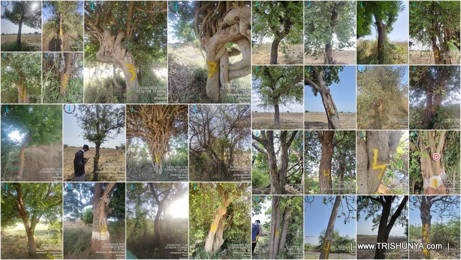
More From the Field, Video
Closing
Tree enumeration pricing looks like a simple density scale, and at its core it genuinely is one, but the real value of the survey lies less in the per kilometre rate itself and more in the accuracy of what gets recorded against every individual tree, since that underlying data often carries direct financial compensation weight and regulatory permission weight well downstream of the actual field visit.
Whether the requirement is a short low density stretch or a full forest corridor for a transmission line project, Trishunya's field teams run tree enumeration survey across India, and the fastest way to get an accurate number for a specific corridor is to walk through the route details directly with a surveyor.