በህንድ የመሬት ወሰን አለመግባባቶች፡ የመሬት ቅየሳ እንዴት እንደሚፈታቸው
አንድ ጊዜ ሁለት ወንድሞች ከበርካታ አሥርተ ዓመታት በፊት የተሠራ አጥር እያንዳንዳቸው አለን ብለው ከሚያምኑት የይዞታ ወሰን ጋር እንደማይጣጣም በመግለጽ የቤተሰብ ይዞታቸውን እንድንለካላቸው ጠይቀውን ነበር። የማንም ዓላማ ክፉ አልነበረም። አባታቸው ያንን አጥር ከገነቡበት ጊዜ ጀምሮ ወሰኑን እንደገና የለካው ማንም አልነበረም፣ እናም ዓመታት እያለፉ ሲሄዱ ትውስታው ከመሬቱ ትክክለኛ እውነታ እየራቀ ሄዷል። በህንድ አብዛኞቹ የመሬት ወሰን አለመግባባቶች የሚጀምሩት በትክክል በዚህ መንገድ ነው።
የመሬት ወሰን አለመግባባት ሆን ተብሎ በማጭበርበር የሚጀምረው አልፎ አልፎ ነው። የሚጀምረው ካልተለካ መስመር ነው፡ መደበኛ ባልሆኑ አጥሮች፣ በአሮጌ ሰነዶች ግልጽ ያልሆነ መግለጫ ወይም ያለ ዳግም ልኬት በተደረገ የውርስ ክፍፍል። የባለሙያ የመሬት ቅየሳ የማንንም ወገን አይይዝም፤ መሬቱን በትክክል በመለካት ሁለቱም ወገኖች እና ፍርድ ቤቶች ሊተማመኑበት የሚችሉትን በመጋጠሚያ ነጥቦች (Coordinate-based) ላይ የተመሰረተ ትክክለኛ ምላሽ ይሰጣል።
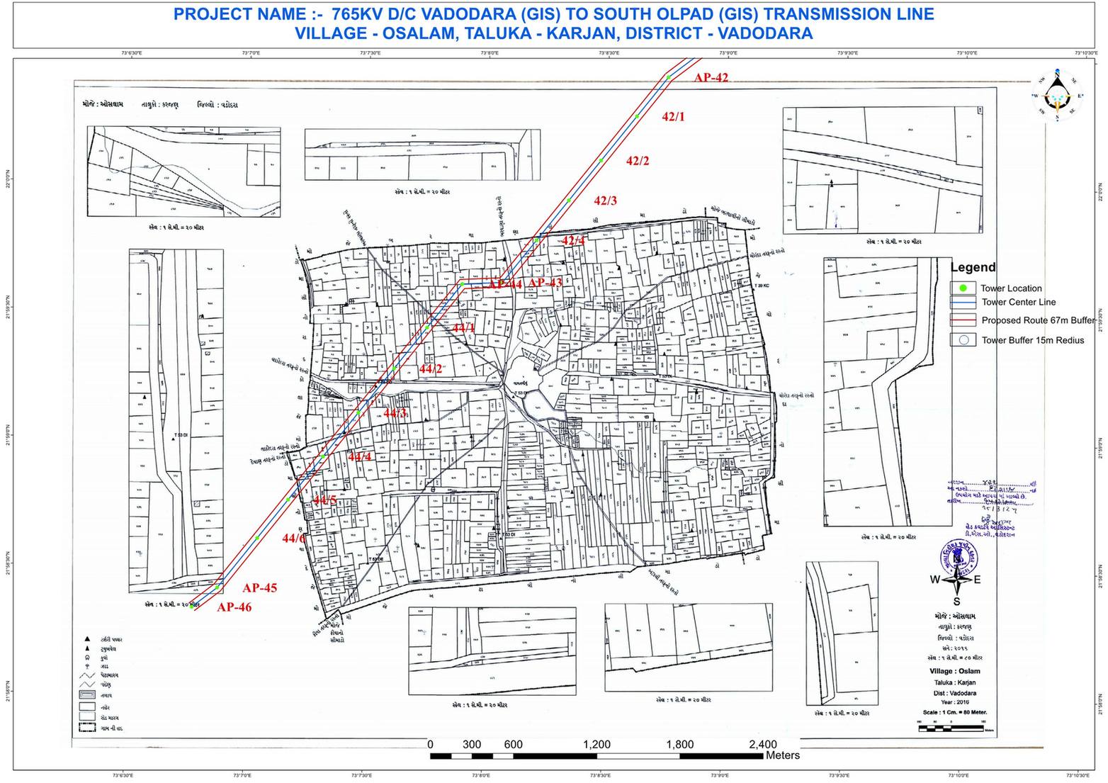
የወሰን አለመግባባቶች ለምን በብዛት ይከሰታሉ
የህንድ ታሪካዊ የመሬት መዝገቦች ከበርካታ አሥርተ ዓመታት በፊት የተዘጋጁት በሰንሰለት እና ኮምፓስ ዘዴዎች ሲሆን ይህም ከዛሬው DGPS ወይም ቶታል ስቴሽን ጋር ሲነፃፀር ትክክለኛነቱ እጅግ አነስተኛ ነበር። በትውልዶች መካከል አጥሮች ቀስ በቀስ መንሸራተታቸው እና ያለ ዳግም ልኬት የተካፈሉ የውርስ መሬቶች በሰነድ እና በመሬቱ ትክክለኛ ሁኔታ መካከል ያለውን ልዩነት በዝምታ እያሰፉ መጥተዋል።
"የመሬቱ ትክክለኛ እውነታ ቅድሚያ ይሰጠዋል" የሚለው መርህ ምን ማለት ነው
የህንድ ፍርድ ቤቶች እና የመሬት ባለስልጣናት ግልጽ መርህ እየተከተሉ ነው፡ ዘመናዊ የDGPS ቅየሳ የረጅም ጊዜ ትክክለኛ ይዞታ ከአሮጌ ሰነዶች የተለየ መሆኑን ሲያረጋግጥ አሁን ለተለካው ወሰን ከፍተኛ የማስረጃ ክብደት ይሰጣል። ይህ የባለቤትነት መብቱን በቀጥታ ባይሽረውም ለመሬት ባለቤቱ ትክክለኛ ዳግም ልኬት በጣም ጠንካራ ቴክኒካዊ ማስረጃ ይሆናል።
የአጥሮች ቀስ በቀስ መሸጋሸግ
ያለ ልኬት ለዓመታት የተጠገኑ አጥሮች ቀስ በቀስ ከህጋዊው የወሰን መስመር ይርቃሉ።
ያለ ቅየሳ የተደረገ የመሬት ክፍፍል
በወራሾች መካከል የመሬት ክፍፍል የሚደረገው በወረቀት ላይ ባሉ ቃላት ብቻ ሲሆን በመሬቱ ላይ ልኬት አይደረግም።
የDGPS የወሰን ዳግም ቅየሳ
ትክክለኛ የመጋጠሚያ ነጥቦች ልኬት ለሁለቱም ወገኖች ገለልተኛ እና የማያከራክር ዋቢ ነጥብ ይሰጣል።
በቅየሳ ማስረጃ ላይ የተመሰረተ እርቅ
ትክክለኛ የቅየሳ ሪፖርት ጉዳዩ ወደ ፍርድ ቤት ሳይሄድ በእርቅ ደረጃ አለመግባባትን ለመፍታት ይረዳል።
የመሬት ወሰን አለመግባባትን ለመፍታት ቁልፍ እርምጃዎች
ገለልተኛ ፈቃድ ያለው የመሬት ቀያሽ ይቅጠሩ
ብቃት ያለው ቀያሽ DGPS ወይም ቶታል ስቴሽን በመጠቀም ትክክለኛውን ወሰን ይለካል እንዲሁም የመጋጠሚያ ነጥቦችን ሪፖርት ያዘጋጃል።
ከመሬት መዝገብ መረጃዎች ጋር ያመሳክሩ
የተለካው ወሰን ከባለቤትነት ሰነድ (7/12)፣ ከሽያጭ ውል እና ከአሮጌ ካርታዎች ጋር ይነፃፀራል።
በመረጃ ላይ የተመሰረተ ቀጥተኛ ውይይት ያድርጉ
ሁለቱም ወገኖች ከተለያዩ ግምቶች ይልቅ አንድ ወጥ ሳይንሳዊ መረጃ ሲመለከቱ አብዛኛዎቹ አለመግባባቶች በቀላሉ ይፈታሉ።
ውይይቱ ካልተሳካ የእርቅ መድረክን ይጠቀሙ
እንደ Lok Adalat ያሉ መድረኮች በቅየሳ ሪፖርቶች ላይ በመመስረት በሚሊዮኖች የሚቆጠሩ ጉዳዮችን በፍጥነት ፈተዋል።
የስም ዝውውር/ማስተካከያ ያድርጉ ወይም ክስ ይመስርቱ
ስምምነት ላይ ካልተደረሰ ይህ የቅየሳ ሪፖርት በፍርድ ቤት ወይም በመሬት መምሪያ ውስጥ ዋና የቴክኒክ ማስረጃዎ ይሆናል።
በርካታ ግዛቶች አሁን ለወሰን አለመግባባቶች የተወሰነ የጊዜ ገደብ አላቸው፡ የቅየሳ ሪፖርቱ ከመጀመሪያው የተሟላ ከሆነ ለቀላል ጉዳዮች 90 ቀናት እና ለተወሳሰቡ ጉዳዮች 120 ቀናት ውስጥ መፍትሄ ይሰጣል።
የመሬት ወሰን አለመግባባት በጩኸት አይሸነፍም፤ በመጀመሪያ መሬቱን በትክክል በለካው አካል ይፈታል።
የእኛ DGPS እና RTK የቅየሳ አገልግሎቶች በተለይ ለወሰን አለመግባባቶች መፍትሄ የተዘጋጁ ሲሆኑ ለህግ ባለሙያዎች እና ለመሬት ባለስልጣናት ተቀባይነት ያላቸውን ሪፖርቶች ያቀርባሉ፣ እንዲሁም በመተላለፊያ ወይም በውሃ ፍሳሽ አለመግባባቶች ውስጥ የመሬት አቀማመጥ (Topography) መረጃዎችን ያካትታሉ።
ያለ ባለሙያ ገለልተኛ የቅየሳ ሪፖርት የወሰን አለመግባባትን ወደ ፍርድ ቤት ከመውሰድ ይቆጠቡ። የቃል ክርክሮች እና አሮጌ ስዕሎች ከሳይንሳዊ ልኬቶች ፊት መቆም አይችሉም።
የመሬት ወሰን አለመግባባት ገጥሞዎታል?
ገለልተኛ የDGPS የመሬት ቅየሳ ወደ ፍርድ ቤት ከመሄድዎ በፊት ጉዳይዎን ሙሉ በሙሉ ግልጽ በሆነ መንገድ ይፈታል።
ተደጋግመው የሚጠየቁ ጥያቄዎች (FAQ)
በጊዜ ሂደት የተሸጋገሹ አጥሮች፣ ያለ ልኬት የተካፈሉ የውርስ መሬቶች እና አሮጌ የተሳሳቱ የመሬት መዝገቦች።
የባለሙያ ቅየሳ በእርቅ ወይም በፍርድ ቤት ውሳኔ ላይ ወሳኝ የሆነ ጠንካራ ቴክኒካዊ ማስረጃ ይሰጣል።
አሮጌ ሰነዶች ግልጽ ባልሆኑበት ጊዜ ፍርድ ቤቶች በዘመናዊ ልኬት ለተረጋገጠው የረጅም ጊዜ ይዞታ ከፍተኛ ክብደት መስጠታቸው ነው።
ከ2 እስከ 5 ሳንቲሜትር ያለው የDGPS ትክክለኛነት ለካዳስተር እና ወሰን ስራዎች ሙሉ በሙሉ ተቀባይነት ያለው መስፈርት ነው።
አዎ። በLok Adalat በቅየሳ ሪፖርት በመታገዝ የሚደረግ እርቅ ከረጅም የፍርድ ቤት ክርክር በጣም ፈጣን እና ወጪ ቆጣቢ ነው።
በአዲሶቹ ደንቦች መሰረት ቀላል ጉዳዮች በ90 ቀናት ውስጥ፣ ውስብስብ ጉዳዮች ደግሞ በ120 ቀናት ውስጥ ይጠናቀቃሉ።
የይዞታ ማረጋገጫ (7/12)፣ የሽያጭ ውል፣ አሮጌ ካርታዎች እና አከራካሪው ቦታ ዝርዝር መረጃ።
አሮጌ አጥር የይዞታ አመላካች ሊሆን ይችላል፣ ነገር ግን ትልቅ ልዩነት ካለ ትክክለኛውን ሳይንሳዊ ልኬት ሊሽር አይችልም።
በህግ አስገዳጅ አይደለም፣ ነገር ግን የሁለቱም መገኘት ወደፊት በልኬት ዘዴው ላይ የሚነሱ ቅሬታዎችን ያስቀራል።
በመሬት መዝገብ ላይ ማስተካከያ (Mutation) እንዲደረግ ማመልከት ወይም ሪፖርቱን ለፍርድ ቤት በማስረጃነት ማቅረብ።
ይህ ስልክ ለፕሮጀክት ጥያቄዎች ብቻ የተመደበ ነው። እባክዎ ለስራ ወይም ስልጠና ጥያቄ አይገናኙ።