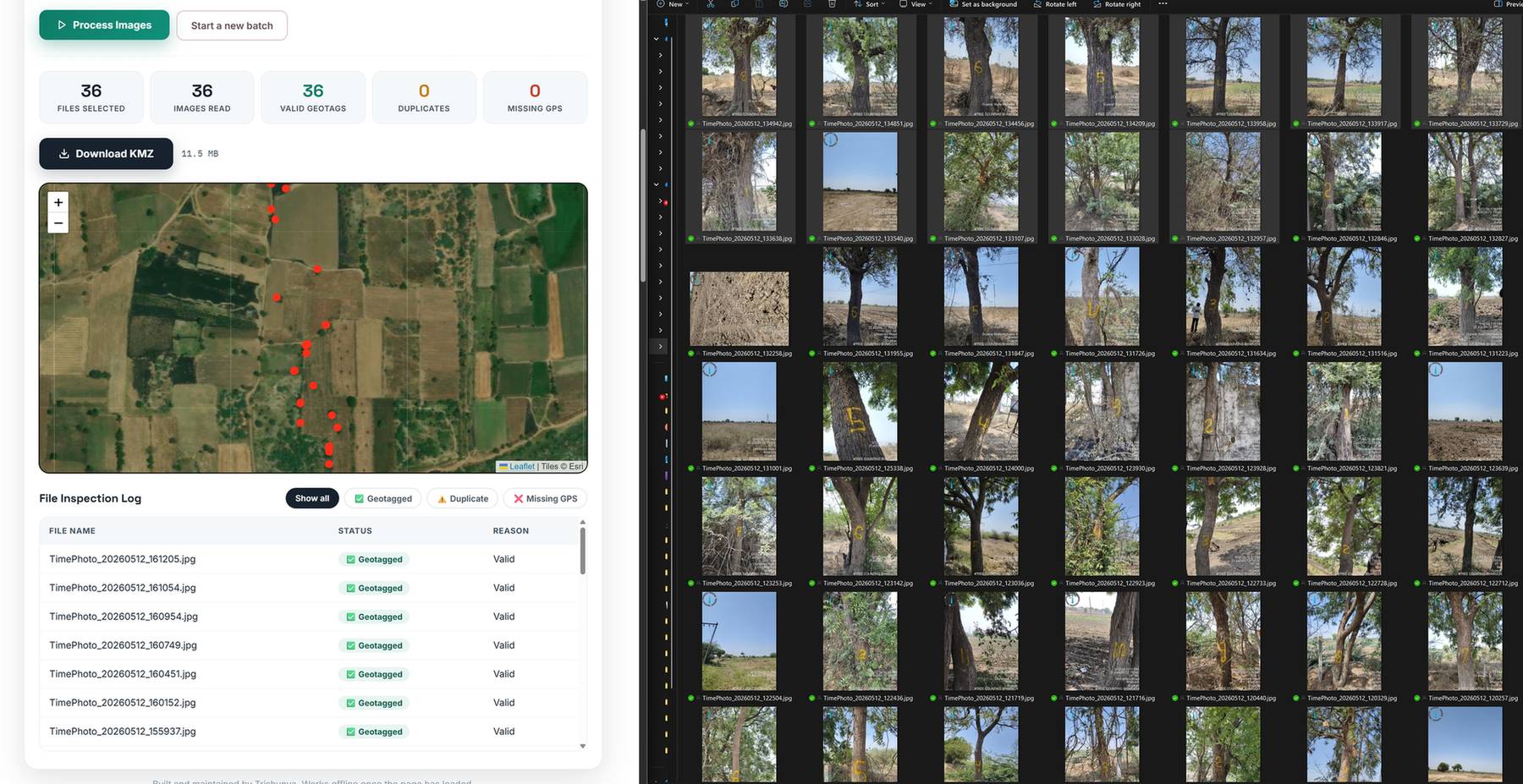
Geotagged Photos to KMZ: A Free Browser Tool That Never Uploads Your Files
A site engineer walks the alignment for six hours, comes back with 400 photos, and the client asks one simple question: where exactly was each one taken? Converting geotagged photos to KMZ answers that question in a way an email full of loose JPEGs never can. Open the file in Google Earth and every photo sits as a pin on the exact coordinate where it was clicked, grouped by date, with the capture time attached. The tool below does that conversion for you, free, and it does it entirely inside your browser. Your photos never leave your computer.
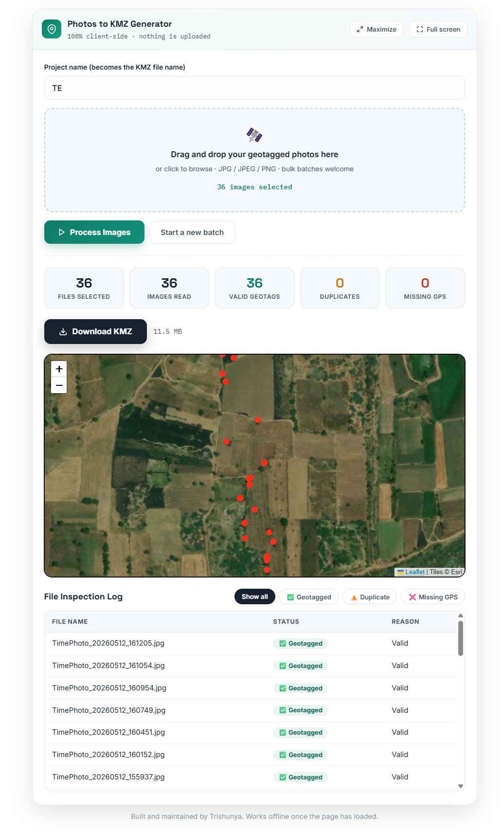
| File Name | Status | Reason |
|---|---|---|
| Process a batch to see the per-file report. | ||
Built and maintained by Trishunya. Works offline once the page has loaded.
Why We Built a Photos to KMZ Tool That Runs Without a Server
The idea came from our own field routine. On drone survey and ground verification jobs, Trishunya teams return with hundreds of geotagged photos per day: chainage markers, encroachments, crop status, structure conditions, benchmark locations. Clients rarely want a folder of images. They want to see the images on the ground, in context, next to their alignment or their layout. KMZ is the format that does this best because Google Earth is already installed in almost every project office in India.
Most online converters solve this by asking you to upload your photos to their server. For infrastructure work that is often a non-starter. Site photographs from a transmission line corridor, a defense-adjacent stretch, or a pre-acquisition parcel are sensitive by default. So this tool takes the opposite approach: every step, from reading EXIF headers to packaging the final KMZ, happens in your browser's own memory using standard web APIs. There is no upload button because there is nothing to upload to. Close the tab and every trace of your data is gone.
Privacy by architecture, not by policy. The tool has no backend, makes no API calls with your files, and writes nothing to any server. You can disconnect from the internet after the page loads and it will still generate your KMZ. That is a stronger guarantee than any privacy statement.
How the Geotagged Photos to KMZ Conversion Works
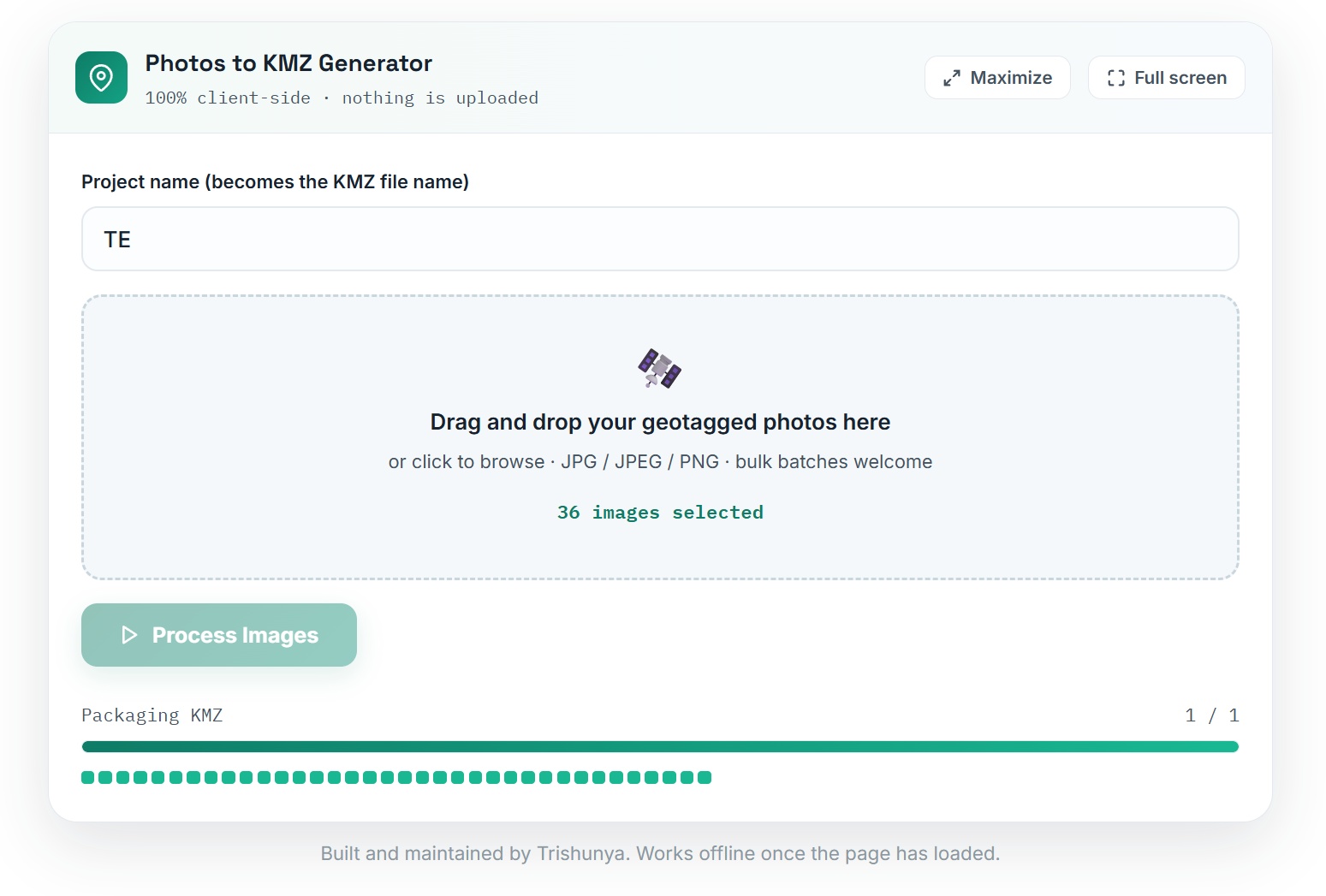
Under the hood the process mirrors what our internal survey software does, just translated to run on the client side. When you press Process Images, the tool reads each photo one at a time instead of loading the whole batch into memory at once, which is why it stays responsive even with very large sets of high resolution images.
Each image's metadata block is parsed locally for GPS latitude, longitude, and the original capture timestamp. Photos without coordinates are flagged, not discarded silently.
Valid photos are ordered by capture time, then deduplicated by coordinate. Two photos at the exact same position (to 6 decimal places, roughly 11 cm) count as duplicates, and the log tells you which ones.
Each surviving photo is downscaled on a hidden canvas and embedded into the KML as a compact JPEG, so the final KMZ stays portable instead of ballooning to gigabytes.
Placemarks are grouped into date folders, a hidden chronological path connects them in shooting order, and everything is zipped into a single .kmz you can open in Google Earth or share on WhatsApp.
Three Field Problems This Tool Quietly Solves
A converter sounds like a small utility until you map it against the situations where projects actually lose time and credibility. These are the three we see most often across construction project monitoring and linear surveys.
Site visit submissions clients can trust
Instead of a zip of 300 photos, submit one KMZ. The client opens it, sees every photo pinned at its true location with date and time, and can replay the visit pin by pin. Disputes about "was this really taken at CH 12+400" simply stop happening.
Geotag validation before you rely on the data
Received photos from a subcontractor or a new field team? Run them through the tool. In seconds you know which images carry genuine GPS coordinates, which are missing tags, and which are suspicious duplicates shot at one spot.
Time-stamped ground truth for progress claims
Monthly progress photos grouped into date folders inside a single file build an honest visual timeline. Open last month's KMZ next to this month's and the change on the ground is undeniable.
Coverage checks on photo-based surveys
The hidden chronological path shows the walking or driving order of capture. Gaps in the trail reveal skipped stretches long before the client finds them, a habit borrowed from our feature geo tagging workflows.
What the Finished KMZ Looks Like in Google Earth
Open the generated file and Google Earth arranges your work into date-wise folders. Click any pin and a clean photo card pops up with the capture date, the exact time, coordinates to eight decimal places, and the original file name for cross-reference. The embedded image travels inside the KMZ itself, so the file works on any machine with no missing-image errors, even years later. Every photo card also carries a small credit line generated by the tool, which is our only signature on your data.
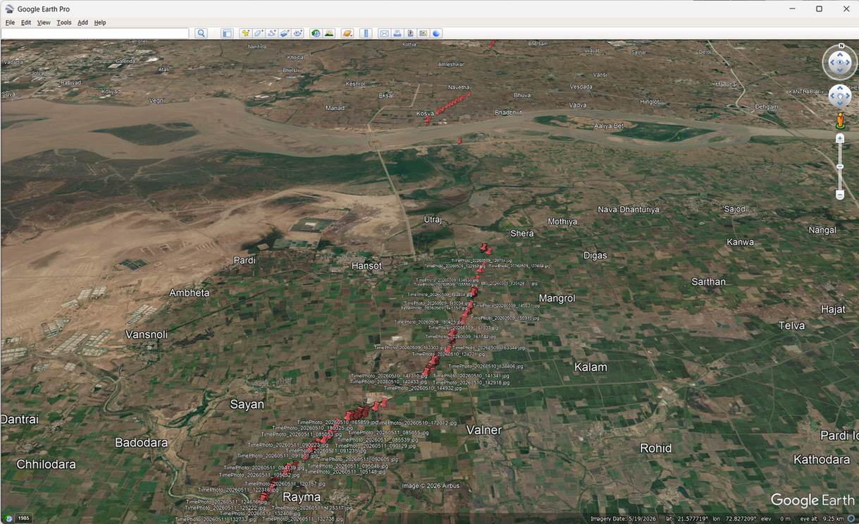
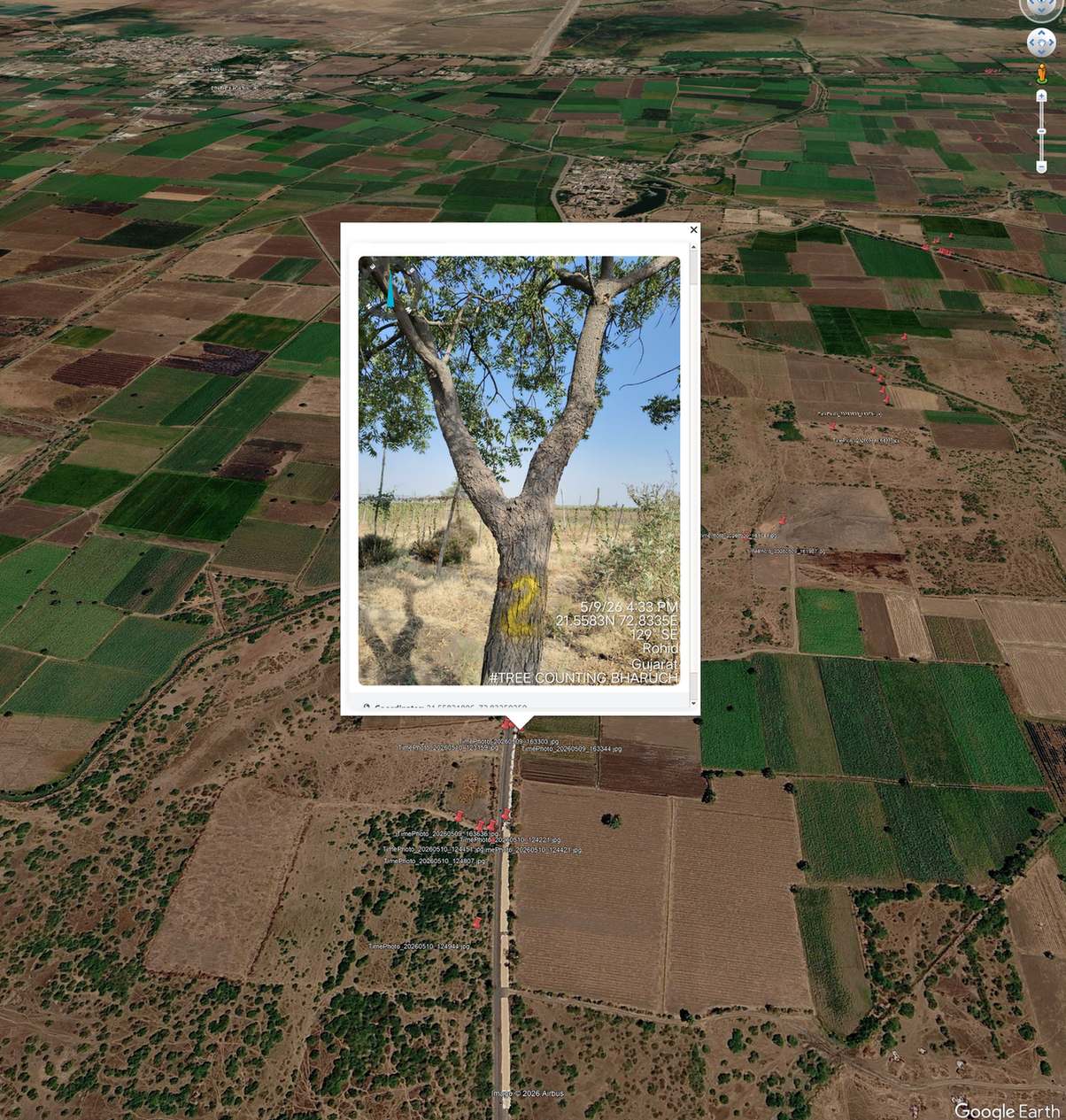
One practical note from our own use. Phone cameras write GPS data only when location services are enabled for the camera app, and most PNG screenshots carry no EXIF at all. If your batch shows a high "Missing GPS" count, that is the tool telling you the truth about your data, not a bug. Fix the capture settings, not the converter.
Frequently Asked Questions
No hard limit. Photos are processed one at a time and compressed before embedding, so batches of several hundred images work fine on a normal laptop. Very large batches simply take longer, and the progress grid keeps you informed throughout.
No. The entire pipeline runs in your browser using local file APIs. You can verify this yourself: load the page, switch off your internet, and the tool will still process photos and generate the KMZ.
The image file genuinely has no coordinates in its EXIF header. Common causes: location was off on the phone, the photo was forwarded through an app that strips metadata (WhatsApp does this by default), or it is a screenshot. The inspection log makes this visible per file, which is exactly how you validate a dataset.
Yes. KMZ is an open format, so QGIS, ArcGIS and most GIS platforms read it directly. For clients we usually recommend Google Earth because it needs zero training: double-click and everything is there.
Use It, Share It, and Tell Us What to Build Next
This generator started as an internal Trishunya utility and earned its place on our website because clients kept asking for the KMZs it produced. It will stay free. If your project needs go beyond photo mapping, into drone survey, DGPS control, LiDAR, or full GIS solutions with dashboards and layered deliverables, that is the work Trishunya does every day across India. Bookmark this page, keep it in your site-visit routine, and send us the tool you wish existed. There is a fair chance we have already built it for ourselves.
Get a quote for Drone Survey and GIS Mapping on WhatsApp