Measure Land Area From Your Phone: Draw It, Or Just Walk It
A free map tool that lets anyone measure land area online in Bigha, Guntha, Vaar, Acre or Hectare, walk a field boundary with GPS, and export the result as a PDF report, KML, or AutoCAD file. No app install, no signup, and your data never leaves your device.
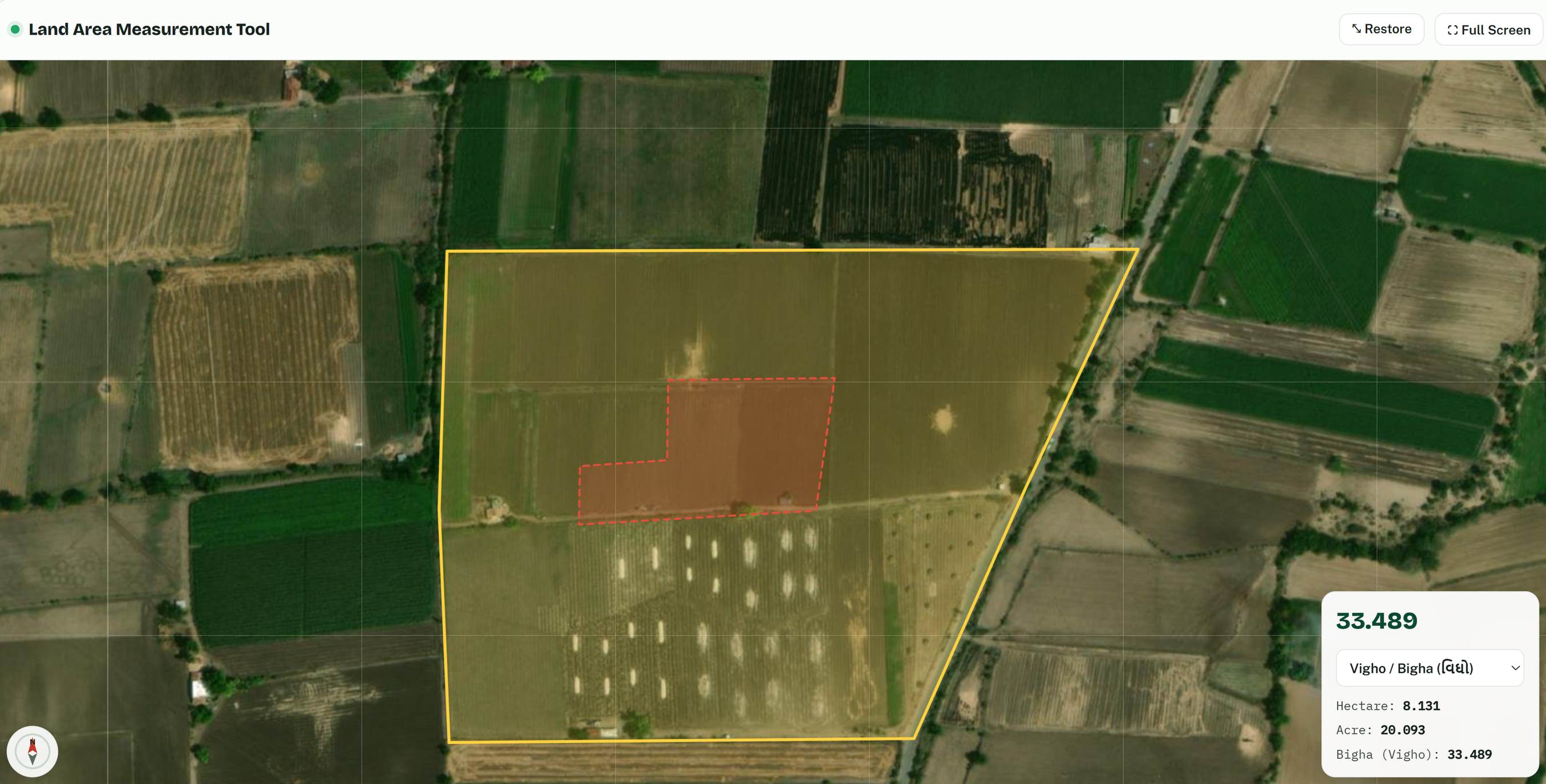
A farmer near Mehsana once asked our survey crew a question that stuck with us: "You have machines worth lakhs. I just want to know if my field is really 4 vigha like the papers say. Is there nothing simple for me?" There is now. The tool below lets you measure land area online, right here on this page, using the same satellite imagery and the same spherical geometry math that professional GIS software uses. Zoom to your plot, tap the corners, and the area appears instantly in Bigha, Guntha, Vaar, Acre, Hectare, square metres or square feet. If you are standing on the land itself, you do not even have to draw: switch on Walk the Boundary, put the phone in your pocket, and walk the edge of your field. The tool drops the corner points for you.
We built this at Trishunya after years of the same phone calls: landowners wanting a quick sanity check before a sale, contractors needing a rough plot size before quoting, farmers double-checking a patwari figure. None of those situations needs a full DGPS and RTK survey on day one. They need a fast, honest first answer. So here it is, free, and it works offline-friendly too: your boundary is auto-saved on your own device, so an accidental refresh will not erase your work.
100% private, 100% on your phone. This page has no backend. Nothing you draw, walk, or export is ever sent to any server, ours included. Every calculation, every file (PNG, PDF, KML, DXF, KMZ) is generated inside your own browser and downloaded straight from memory. Close the tab and it is gone from everywhere except your device.
How to Measure Land Area Online in Five Steps
The tool is built for bright sunlight and non-technical hands, the way a good field instrument should be. Buttons are large, the satellite view is high resolution Esri World Imagery, and the live area panel updates the moment you move a point. Here is the whole workflow to measure land area online, start to finish:
- Find your plot.
Tap "Find My Location" to jump to where you are standing, or simply pan and pinch-zoom the satellite map to your village and field. Zoom in close enough to see bunds, trees and boundary walls clearly.
- Draw the boundary.
Tap "Draw Field", then tap each corner of your plot on the map. Tap the first point again to close the shape. The area appears instantly in the floating panel.
- Cut out what does not count.
A farmhouse, a well, a pond inside the field? Use "Exclusion Zone" to draw a hole inside your boundary. The tool subtracts it from the total automatically.
- Pick your unit.
Switch the panel between square metres, square feet, Vaar, Guntho, Small Vigho, Vigho, Acre, Hectare and Are. Hectare, Acre and Bigha stay pinned below so you can always compare against your land records.
- Export and share.
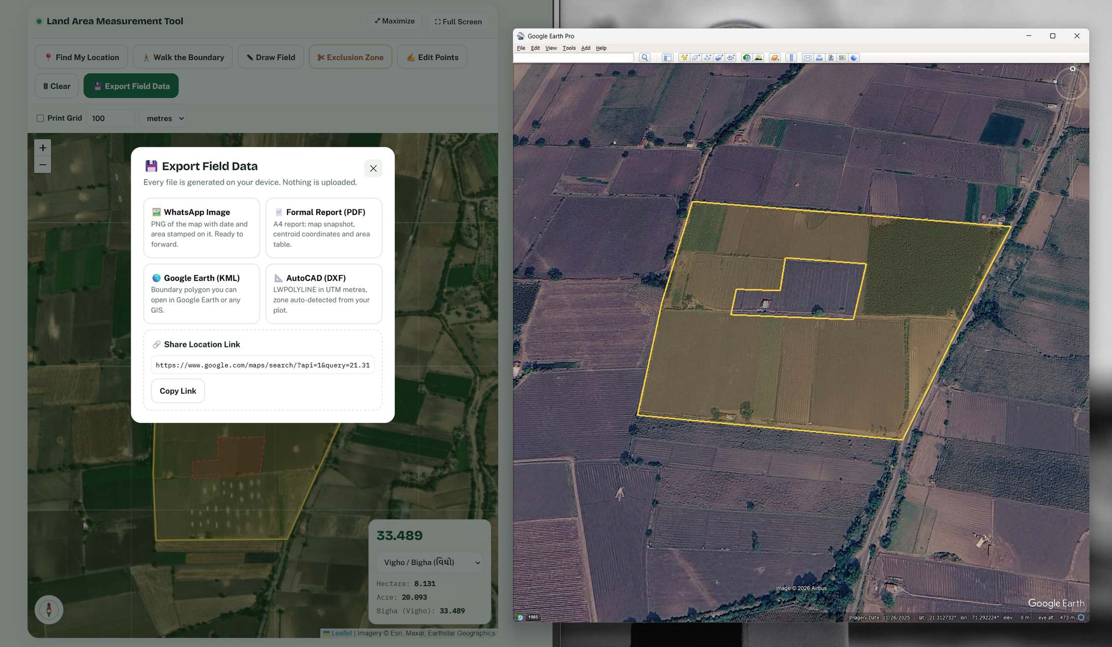
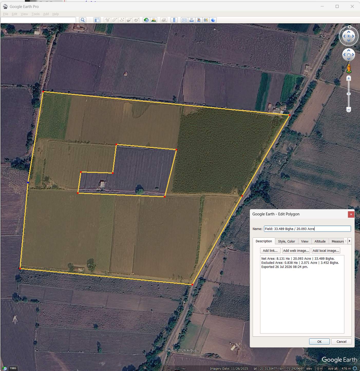
One tap on "Export Field Data" gives you a WhatsApp-ready image with the date and area stamped on it, a formal A4 PDF report, a KML for Google Earth, a DXF for AutoCAD, or a Google Maps link of your plot centre.
Measure Land Area by Walking: Your Phone Becomes the Instrument
This is the feature our field engineers are most fond of, because it mirrors how professional stakeout actually happens. Switch on "Walk the Boundary" while standing at one corner of your field. The tool uses your phone's GPS through the browser's own geolocation API and drops a vertex automatically every few metres as you walk the perimeter. By the time you return to your starting corner, the polygon is closed and the area is on screen. No tapping, no guessing where the boundary runs on the image. You measured your land by walking it, the oldest survey method there is, upgraded with satellite positioning.
Be honest with yourself about accuracy, though, because we always are with our clients. A phone GPS is typically accurate to a few metres in open sky. For a quick check, a sale discussion, or a quote estimate, that is usually plenty. For a legal boundary dispute, a land acquisition case, or construction setting-out, it is not, and that is exactly where survey-grade equipment earns its keep. Trishunya crews use RTK receivers that resolve positions to centimetres, and for large or complicated parcels a drone survey maps every metre of the site in one flight. Use the free tool for the first answer. Call professionals for the final one.
Field tip from our surveyors: walk the boundary in the morning or late afternoon and hold the phone away from your body on the field side. GPS accuracy drops near tree lines, compound walls and under power lines, so slow down at those stretches and let the position settle before moving on.
Bigha, Guntha, Vaar: Local Units Built In
Most online area calculators stop at acres and hectares, which is useless when your 7/12 extract or your grandfather's memory speaks in Vigho and Guntho. This tool speaks the local language of land. The conversion table below is the exact one wired into the calculator, based on the Gujarat standard where 1 Vigho equals 2428.08 square metres and 1 Guntho equals 121 square Vaar. If your district uses a slightly different Bigha, the multiplier is a single constant in the code, easy to adjust.
| 1 unit equals → | m² | ft² | Vaar | Guntho | Small Vigho | Vigho | Acre | Hectare |
|---|---|---|---|---|---|---|---|---|
| Vaar (yd²) | 0.836 | 9 | 1 | 0.00826 | 0.00052 | 0.00035 | 0.0000836 | 0.0000836 |
| Guntho | 101.17 | 1088.98 | 121 | 1 | 0.0625 | 0.04167 | 0.02471 | 0.010117 |
| Small Vigho | 1618.72 | 17423.74 | 1936 | 16 | 1 | 0.6667 | 0.4 | 0.16187 |
| Vigho (Bigha) | 2428.08 | 26135.61 | 2904 | 24 | 1.5 | 1 | 0.6 | 0.24281 |
| Acre | 4046.86 | 43560 | 4840 | 40 | 2.5 | 1.6667 | 1 | 0.40469 |
| Hectare | 10000 | 107639 | 11959.5 | 98.84 | 6.1775 | 4.1183 | 2.47105 | 1 |
| Are | 100 | 1076.39 | 119.595 | 0.9884 | 0.0618 | 0.0412 | 0.02471 | 0.01 |
There is one more print-friendly touch: a toggleable grid overlay. Turn on "Print Grid", choose a spacing in metres or feet, and the map draws a measured grid over your plot. Take a screenshot or export the PDF, and anyone reading the printout can visually estimate distances against the grid, the same way engineers read a drawing sheet.
Bonus Tool: Check If Your Site Photos Are Really Geo-Tagged, Then Pack Them Into a KMZ
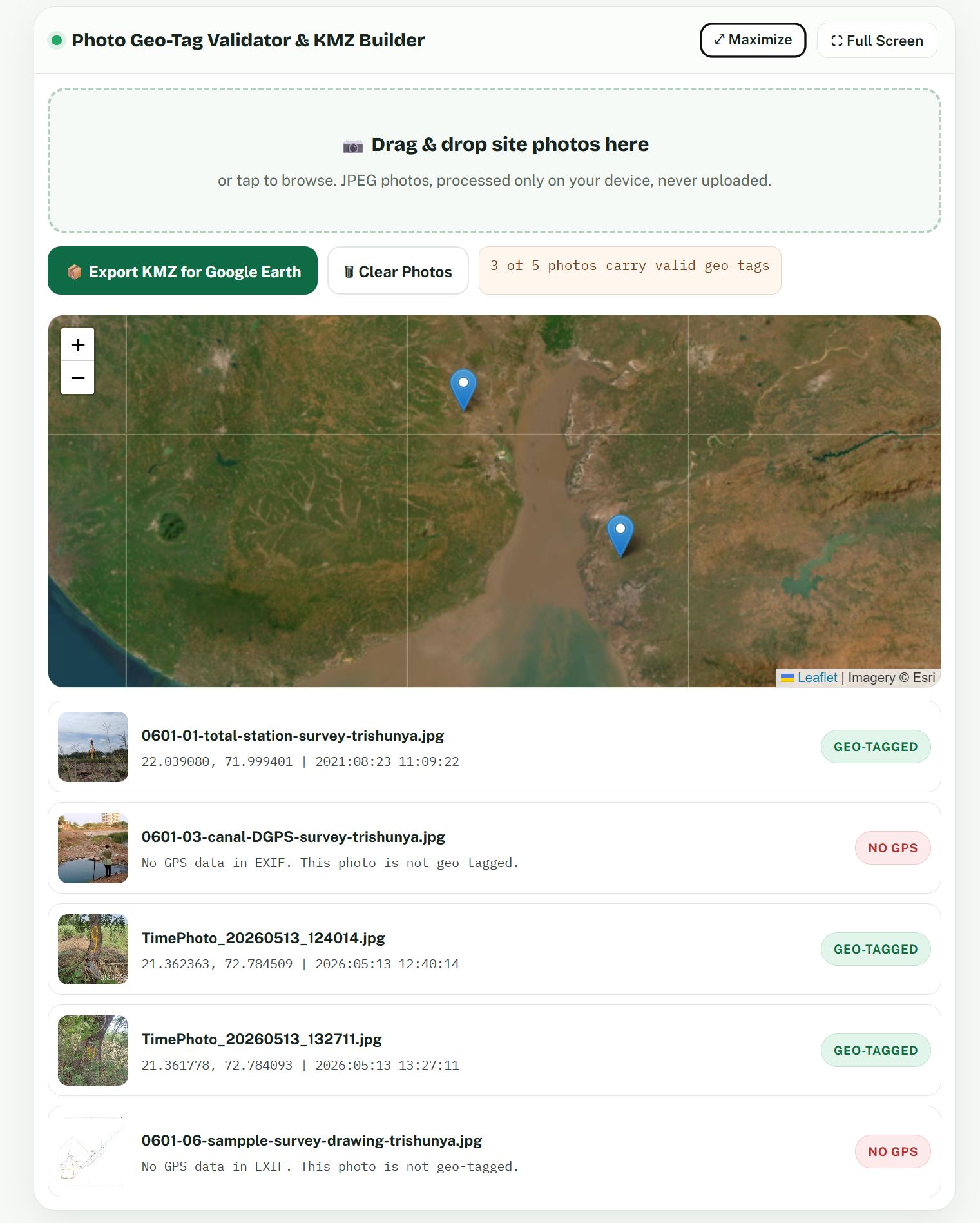
Here is a problem every project engineer recognises. A site team sends 60 photos on WhatsApp. The client asks: where exactly was photo 23 taken, and when? Nobody knows. Worse, some "geo-tagged" photos turn out to have no GPS data at all because a camera app stripped it. The second tool on this page fixes both problems without uploading a single photo anywhere. Drop your JPEGs below and it reads the EXIF metadata directly on your device: it shows which images carry a genuine GPS position and capture time, plots every geo-tagged photo on a map, and then packs the whole set into one KMZ file. Open that KMZ in Google Earth and every photo sits at its exact location, stamped with its exact date and time. One file, complete site evidence, verifiable by anyone.
Why does geo-tag validation matter so much? Because photographic evidence is only evidence if its position and time can be trusted. On feature geo-tagging assignments, Trishunya teams routinely verify that every asset photo, every pole, chamber, tree or structure, carries coordinates that match the surveyed position. When a photo has been edited, forwarded through certain apps, or shot with location switched off, the GPS block in its EXIF header is missing or altered, and this tool exposes that in seconds. Site supervisors use it to audit contractor submissions. Consultants use it to prepare clean KMZ deliverables for clients who want to open one file and see the whole site laid out geographically, photo by photo, date by date.
When a Free Tool Is Enough, and When It Is Not
We are a surveying company publishing a free measurement tool, so let us be direct about where the line sits. This tool is genuinely good for: checking your land area against records before a purchase or sale conversation, estimating plot size for quotations, preparing a quick KML of a proposed site, packaging site visit photos as verifiable KMZ evidence, and settling that friendly argument about whose field is bigger. It is deliberately not a substitute for: legal boundary demarcation, land acquisition documentation, construction stakeout, or any measurement where a few metres of GPS drift changes the outcome.
For those, the physics of positioning demands better instruments. A DGPS or RTK base-rover pair, a total station traverse, or an aerial mapping flight with ground control points brings the uncertainty down from metres to centimetres. That difference is not marketing, it is measurable, and it is what separates a screenshot from a survey. If your quick check with this tool raises a real question about your boundary or your area, that is the moment to bring in a professional crew, and Trishunya handles exactly this kind of work across India every week, from single plots to land acquisition corridors hundreds of kilometres long.
Common Questions About Measuring Land Area From a Phone
How accurate is this land area measurement tool?
Do my map drawings or photos get uploaded anywhere?
Can I measure in Bigha and Guntha?
What is a KMZ and why should site photos go into one?
Will the tool work offline in the field?
Try It, Then Tell Us What Your Land Says
Scroll back up, tap "Find My Location", and measure something: your field, your plot, your society compound. It costs nothing, installs nothing, and tells no one. If the number surprises you, or if the number matters enough that it must stand up in an office, a court, or a construction drawing, talk to us. Trishunya's crews carry the RTK receivers, drones and total stations that turn a good estimate into a certified fact, and we are happy to start that conversation from whatever this little tool showed you.