ভারতে জমি জরিপ খরচ ২০২৬: সম্পূর্ণ প্রতি একর মূল্য নির্ধারণ গাইড
"প্রতি একরে কত খরচ হবে?" এটি সাধারণত প্রথম এবং সবচেয়ে কঠিন প্রশ্ন যার সৎ উত্তর দেওয়া প্রয়োজন। কারণ একটি ন্যায্য প্রতি-একর মূল্য তিনটি বিষয়ের উপর নির্ভর করে যা জমিভেদে পরিবর্তিত হয়: জরিপ পদ্ধতি, জমির ভূপ্রকৃতি এবং মোট আয়তন। এই তিনটি বিষয় বিবেচনা না করে দেওয়া কোনো কোটেশন হয় ভুল, নয়তো অতিরিক্ত বাড়িয়ে বলা।
২০২৬ সালে ভারতে জমি জরিপের খরচ একটি বিস্তৃত পরিসরে বিস্তৃত: সমতল ও উন্মুক্ত জমিতে ড্রোন জরিপের ক্ষেত্রে প্রতি একরে প্রায় ₹৫০০ থেকে শুরু করে ঘন ও বাধাগ্রস্ত জমিতে টোটাল স্টেশন কাজের জন্য প্রতি একরে কয়েক হাজার টাকা পর্যন্ত। এই গাইডে আলোচনা করা হয়েছে কোন বিষয়গুলো মূল্যের পরিবর্তন ঘটায়।
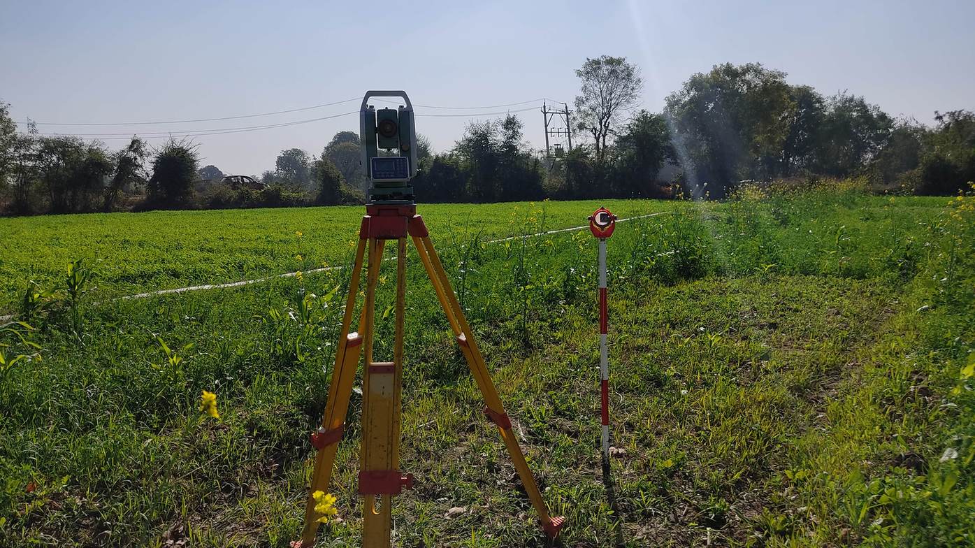
পদ্ধতি অনুযায়ী জমি জরিপের খরচ
| জরিপ পদ্ধতি | সাধারণ খরচ | বিশেষ দ্রষ্টব্য |
|---|---|---|
| ড্রোন জরিপ | ₹৫০০ থেকে ₹১,৫০০ প্রতি একর | আয়তন বাড়লে প্রতি একর খরচ কমে; GCP কাজের আলাদা চার্জ |
| DGPS / RTK জরিপ | ₹১,৫০০ থেকে ₹৪,০০০ প্রতি কিমি, বা ₹৮,০০০ থেকে ₹২৫,০০০ প্রতি দিন | করিডোর ও সীমানা নির্ধারণের জন্য সেরা |
| টোটাল স্টেশন জরিপ | সমতল এলাকায় ₹৮০০ থেকে ₹২,০০০ প্রতি কিমি | ধীরগতির কারণে প্রতি একরে কার্যকর খরচ বেশি |
| গ্রাউন্ড কন্ট্রোল পয়েন্ট (GCP) | ₹১,৫০০ থেকে ₹৩,০০০ প্রতি পয়েন্ট, বা ₹১৫,০০০ থেকে ₹৫০,০০০ নির্দিষ্ট | ড্রোনের ইঞ্জিনিয়ারিং নির্ভুলতার জন্য অপরিহার্য |
বড় জমিতে প্রতি একর খরচ কেন কম হয়
যন্ত্রপাতি পরিবহন (মোবিলাইজেশন), ফ্লাইট প্ল্যানিং এবং গ্রাউন্ড কন্ট্রোল সেটআপ হলো নির্দিষ্ট খরচ যা জমির আয়তন নির্বিশেষে প্রায় একই থাকে। যখন এই খরচটি বেশি একরের মধ্যে ভাগ হয়ে যায়, তখন প্রতি একরের দর উল্লেখযোগ্যভাবে কমে যায়। একটি ১০ একরের ড্রোন সার্ভেতে প্রতি একরে ₹১,৫০০ খরচ হতে পারে, যেখানে একই ধরনের ৫০০ একর জমিতে তা প্রতি একরে ₹৬০০ পর্যন্ত নেমে আসে।
জমির জটিলতা
ঘন গাছপালা, খাড়া ঢাল বা শহুরে বাধা কাজের গতি কমায় এবং প্রতি একরে খরচ বৃদ্ধি করে।
নির্ভুলতার মান
উচ্চ ইঞ্জিনিয়ারিং মানের জন্য ঘন গ্রাউন্ড কন্ট্রোল পয়েন্টের প্রয়োজন হয়, যা খরচ বাড়ায়।
আউটপুট ফরম্যাট
সাধারণ বাউন্ডারি স্কেচের চেয়ে কনট্যুর, DEM এবং অর্থোমোজাইক সমৃদ্ধ 3D মডেলের খরচ বেশি।
যাতায়াত ব্যবস্থা
প্রত্যন্ত বা দুর্গম এলাকার জমিতে কর্মীদের যাতায়াত এবং পরিবহন ব্যয় বৃদ্ধি পায়।
একটি ১০০ একরের জমিতে টোটাল স্টেশন দলের ১৫ থেকে ২০ কার্যদিবস এবং ₹৮০,০০০ থেকে ₹১,৫০,০০০ খরচ হয়। একই জমি DGPS গ্রাউন্ড কন্ট্রোল সহ ড্রোনের মাধ্যমে মাত্র এক সপ্তাহে ₹৩৫,০০০ থেকে ₹৫০,০০০ খরচে সম্পন্ন করা যায়।
একটি সঠিক জমি জরিপ কোটেশনে কী থাকা উচিত
যেকোনো কোটেশনে ফিল্ড টাইম, গ্রাউন্ড কন্ট্রোল পয়েন্ট সার্ভে, ডেটা প্রসেসিং এবং চূড়ান্ত রিপোর্টের আলাদা বিবরণ থাকা উচিত। এটি ছাড়া অন্য ভেন্ডরের সাথে তুলনা করা অসম্ভব। আমাদের drone survey service প্রতিটি উপাদান আলাদাভাবে উল্লেখ করে এবং প্রতিটি প্রকল্পে topographic আউটপুট অন্তর্ভুক্ত করে।
যেসব ড্রোন সার্ভে কোটেশনে গ্রাউন্ড কন্ট্রোল পয়েন্ট (GCP) অন্তর্ভুক্ত থাকে না, সেগুলো দেখতে সস্তা লাগলেও জরিপ-মানের নির্ভুলতা দিতে পারে না। মূল্যের তুলনা করার আগে সর্বদা GCP নিশ্চিত করুন।
সবচেয়ে কম প্রতি-একর সংখ্যাটি খুব কমই বলে যে আপনি আসলে কী পাচ্ছেন। কোটেশন তুলনা করার আগে কী অন্তর্ভুক্ত আছে তা জেনে নিন।
জমি জরিপের বাজেট কীভাবে তৈরি করবেন
প্রথমে আপনার প্রয়োজনীয় আউটপুট নির্ধারণ করুন: সীমানা নির্ধারণ, ভূসংস্থান ম্যাপিং বা উভয়ই। ১৫-২০ একরের বেশি জমির ক্ষেত্রে DGPS-নিয়ন্ত্রিত ড্রোন সার্ভে সবচেয়ে সাশ্রয়ী ও নির্ভুল সমাধান দেয়, যেখানে ছোট বা অত্যন্ত ঘন এলাকার জন্য টোটাল স্টেশন বা সরাসরি DGPS বেশি কার্যকর।
আপনার জমির জন্য সঠিক প্রতি-একর খরচ জানতে চান?
জমির অবস্থান, আয়তন এবং ধরন আমাদের জানান, আমরা আপনাকে আনুমানিক নয়, প্রকৃত কোটেশন দেব।
Frequently Asked Questions
ড্রোন সার্ভে সাধারণত প্রতি একরে ₹৫০০ থেকে ₹১,৫০০ এর মধ্যে হয়, আর টোটাল স্টেশন ও DGPS কাজ কিলোমিটার বা দৈনিক ভিত্তিতে নির্ধারিত হয়।
সবসময় নয়। অনেক ক্ষেত্রে GCP-র জন্য পয়েন্ট প্রতি ₹১,৫০০ থেকে ₹৩,০০০ বা আলাদা ফি নেওয়া হয়, তাই কোটেশন নেওয়ার সময় এটি যাচাই করা উচিত।
মোবিলাইজেশন এবং প্রাথমিক সেটআপের নির্দিষ্ট খরচ কম আয়তনের মধ্যে ভাগ হওয়ার কারণে প্রতি একরে রেট বেড়ে যায়।
বড় ও উন্মুক্ত জমির ক্ষেত্রে হ্যাঁ, প্রায় ৫০ থেকে ৭০ শতাংশ পর্যন্ত। তবে ছোট ও ঘন প্লটে টোটাল স্টেশন তুলনামূলকভাবে বেশি সাশ্রয়ী হতে পারে।
DGPS সার্ভে সাধারণত প্রতিদিন ₹৮,০০০ থেকে ₹২৫,০০০ অথবা লিনিয়ার করিডোর কাজের ক্ষেত্রে প্রতি কিলোমিটারে ₹১,৫০০ থেকে ₹৪,০০০ হয়ে থাকে।
জটিল ভূপ্রকৃতি, অতিরিক্ত GCP-র প্রয়োজনীয়তা, দুর্গম যাতায়াত ব্যবস্থা এবং বিস্তারিত 3D টপোগ্রাফিক মডেল খরচ বাড়ায়।
হ্যাঁ, এবং প্রতিটি কোটেশন সমান শর্তে তুলনা করা উচিত: একই পদ্ধতি, একই আউটপুট ফরম্যাট এবং গ্রাউন্ড কন্ট্রোলের পরিধি।
হ্যাঁ। সমতল ও উন্মুক্ত জমিতে DGPS ও ড্রোন উপযুক্ত। তবে ঘন জঙ্গল বা খাড়া পাহাড়ে টোটাল স্টেশনের প্রয়োজন হয়।
হ্যাঁ, অনেক সময় কম খরচের কোটেশনে GCP সার্ভে বা সঠিক ডেটা প্রসেসিং বাদ দেওয়া হয়, যা পরবর্তীতে নকশায় বড় ভুল তৈরি করে।
আয়তন ও স্যাটেলাইট ইমেজ দেখে প্রাথমিক ধারণা পাওয়া সম্ভব, তবে চূড়ান্ত কোটেশনের জন্য সাইটের প্রবেশপথ ও বাধাগুলো পর্যালোচনা করা জরুরি।
এই হেল্পলাইন শুধুমাত্র প্রকল্পের অনুসন্ধানের জন্য সংরক্ষিত। প্রশিক্ষণ বা চাকরির তথ্যের জন্য যোগাযোগ করবেন না।