Home Blog LiDAR vs Photogrammetry: Which Wins for Topo Surveys

LiDAR vs Photogrammetry: Which Wins for Topo Surveys

🧮 2  |  🟢 2
21 Jan 2026 Trishunya Team
LiDAR vs Photogrammetry: Which Wins for Topo Surveys
Drone LiDAR Surveying · Technology Comparison

LiDAR vs Photogrammetry: Which Is Better for Topographic Surveys?

📅 21 Jan 2026 ⏱ 3 min read 🏷 LiDAR TI Trishunya India

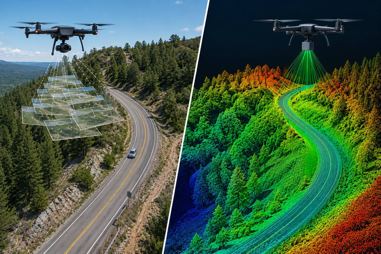
Fly the same forested site with a photogrammetry drone and a LiDAR-equipped one, and you get two different pictures of the ground. Photogrammetry sees the treetops. LiDAR sees through gaps in the canopy to the actual terrain beneath. That single difference decides which technology a project actually needs.

LiDAR and photogrammetry both produce terrain models from aerial data, but they capture the world in fundamentally different ways. Photogrammetry builds a 3D model from overlapping photographs. LiDAR fires laser pulses and measures their return time, some of which slip through vegetation gaps to reach bare ground.

LiDAR vs photogrammetry comparison for topographic surveys
LiDAR and photogrammetry capture terrain through fundamentally different methods.
2-3x
LiDAR cost vs photogrammetry
Canopy penetration: LiDAR only
Higher
Point density typically from LiDAR

Watch Canopy Penetration in Action

LiDAR vs Photogrammetry Under Tree Canopy

Laser pulses reach the ground through canopy gaps. Camera-based photogrammetry stops at the treetops.
Green pulses reach the ground. Red camera rays stop at the canopy.

Compare Point Cloud Density

Point Cloud Density Comparison

Toggle between technologies to see typical point cloud density on the same terrain patch.

Find Your Cost-Accuracy Balance

Cost vs Accuracy Tradeoff

Click anywhere on the plot to see which technology fits that cost and accuracy combination.

Side-by-Side Comparison

FactorPhotogrammetryLiDAR
Canopy penetrationNo, sees only visible surfacesYes, laser pulses reach ground through gaps
CostBaseline (₹500-1,500/acre)2 to 3 times photogrammetry cost
Best terrainOpen, minimally vegetated sitesForested, vegetated, or complex terrain
Data outputPhoto-realistic orthomosaic + DTMDense point cloud with ground classification

For open sites with minimal vegetation, photogrammetry delivers comparable accuracy at a fraction of LiDAR's cost. Reserve LiDAR specifically for forested, vegetated, or canopy-obstructed terrain where photogrammetry simply cannot see the ground.

Photogrammetry photographs what it can see. LiDAR measures what is actually there, even when it is hidden.

Choosing the Right Technology

Match the technology to the terrain, not the project budget alone. Our drone survey team evaluates vegetation density and accuracy requirements before recommending LiDAR over standard photogrammetry, and every LiDAR scan deliverable includes ground classification data showing exactly what was captured beneath the canopy.

Not sure whether your site needs LiDAR?

Share your terrain type and vegetation density, and we will recommend the right technology.

Frequently Asked Questions

LiDAR uses laser pulses that can penetrate gaps in vegetation to reach the ground, while photogrammetry builds terrain models from overlapping photographs limited to visible surfaces.

Not necessarily. For open, minimally vegetated sites, photogrammetry delivers comparable accuracy at significantly lower cost. LiDAR earns its premium specifically in vegetated terrain.

LiDAR sensors are more expensive hardware, generate larger datasets, and require specialized processing, typically costing 2 to 3 times more than equivalent photogrammetry surveys.

No, photogrammetry relies on visible camera imagery and cannot see beneath tree canopy, which is the core advantage LiDAR offers for forested terrain.

LiDAR generally produces higher point density, especially in complex terrain, though modern photogrammetry can also achieve dense point clouds on well-textured, open surfaces.

Yes, since LiDAR uses its own laser pulses rather than relying on ambient light, unlike photogrammetry which depends on good lighting conditions for image quality.

Forested areas, dense vegetation, and complex terrain with canopy obstruction benefit most, since these are exactly the conditions photogrammetry cannot handle well.

Photogrammetry will capture the canopy surface but not the ground beneath it, so LiDAR is generally recommended for accurate bare-earth data in forested sites.

Yes, LiDAR still benefits from DGPS-surveyed ground control points to achieve and verify survey-grade accuracy, similar to photogrammetry workflows.

Photogrammetry processing is often faster due to smaller file sizes, while LiDAR's denser datasets typically require more processing time and specialized software.

Back to all articles