የድሮን LiDAR ቅየሳ ምንድን ነው? ለጀማሪዎች የተዘጋጀ ሙሉ መመሪያ
LiDAR ማለት የብርሃን ቅኝት እና የርቀት መለኪያ (Light Detection and Ranging) ማለት ሲሆን ጽንሰ-ሐሳቡ በጣም ቀላል ነው፡ የሌዘር ምት መላክ፣ ተመልሶ እስኪመጣ የሚፈጅበትን ጊዜ መለካት እና ትክክለኛውን ርቀት ማስላት። በድሮን ላይ የተገጠመ የ LiDAR ሴንሰር በበረራ ወቅት በሰከንድ በመቶ ሺዎች የሚቆጠሩ የሌዘር ምቶችን በመላክ የመሬቱን ጥቅጥቅ ያለ የ 3D ዲጂታል ካርታ ይገነባል።
ተራ ካሜራ ከፀሐይ በሚያንጸባርቀው ብርሃን ላይ ጥገኛ ሲሆን፣ LiDAR የራሱን ብርሃን ያመነጫል እንዲሁም ይለካል። ይህ ልዩነት በዝቅተኛ ብርሃን ውስጥ እንዲሠራ፣ ጥቅጥቅ ባሉ ዛፎች እና ቅጠሎች መካከል አልፎ ወደ መሬት እንዲደርስ እና ተራ ፎቶግራፍ ሊያገኘው የማይችለውን ከፍተኛ ትክክለኛነት እንዲሰጥ ያስችለዋል።
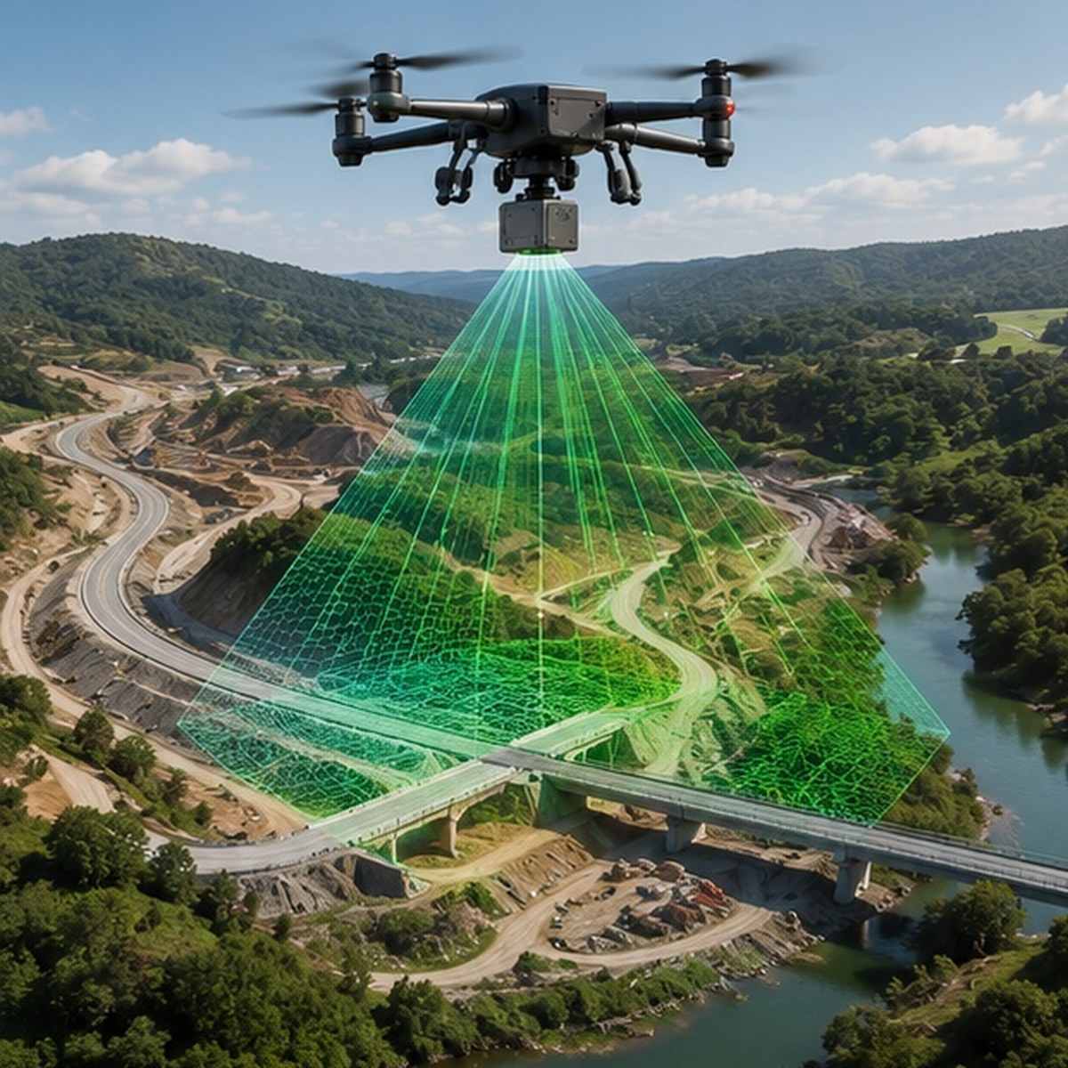
የ LiDAR ስካን በቅጽበት ሲገነባ ይመልከቱ
የቀጥታ LiDAR ፖይንት ክላውድ ሲሙሌሽን
እራስዎ ይሞክሩት: የሌዘር ምት ይላኩ
የርቀት መለኪያ ሲሙሌተር
የፖይንት ክላውድ ጥግግትን ይቆጣጠሩ
የነጥብ ጥግግት ማስተካከያ
የድሮን LiDAR ቅየሳ እንዴት ይሰራል
የሌዘር ምት ልቀት
ድሮኑ በታቀደው መስመር ሲበር ሴንሰሩ ፈጣን የሌዘር ምቶችን ወደ መሬት ይልካል።
የመመለሻ ጊዜ መለካት
የርቀቱን መጠን ለማወቅ የእያንዳንዱ ምት መመለሻ ጊዜ በናኖሰከንድ በትክክል ይለካል።
የቦታ እና አቅጣጫ ክትትል
GPS እና ሴንሰሮች ለእያንዳንዱ ምት የድሮኑን ትክክለኛ መጋጠሚያ እና ዘንበል ያለ አንግል ይመዘግባሉ።
የ 3D ፖይንት ክላውድ መፈጠር
በሚሊዮኖች የሚቆጠሩ ነጥቦች ተጣምረው የቦታውን ጥቅጥቅ ያለ የ 3D ፖይንት ክላውድ ይፈጥራሉ።
የመሬት ምደባ (Classification)
ልዩ ሶፍትዌር እውነተኛውን የመሬት ገጽታ ከዛፎች እና ሕንፃዎች ነጥቦች ይለያል።
አንድ የ LiDAR በረራ በአንድ ምት ብዙ ምላሾችን (Multiple Returns) ሊመዘግብ ይችላል። ይኸውም አንድ የሌዘር ምት የዛፉን ጫፍ ሊመታ እና የተወሰነው በቅጠሎች መካከል አልፎ መሬት ላይ በማረፍ ሁለት የተለያዩ የመረጃ ነጥቦችን ይመዘግባል።
LiDAR የመሬቱን ፎቶ ብቻ አያነሳም። በሌዘር ምቶች አማካኝነት የመሬቱን ገጽታ በእውነተኛ መለኪያ ይለካል።
የድሮን LiDAR ቅየሳ መቼ ይመረጣል
ጥቅጥቅ ያሉ የደን አካባቢዎች፣ ዝቅተኛ የብርሃን ሁኔታዎች እና ትክክለኛ የመሬት ከፍታ መረጃ የሚያስፈልጋቸው የምህንድስና ፕሮጀክቶች LiDAR ከፎቶግራሜትሪ የላቀ ውጤት የሚሰጥባቸው ናቸው። የ drone survey ቡድናችን በእነዚህ አስቸጋሪ ሁኔታዎች ውስጥ LiDAR ን በመጠቀም ለምህንድስና ስራዎች የተመደበ የ LiDAR scan መረጃ ያቀርባል።
LiDAR ለፕሮጀክትዎ ተስማሚ መሆኑን ማወቅ ይፈልጋሉ?
የመሬትዎን አይነት ይንገሩን እና የ LiDAR ቅየሳ ምን አይነት መረጃ እንደሚያቀርብ እናብራራለን።
ተደጋግመው የሚጠየቁ ጥያቄዎች (FAQ)
Light Detection and Ranging ማለት ሲሆን በሌዘር ብርሃን አማካኝነት ርቀትን የሚለካ ቴክኖሎጂ ነው።
LiDAR የራሱን ሌዘር በመጠቀም ከዛፎች ስር ያለውን መሬት ያያል፣ ካሜራ ግን በፀሐይ ብርሃን ላይ ብቻ የተመሰረተ ነው።
አዎ፣ የፀሐይ ብርሃን ስለማያስፈልገው በጨለማ ውስጥም ሙሉ ትክክለኛነት ይሰራል።
የመሬቱን እና የሕንፃዎችን ቅርጽ የሚወክሉ በሚሊዮኖች የሚቆጠሩ የ 3D ነጥቦች ስብስብ ነው።
የመሬት ገጽታን ከዛፎች እና ግንባታዎች የመለየት ሂደት ነው።
ዘመናዊ ሴንሰሮች በሰከንድ ከመቶ ሺዎች እስከ ከአንድ ሚሊዮን በላይ ምቶችን ይልካሉ።
አዎ፣ የቅየሳ ደረጃ ትክክለኛነትን ለማረጋገጥ የመሬት መቆጣጠሪያ ነጥቦች ያስፈልጋሉ።
አንድ ሌዘር ከዛፍ ቅጠሎች እና ከመሬት ተመልሶ ብዙ መረጃዎችን የመመዝገብ ችሎታ ነው።
በላቁ መሳሪያዎች ምክንያት የመነሻ ዋጋው ከፍ ያለ ቢሆንም በደን ውስጥ ብዙ ጊዜ እና ወጪ ይቆጥባል።
በደን ልማት፣ የኤሌክትሪክ መስመሮች ፍተሻ፣ የመንገድ እና የባቡር መስመር ዝርጋታ እና የመሬት ካርታ ስራ።
ይህ መስመር ለፕሮጀክት ጥያቄዎች ብቻ የተከለለ ነው። እባክዎን ለስራ ወይም ለስልጠና ጥያቄዎች አይጠቀሙበት።