Home Blog Drone LiDAR for Powerline and Transmission Inspection

Drone LiDAR for Powerline and Transmission Inspection

🧮 2  |  🟢 2
29 Jan 2026 Trishunya Team
Drone LiDAR for Powerline and Transmission Inspection
Drone LiDAR · Powerline & Utility Inspection

Drone LiDAR for Powerline and Transmission Inspection

📅 29 Jan 2026 ⏱ 3 min read 🏷 Powerline Inspection TI Trishunya India

Vegetation growing too close to a transmission line is one of the leading causes of power outages and wildfire ignition worldwide. Drone LiDAR gives utility operators a precise, repeatable way to measure exactly how close vegetation has grown to every conductor along a corridor.

Unlike visual inspection, LiDAR measures actual three-dimensional distance between conductor and vegetation, accounting for conductor sag under load and temperature, not just how things look from a photograph.

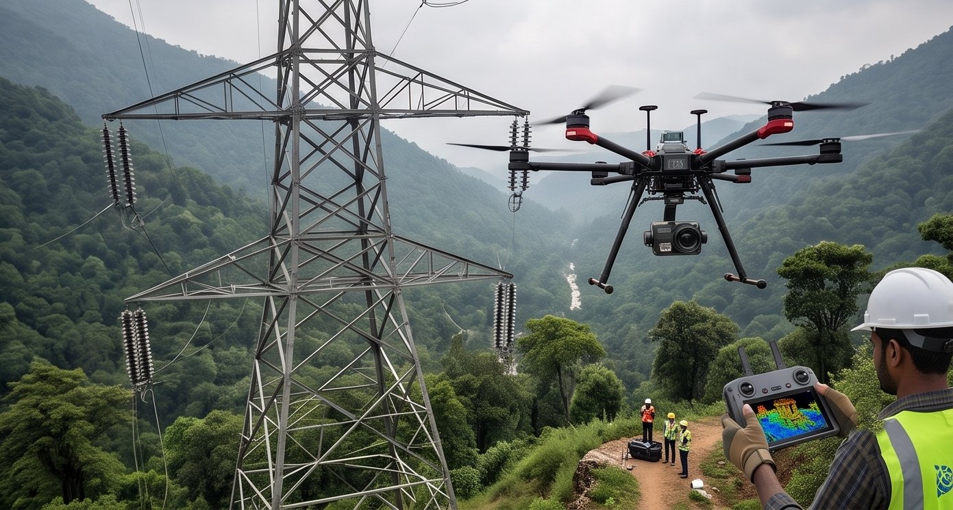
Drone LiDAR powerline transmission corridor inspection
LiDAR measures precise clearance distances between conductors and surrounding vegetation.
3D
True clearance measurement
Sag-aware
Accounts for load & temperature
km
Corridor length per flight

Watch Conductor Sag and Clearance Live

Live Sag and Encroachment Monitor

The conductor sags realistically between towers while a vegetation point grows toward it, triggering a clearance alert when it gets too close.
Real inspections flag every point where clearance falls below the safety threshold.

See How Temperature Affects Sag

Interactive Sag Calculator

Drag the slider to change conductor temperature and watch how sag and clearance change in response.
40°C conductor temp

Check Clearance Along the Corridor

Click to Inspect Clearance Zones

Click along the corridor line to check simulated vegetation clearance at that point, exactly as an inspector reviews LiDAR data.
Red zones indicate clearance below the typical safety threshold.

How Powerline LiDAR Inspection Works

1

Corridor flight planning

The drone flies the full transmission line route, capturing conductors, towers, and surrounding vegetation in one pass.

2

Conductor extraction

Software automatically identifies and extracts conductor lines from the point cloud based on their characteristic linear pattern.

3

Vegetation height modeling

Vegetation points near the corridor are classified and their height above ground calculated precisely.

4

Clearance distance calculation

The true three-dimensional distance between each conductor point and nearby vegetation is calculated automatically.

5

Encroachment flagging

Any location where clearance falls below the safety threshold is flagged for maintenance crew action.

Conductor sag increases with electrical load and ambient temperature, meaning clearance measured on a cool day with low load can be dangerously misleading. Accurate inspection models must account for worst-case sag conditions.

A photograph shows you vegetation near a line. LiDAR tells you exactly how many centimeters of clearance remain.

Protecting Your Transmission Infrastructure

Regular LiDAR-based corridor inspection helps utilities catch encroachment risks before they cause outages or safety incidents. Our drone survey team plans repeatable corridor flight paths for periodic LiDAR scan inspections tailored to transmission line maintenance programs.

Need a powerline corridor inspection?

Tell us your corridor length and we will outline a LiDAR inspection plan tailored to your network.

Frequently Asked Questions

LiDAR measures true three-dimensional clearance distance between conductors and vegetation, while visual inspection only estimates proximity from images.

Conductor sag is the downward curve a power line takes between towers, which increases with electrical load and ambient temperature.

LiDAR classifies vegetation points near the corridor and calculates their precise distance to conductors, flagging any location below the safety clearance threshold.

Yes, a single continuous drone flight can capture kilometers of corridor data in one pass, far faster than ground-based inspection crews.

Vegetation growing too close to conductors can cause arcing or direct contact, both leading causes of outages and fire ignition risk near transmission lines.

Yes, higher conductor temperatures increase sag, reducing clearance, so accurate inspection models must account for worst-case temperature and load conditions.

Inspection frequency depends on vegetation growth rates and regulatory requirements, though many utilities schedule periodic LiDAR surveys as part of ongoing maintenance programs.

Yes, extracted clearance data can feed directly into vegetation management systems, helping utilities prioritize trimming crews based on actual encroachment risk.

Properly verified LiDAR data with checkpoint accuracy documentation is widely used to support regulatory vegetation clearance compliance reporting.

Typical deliverables include classified point cloud data, extracted conductor models, and a clearance report flagging specific encroachment locations along the corridor.

Back to all articles