ላይዳር ለደን ልማት፦ የደን እንጨት መጠንን በትክክል መለካት
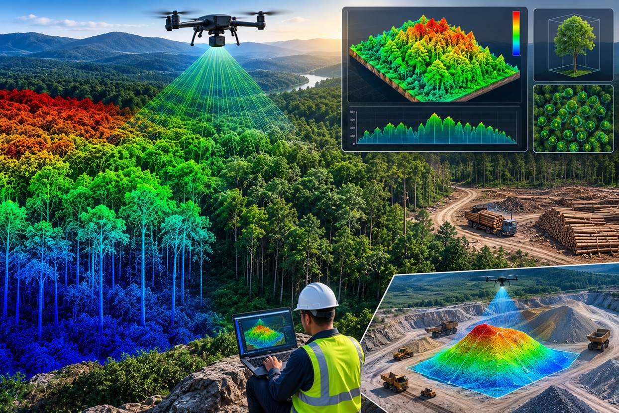
አንድ የደን ክልል ምን ያህል እንጨት እንደያዘ መገመት በተለምዶ የባለሙያዎችን ቡድን በመላክ ጥቂት የናሙና ዛፎችን መለካት እና ያንን መረጃ ለጠቅላላው ደን ማባዛትን ይጠይቅ ነበር። የድሮን ላይዳር (LiDAR) ቴክኖሎጂ በእያንዳንዱ በተቃኘው አካባቢ የሚገኙ ዛፎችን በሙሉ የሚሸፍን የተሟላ የዛፍ አናት ከፍታ ሞዴል (Canopy Height Model) በማዘጋጀት የናሙና ግምታዊ ስራን ያስቀራል።
ላይዳር ለእያንዳንዱ ነጥብ የመሬቱን ከፍታ እና የዛፉን አናት ከፍታ በአንድነት በመቅረጽ የዛፎቹን ቁመት በቀጥታ ያሰላል። ይህ ቁመት ከዛፎቹ አናት ስፋት ጋር ተደምሮ ለደን ባለሙያዎች በመላው ደን ውስጥ ያለውን የእንጨት መጠን እና የባዮማስ ክምችት በትክክል ለመገመት አስተማማኝ መሰረት ይሰጣል።
የዛፍ አናት ከፍታ ሞዴል ግንባታን ይመልከቱ
የቀጥታ የደን መጠን ክምችት ስሌት
የዛፎችን ጥግግት ያስተካክሉ
በይነተገናኝ የእንጨት መጠን ማስያ
ነጠላ ዛፎችን ይመርምሩ
ለመለካት ዛፉ ላይ ይጫኑ
የላይዳር የእንጨት መጠን ግምት እንዴት እንደሚሰራ
የዲጂታል የመሬት ገጽታ ሞዴል (DTM) ግንባታ
የመሬት ነጥቦች ምደባ ከዛፎች አናት በታች ያለውን ትክክለኛ ባዶ የመሬት ገጽታ ይፈጥራል።
የዲጂታል የገጽታ ሞዴል (DSM) ግንባታ
በእያንዳንዱ አካባቢ ያሉ ከፍተኛ የሌዘር ነጸብራቆች የዛፎቹን አናት የሚወክል የገጽታ ሞዴል ይፈጥራሉ።
የዛፍ አናት ከፍታ ሞዴል (CHM) ስሌት
የመሬት ከፍታን ከገጽታ ከፍታ ላይ በመቀነስ በደኑ ውስጥ ላለ እያንዳንዱ ነጥብ ትክክለኛ የዛፍ ቁመት ይሰጣል።
የእያንዳንዱ ዛፍ መለያየት (Segmentation)
አልጎሪዝሞች ለእያንዳንዱ ዛፍ ጥልቅ ትንተና ለማድረግ በCHM ውስጥ ነጠላ የዛፍ አናቶችን ይለያሉ።
የእንጨት መጠን እና ባዮማስ ግምት
ቁመት፣ የአናት ስፋት እና ዝርያ-ተኮር የአሎሜትሪክ ቀመሮች ተጣምረው አጠቃላይ የእንጨት መጠንን ይገምታሉ።
ላይዳር ከጥቂት የናሙና ቦታዎች ይልቅ መላውን ደን ስለሚሸፍን፣ የመጠን ግምቱ በቦታው ላይ ያሉ የተፈጥሮ ልዩነቶችን፣ ክፍተቶችን፣ ጥቅጥቅ ያሉ ቦታዎችን እና የደን ጠርዞችን በትክክል ያካትታል።
የናሙና መሬት የሚነግርዎት ስለ ጥቂት ዛፎች ብቻ ነው። ላይዳር ግን በመላው ደን ውስጥ ስላለ እያንዳንዱ ዛፍ ይነግርዎታል።
ይህንን ለደን ልማት ፕሮጀክቶች መተግበር
ለንግድ እንጨት ክምችት፣ ለካርቦን ክምችት ምዘና ወይም ለተከላ ደን አስተዳደር የተሟላ የዛፍ አናት ሽፋን በደን ትንተና ውስጥ አዳዲስ እድሎችን ይከፍታል። የእኛ የድሮን ቅኝት ቡድን ለደን እና ተከላ ደን ባለቤቶች ከተዘጋጀ የላይዳር ቅኝት መረጃ አስተማማኝ የዛፍ አናት ከፍታ ሞዴሎችን ያቀርባል።
የደን እንጨት መጠን ወይም የባዮማስ ምዘና ይፈልጋሉ?
የደኑን ስፋት እና የዛፍ ዝርያዎችን ይንገሩን፣ እኛም በላዳር ላይ የተመሰረተውን አቀራረባችንን እናብራራለን።
ተደጋግመው የሚጠየቁ ጥያቄዎች
ላይዳር በእያንዳንዱ ነጥብ የመሬቱን ከፍታ ከዛፉ አናት ከፍታ ላይ በመቀነስ ትክክለኛውን የዛፍ ቁመት ያሰላል።
ከላዳር የመሬት እና የገጽታ ሞዴሎች የተሰላ እና በደኑ ውስጥ በእያንዳንዱ ቦታ ያለውን የዛፍ ቁመት የሚያሳይ የመረጃ ስብስብ ነው።
ላይዳር ከናሙና ቦታ ይልቅ መላውን ደን ስለሚይዝ፣ በአካባቢው ያሉ ተፈጥሯዊ ልዩነቶችን ያካተተ የተሻለ እና ተጨባጭ ግምት ይሰጣል።
አዎ፣ የሴግሜንቴሽን አልጎሪዝሞች በCHM ውስጥ የእያንዳንዱን ዛፍ አናት በመለየት የነጠላ ዛፍ ቁመት እና መጠን ትንተና ያስችላሉ።
የዛፍ ቁመት፣ የአናት ስፋት እና የእንጨት መጠንን የሚያገናኝ የሂሳብ ቀመር ሲሆን የላይዳር መረጃን ወደ እንጨት መጠን ለመቀየር ያገለግላል።
አዎ፣ ከላይዳር የዛፍ አናት መረጃ የሚሰላው የባዮማስ ግምት ለደን ካርቦን ክምችት ምዘና እና ክትትል ቁልፍ ግብዓት ነው።
አዎ፣ ለሁለቱም ይሰራል፤ የተተከሉ ደኖች ተከታታይነት እና ወጥነት ያለው አቀማመጥ ትንተናውን የበለጠ ያቀለዋል።
ሽፋኑ በድሮኑ የበረራ አቅም እና እቅድ ላይ የተመሰረተ ሲሆን ከትንንሽ ይዞታዎች እስከ ትላልቅ የደን ተከላዎች ድረስ በብቃት ይሸፍናል።
ጥቂት ዛፎችን በመሬት ላይ በእጅ በመለካት የሚደረግ ማረጋገጫ ጥቅም ላይ የዋሉትን የአሎሜትሪክ ቀመሮች ለማስተካከል እና ለማረጋገጥ ይረዳል።
በላይዳር መረጃ ላይ የሚታዩ የአናት መዋቅር መዛባቶች የበሽታ ወይም የጭንቀት ምልክቶችን ሊያሳዩ ይችላሉ፤ ይህም በማልቲስፔክትራል ዳሳሾች ይደገፋል።
ይህ መስመር ለፕሮጀክት ጥያቄዎች ብቻ የተመደበ ነው። እባክዎ ለስልጠና ወይም ለስራ ጥያቄዎች አይጠቀሙበት።