የሀይቅ እና የዴም የውሃ መያዝ አቅም ጥናት፡ ለምን አስፈለገ
እያንዳንዱ የውሃ ሀይቅ በወንዞች በሚመጣው ደለል ምክንያት በጊዜ ሂደት የውሃ መያዝ አቅሙን ያጣል። ከበርካታ አሥርተ ዓመታት በፊት የተወሰነ የውሃ መጠን እንዲይዝ የተነደፈ ዴም ዛሬ በጣም አነስተኛ መጠን ሊይዝ ይችላል፤ እውነተኛውን ቁጥር ለማወቅ ብቸኛው መንገድ በቀጥታ መለካት ነው።
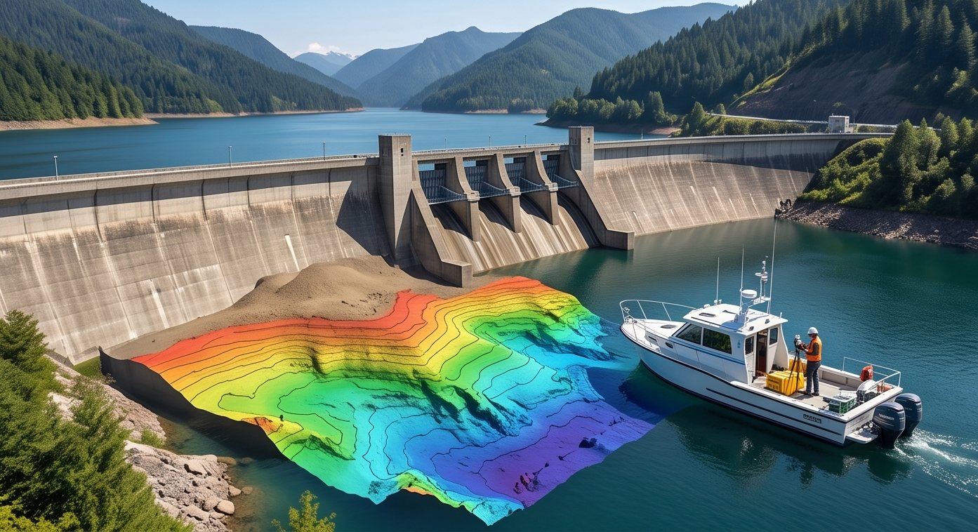
የሀይቅ የባቲሜትሪክ ጥናት የአሁኑን የታችኛውን ከፍታ ከፊተኛው የንድፍ ፕሮፋይል ጋር በማወዳደር፣ በደለል ምክንያት ምን ያህል አቅም እንደጠፋ እና ደለሉ የት እንደተከማቸ በትክክል ያሳያል።
በጊዜ ሂደት ደለል ሲከማች ይመልከቱ
የቀጥታ የደለል ክምችት ሲሙሌሽን
በጊዜ ሂደት የጠፋውን አቅም ይመልከቱ
በይነተገናኝ የአቅም ማስያ
የንድፍ እና የእውነተኛ ጥልቀትን ያወዳድሩ
ለማወዳደር መስቀለኛ ክፍሉን ይጫኑ
የሀይቅ አቅም ጥናት እንዴት እንደሚሰራ
ሙሉ የሀይቁ የባቲሜትሪክ ካርታ ዝግጅት
የሶናር ጥናት መስመሮች ሙሉውን ሀይቅ በመሸፈን የአሁኑን የታችኛውን ከፍታ በጠቅላላው የውሃ አካል ላይ ይመዘግባሉ።
ከንድፍ ፕሮፋይል ጋር ማወዳደር
የአሁኑ የጥልቀት መረጃ ከመጀመሪያው የንድፍ ባቲሜትሪ ወይም ቀደም ብሎ ከተገኘ ጥናት ጋር ይነፃፀራል።
የደለል መጠን ስሌት
በንድፍ እና በአሁኑ ፕሮፋይሎች መካከል ያለው ልዩነት አጠቃላይ የደለል መጠንን ለማስላት ይሰላል።
የአቅም ኩርባ ማዘጋጀት
የተሻሻለው የውሃ መያዝ አቅም ኩርባ በተለያዩ የውሃ ደረጃዎች ያለውን እውነተኛ አቅም ያሳያል።
የአስተዳደር ምክረ ሀሳቦች
ውጤቶቹ የደለል ማጽዳት ቅድሚያዎችን፣ የውሃ ደረጃ እቅድን እና የዴም ደህንነት ግምገማዎችን ለመወሰን ይረዳሉ።
ዛሬ በሥራ ላይ ያሉ በርካታ ዴሞች ከፍተኛ የደለል ክምችት ከመከሰቱ በፊት፣ ከበርካታ አሥርተ ዓመታት በፊት በተሰሉ የአቅም ቁጥሮች የተነደፉ ናቸው። የአሁኑ የባቲሜትሪክ ጥናት ከኦፊሴላዊ መዝገቦች ያነሰ የውሃ መያዝ አቅምን ያሳያል።
የዴም የንድፍ አቅም ያለፈ ታሪክ ቁጥር ነው። የባቲሜትሪክ ጥናት ግን ዛሬ በእውነት የሚይዘውን ይነግርዎታል።
የሀይቅ አቅም ግምገማዎን ማቀድ
የሀይቅ አቅም ግምገማ ለማድረግ ካሰቡ ወይም የታደሰ የባቲሜትሪክ ጥናት ከፈለጉ፣ ቡድናችን ለማንኛውም መጠን ላላቸው ዴሞች የተዘጋጁ የጥናት አገልግሎቶችን ይሰጣል።
የታደሰ የሀይቅ አቅም ግምገማ ይፈልጋሉ?
ስለ ሀይቅዎ ይንገሩን እና የባቲሜትሪክ ጥናት አካሄዳችንን እናብራራለን።
ተደጋግመው የሚጠየቁ ጥያቄዎች
በወንዞች የሚመጣው ደለል በሀይቁ ስር በመከማቸት ሊይዝ የሚችለውን የውሃ መጠን በሂደት ይቀንሳል።
ሶናርን የሚጠቀም የባቲሜትሪክ ጥናት የአሁኑን የታችኛውን ከፍታ በመለካት ከመጀመሪያው ንድፍ ጋር ያወዳድራል።
ድግግሞሹ በደለል ክምችት ፍጥነት እና በህጋዊ መስፈርቶች ይወሰናል፣ ብዙዎች በየጥቂት ዓመታት ያደርጋሉ።
የአቅም ኩርባ በተለያዩ የውሃ ደረጃዎች ሊያዝ የሚችለውን የውሃ መጠን በአዲሱ የጥናት መረጃ መሰረት ያሳያል።
አዎ፣ ደለል የት እንደተከማቸ የሚያሳይ መረጃ ማጽዳት የሚገባቸውን ቦታዎች ለመለየት ይረዳል።
አዎ፣ ትክክለኛ የአቅም መረጃ የጎርፍ ስሌቶችን እና የዴም ደህንነት እቅዶችን ይደግፋል።
የአቅም ማጣት እንደ የአፈር መሸርሸር እና የዴሙ እድሜ ይለያያል፣ ስለዚህ ጥናት አስፈላጊ ነው።
ሶናር እና ጂፒኤስ የተገጠፈላቸው የጥናት ጀልባዎች ወይም ሰው አልባ መሳሪያዎች ጥቅም ላይ ይውላሉ።
አዎ፣ የባቲሜትሪክ ጥናቶች አብዛኛውን ጊዜ የዴሙን መደበኛ ሥራ ሳይረብሹ ይካሄዳሉ።
የባቲሜትሪክ ካርታ፣ የደለል መጠን ሪፖርት እና የተሻሻለ የአቅም ኩርባ ይገኙበታል።
ይህ መስመር ለፕሮጀክት መሪዎች ብቻ የተጠበቀ ነው። እባክዎን ለትምህርት፣ ለስልጠና ወይም ለስራ ጥያቄዎች አይገናኙ።