স্বামিত্ব যোজনা ২০২৬: গ্রামীণ ভারতে ড্রোন ল্যান্ড ম্যাপিংয়ের সম্পূর্ণ বিশ্লেষণ
ভারতের লক্ষ লক্ষ গ্রামীণ পরিবার প্রজন্মের পর প্রজন্ম ধরে কোনো আইনি মালিকানা দলিল ছাড়াই তাদের জমিতে বসবাস করে আসছিল। তাদের কাছে কোনো প্রপার্টি কার্ড ছিল না, ছিল না স্পষ্ট মালিকানা স্বত্ব, এবং ব্যাংক থেকে ঋণ নেওয়ার কোনো সুযোগও ছিল না। স্বামিত্ব (SVAMITVA) যোজনা এই শূন্যতা পূরণ করার লক্ষ্যেই চালু করা হয়েছে, ড্রোনের এক একটি সফল উড্ডয়নের মাধ্যমে।
স্বামিত্ব যোজনা (Survey of Villages and Mapping with Improvised Technology in Village Areas) হলো কেন্দ্রীয় সরকারের একটি যুগান্তকারী প্রকল্প যা গ্রামীণ বসতি এলাকার ড্রোন জরিপ সম্পন্ন করে জমির মালিকদের আইনি প্রপার্টি কার্ড প্রদান করে। ২০২৫ সালের শেষ নাগাদ প্রায় ৩.২৮ লাখ গ্রামে ড্রোন সার্ভে সম্পন্ন হয়েছে, যা সামগ্রিক লক্ষ্যের প্রায় ৯৫ শতাংশ, এবং ১.৮ লাখেরও বেশি গ্রামের জন্য প্রপার্টি কার্ড তৈরি করা হয়েছে।
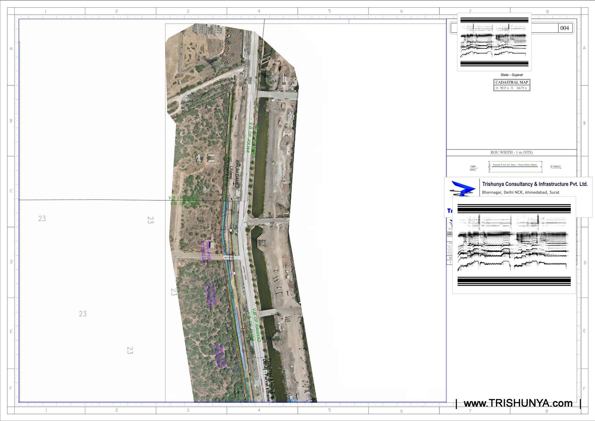
স্বামিত্ব যোজনা প্রকৃতপক্ষে কীভাবে কাজ করে
এই প্রকল্পে গ্রামের জনবসতিপূর্ণ (আবাদি) এলাকার উপর দিয়ে ড্রোন উড়িয়ে উচ্চমানের ছবি তোলা হয়, যা পরবর্তীতে প্রতিটি স্বতন্ত্র সম্পত্তির সীমানা নির্দেশক বিস্তারিত মানচিত্রে রূপান্তর করা হয়। এই সীমানার উপর ভিত্তি করেই তৈরি হয় প্রপার্টি কার্ড, যা রাজ্য রাজস্ব বিভাগ দ্বারা স্বীকৃতিপ্রাপ্ত এবং যার মাধ্যমে মালিকানা হস্তান্তর, ক্রয়-বিক্রয় ও ব্যাংক ঋণের সুযোগ পাওয়া যায়।
ড্রোন সার্ভে প্রক্রিয়ার ধাপসমূহ
গ্রাউন্ড কন্ট্রোল পয়েন্ট (GCP) স্থাপন
ড্রোনের বায়বীয় ছবিকে সঠিক স্থানাঙ্কের সাথে যুক্ত করতে গ্রামে DGPS-ভিত্তিক রেফারেন্স পয়েন্ট স্থাপন করা হয়।
বসতি এলাকায় ড্রোন উড্ডয়ন
গ্রামের আবাসিক এবং ব্যক্তিগত সম্পত্তির উচ্চমানের আকাশচিত্র ধারণ করা হয়।
সীমানা চিহ্নিতকরণ
প্রক্রিয়াজাত ছবির সাহায্যে স্থানীয় বাসিন্দাদের উপস্থিতিতে প্রতিটি প্লটের সীমানা নির্ধারণ করা হয়।
খসড়া মানচিত্র ও রেকর্ডের প্রকাশ
চূড়ান্ত করার আগে খসড়া মানচিত্র জনসমক্ষে প্রদর্শন করা হয় যাতে বাসিন্দারা যে কোনো আপত্তি বা সংশোধন জানাতে পারেন।
আইনি প্রপার্টি কার্ড প্রদান
যাচাইকরণের পর সরকার আইনি স্বীকৃতিপ্রাপ্ত প্রপার্টি কার্ড (যেমন ঘরাউনি বা সম্পত্তি পত্রক) প্রদান করে।
রাজ্যভিত্তিক অগ্রগতির চিত্র
বিভিন্ন রাজ্যে কাজের অগ্রগতি ভিন্ন। হরিয়ানা, উত্তরাখণ্ড, গোয়া, ত্রিপুরা, পুদুচেরি এবং আন্দামান ও নিকোবর দ্বীপপুঞ্জে ড্রোন সার্ভে এবং কার্ড বিতরণ দুটোই সম্পন্ন হয়েছে। তবে তামিলনাড়ু, বিহার এবং ওড়িশার মতো বড় রাজ্যগুলিতে বিপুল সংখ্যক গ্রামের কারণে কাজ এখনও চলমান রয়েছে।
| কাজের স্থিতি | উদাহরণস্বরূপ রাজ্য / কেন্দ্রশাসিত অঞ্চল |
|---|---|
| সার্ভে ও কার্ড বিতরণ সম্পূর্ণ | হরিয়ানা, উত্তরাখণ্ড, গোয়া, ত্রিপুরা, পুদুচেরি, আন্দামান ও নিকোবর |
| সার্ভে প্রায় সম্পূর্ণ, কার্ড বিতরণ চলমান | দেশের অধিকাংশ অংশগ্রহণকারী রাজ্য |
| সার্ভে ও কার্ড উভয়ই প্রক্রিয়াধীন | তামিলনাড়ু, বিহার, ওড়িশা (বড় রাজ্যগুলির মধ্যে) |
স্বামিত্ব কার্ড শুধুমাত্র একটি সাধারণ কাগজের টুকরো নয়। এর ভিত্তিতে এগারো হাজারেরও বেশি ঋণগ্রহীতাকে সতেরো শত কোটি টাকারও বেশি ব্যাংক ঋণ দেওয়া হয়েছে, যা অব্যবহৃত গ্রামীণ জমিকে আর্থিক সম্পদে পরিণত করেছে।
গ্রামীণ পরিবার ছাড়াও এই প্রযুক্তির গুরুত্ব
স্বামিত্ব প্রকল্প জাতীয় স্তরে প্রমাণ করেছে যে ঐতিহ্যবাহী পদ্ধতির তুলনায় drone survey অনেক দ্রুত, সাশ্রয়ী এবং আইনগতভাবে নির্ভরযোগ্য ডেটা তৈরি করে। এই একই DGPS-ড্রোন পদ্ধতি এখন বেসরকারি জমি মালিক এবং নির্মাতারা topographic ও বাউন্ডারি ম্যাপিংয়ের জন্য ব্যবহার করছেন।
ড্রোন জরিপের মাধ্যমে তৈরি একটি প্রপার্টি কার্ড প্রায়শই একজন গ্রামীণ পরিবারের নিজস্ব ভিটের জন্য পাওয়া জীবনের প্রথম আইনি দলিল।
আপনার গ্রামে জরিপ হলে কী পরীক্ষা করবেন
আপনার গ্রামে ড্রোন সার্ভে সম্পন্ন হলে খসড়া মানচিত্রটি গ্রাম পঞ্চায়েতে জনসমক্ষে প্রদর্শিত হয়। এই সময়ে আপনার সীমানা সরেজমিনে মেপে নেওয়া তথ্যের সাথে মিলছে কিনা তা যাচাই করা অত্যন্ত জরুরি, কারণ চূড়ান্ত কার্ড ইস্যু হওয়ার পর সংশোধন করা একটি জটিল প্রশাসনিক প্রক্রিয়া।
সরকারি প্রকল্পের বাইরে ব্যক্তিগত ড্রোন বা DGPS সার্ভে প্রয়োজন?
আমাদের দল ব্যক্তিগত জমি ও অবকাঠামো প্রকল্পের জন্য স্বামিত্ব প্রকল্পের সমমানের উচ্চ নির্ভুলতা প্রদান করে।
Frequently Asked Questions
SVAMITVA মানে হলো Survey of Villages and Mapping with Improvised Technology in Village Areas, যা গ্রামীণ জমি জরিপের একটি কেন্দ্রীয় প্রকল্প।
ড্রোন গ্রামের জনবসতি এলাকার উচ্চমানের ছবি তোলে, যা DGPS পয়েন্টের সাথে যুক্ত করে নিখুঁত সীমানা মানচিত্রে রূপান্তরিত হয়।
এটি ড্রোন জরিপের ভিত্তিতে গ্রামীণ জমির মালিকদের দেওয়া একটি আইনি দলিল, যা জমি হস্তান্তর ও ব্যাংক ঋণের জামানত হিসেবে ব্যবহার করা যায়।
২০২৫ সালের শেষ নাগাদ প্রায় ৩.২৮ লাখ গ্রামে ড্রোন সার্ভে সম্পন্ন হয়েছে, যা মোট লক্ষ্যের প্রায় ৯৫ শতাংশ।
হ্যাঁ, এই কার্ডের বিপরীতে ব্যাংকগুলো ইতিমধ্যে দেশজুড়ে হাজার হাজার কোটি টাকার ঋণ মঞ্জুর করেছে।
হরিয়ানা, উত্তরাখণ্ড, গোয়া, ত্রিপুরা, পুদুচেরি এবং আন্দামান ও নিকোবর দ্বীপপুঞ্জে সার্ভে ও কার্ড বিতরণ সম্পূর্ণ হয়েছে।
খসড়া মানচিত্র প্রদর্শনের সময় অবিলম্বে পঞ্চায়েত বা রাজস্ব কর্তৃপক্ষের কাছে লিখিত আপত্তি জমা দিন।
না, এটি প্রধানত গ্রামের আবাসিক বসতি (আবাদি) এলাকার জন্য, কৃষিজমির জন্য নয়।
DGPS গ্রাউন্ড কন্ট্রোল পয়েন্টের সমন্বয়ে এটি সেন্টিমিটার স্তরের ইঞ্জিনিয়ারিং নির্ভুলতা প্রদান করে।
হ্যাঁ, স্বামিত্ব প্রকল্পে ব্যবহৃত DGPS-ড্রোন প্রযুক্তি ব্যক্তিগত জমি জরিপ ও অবকাঠামো উন্নয়নে বহুলভাবে ব্যবহৃত হয়।
এই নম্বরটি শুধুমাত্র প্রকল্প সংক্রান্ত অনুসন্ধানের জন্য। প্রশিক্ষণ বা চাকরির জন্য যোগাযোগ করবেন না।