ভারতে টপোগ্রাফিক সার্ভে খরচ: ২০২৬ সালের প্রজেক্ট অনুযায়ী দর
প্রায় একই আকারের প্লট থাকা সত্ত্বেও দুই ডেভেলপার একই ধরনের টপোগ্রাফিক সার্ভের জন্য তিন গুণ ভিন্ন কোটেশন পেয়েছিলেন। এই পার্থক্যের কারণ অতিরিক্ত মুনাফা ছিল না, আসল কারণ ছিল জমির ভূপ্রকৃতি, ডেলিভারেবলসের গভীরতা এবং নিখুঁততার মান। এই তিনটি বিষয় মোট এলাকা বা একরের পরিমাণের চেয়েও খরচকে বেশি প্রভাবিত করে।
২০২৬ সালে ভারতে টপোগ্রাফিক সার্ভের খরচ মূলত প্রজেক্টের আকার, ভূমির জটিলতা এবং চূড়ান্ত রিপোর্টে কতটা বিশদ তথ্য প্রয়োজন তার উপর নির্ভর করে। ছোট ও জটিল শহুরে প্লটে প্রতি একরে খরচ প্রায়শই বড় ও সমতল শিল্পাঞ্চলের চেয়ে বেশি হয়, যা নতুন গ্রাহকদের প্রত্যাশার বিপরীত।
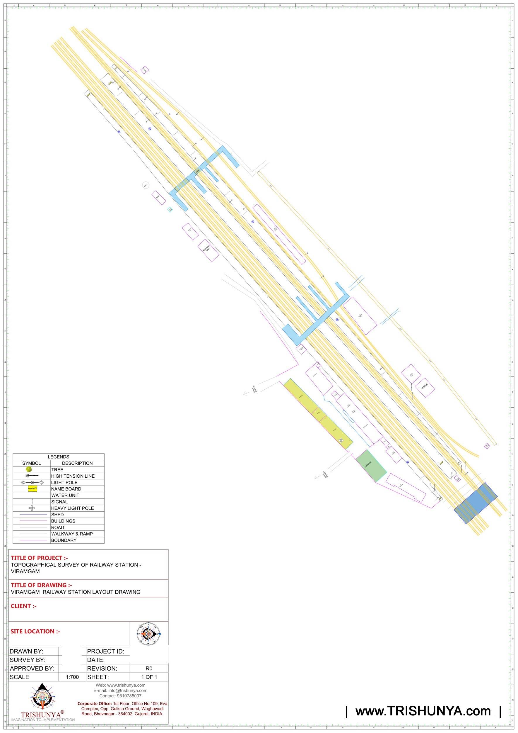
প্রজেক্টের আকার অনুযায়ী টপোগ্রাফিক সার্ভের হার
| প্রজেক্টের আকার | সাধারণ দর | বিশেষ বিবরণ |
|---|---|---|
| ৫ একরের কম | ₹১৫,০০০ থেকে ₹৩৫,০০০ প্রতি একর | নির্দিষ্ট মোবিলাইজেশন খরচের কারণে প্রতি একরে হার বেশি |
| ৫ থেকে ৫০ একর | মাঝারি দর, এলাকা বৃদ্ধির সাথে কমে | বাণিজ্যিক ও আবাসন প্রজেক্টের জন্য সর্বাধিক সাধারণ সীমা |
| ৫০ একরের বেশি | ₹৫,০০০ থেকে ₹১২,০০০ প্রতি একর | শিল্প পার্ক এবং বৃহদাকার অবকাঠামো প্রজেক্ট |
| ড্রোন ফটোগ্রামেট্রি | ₹১,২০০ থেকে ₹৩,০০০ প্রতি একর | DTM ও অর্থোমোজাইক অন্তর্ভুক্ত; GCP খরচ আলাদা হতে পারে |
জমির পরিমাপের বাইরে যেসব বিষয় মূল্য নির্ধারণ করে
সমতল ভূমিতে প্রতিদিন ৫ থেকে ১০ হেক্টর সার্ভে করা সম্ভব হয়। অন্যদিকে পাহাড়ি বা ঢেউ খেলানো জমিতে এটি কমে প্রতিদিন ১ থেকে ৩ হেক্টরে নেমে আসে, যা একই মানের ডেলিভারেবলসের জন্য খরচ ৩০ থেকে ৫০ শতাংশ পর্যন্ত বাড়িয়ে দেয়। সাইটের দূরত্বের ভিত্তিতে মোবিলাইজেশন খরচ ₹১৫,০০০ থেকে ₹১,০০,০০০ পর্যন্ত আলাদাভাবে ধরা হয় এবং এর সাথে ১৮ শতাংশ জিএসটি যুক্ত হয়।
NABL স্বীকৃত মানের ডেলিভারেবলস, যেমন অটোক্যাড ফাইল, DTM, কনট্যুর ম্যাপ, ক্রস-সেকশন এবং কন্ট্রোল-পয়েন্ট রিপোর্ট সহ কোটেশন সাধারণ রিপোর্টের চেয়ে কিছুটা বেশি মনে হবে। মূল্য যাচাইয়ের আগে কাজের পরিধি যাচাই করা জরুরি।
টপোগ্রাফিক সার্ভে কোটেশন সঠিকভাবে মূল্যায়ন করার নিয়ম
একটি নির্ভরযোগ্য কোটেশনে ফিল্ড সার্ভে, গ্রাউন্ড কন্ট্রোল পয়েন্ট (GCP), ডেটা প্রসেসিং এবং ডেলিভারেবলসের খরচ আলাদাভাবে উল্লেখ থাকে। আমাদের টপোগ্রাফিক সার্ভে কোটেশনে এই সমস্ত তথ্য স্পষ্ট থাকে। এছাড়া সীমানা নির্ধারণের প্রয়োজনে আমরা অস্পষ্ট চার্জ না দেখিয়ে সরাসরি DGPS সার্ভে যুক্ত করি।
টপোগ্রাফিক সার্ভে কোটেশনে সবচেয়ে কম মূল্যের অর্থ প্রায়শই সবচেয়ে কম ডেলিভারেবলস, সেরা ডিল নয়।
যে কোটেশনে গ্রাউন্ড কন্ট্রোল পয়েন্ট, মোবিলাইজেশন বা জিএসটি উল্লেখ থাকে না, তা প্রাথমিকভাবে কম মনে হতে পারে। সিদ্ধান্ত নেওয়ার আগে সম্পূর্ণ ব্রেকডাউন দেখে নিন।
আপনার প্রজেক্টের জন্য টপোগ্রাফিক সার্ভে কোটেশন প্রয়োজন?
আপনার সাইটের আকার, জমির ধরন এবং প্রজেক্টের পর্যায় জানান, আমরা একটি স্বচ্ছ এবং বিশদ কোটেশন প্রদান করব।
সচরাচর জিজ্ঞাস্য প্রশ্নাবলী (FAQ)
৫ একরের কম ছোট সাইটে সাধারণত ₹১৫,০০০ থেকে ₹৩৫,০০০ প্রতি একর খরচ হয়, যেখানে ৫০ একরের বেশি বড় শিল্প প্রজেক্টে এই দর নেমে ₹৫,০০০ থেকে ₹১২,০০০ প্রতি একরে দাঁড়ায়।
পাহাড়ি এলাকায় প্রতিদিনের সার্ভের অগ্রগতি কমে ১-৩ হেক্টরে নেমে আসে, যার ফলে কাজের সময় ও শ্রম বেড়ে মোট খরচ ৩০ থেকে ৫০ শতাংশ বৃদ্ধি পায়।
হ্যাঁ, বিশেষ করে বড় প্রজেক্টের ক্ষেত্রে। ড্রোন ফটোগ্রামেট্রির দর প্রায় ₹১,২০০ থেকে ₹৩,০০০ প্রতি একর, যা বৃহৎ এলাকায় প্রথাগত পদ্ধতির চেয়ে অনেক সাশ্রয়ী।
একটি সঠিক কোটেশনে অটোক্যাড ফাইল, ডিজিটাল টেরেন মডেল (DTM), কনট্যুর ম্যাপ, ক্রস-সেকশন এবং কন্ট্রোল পয়েন্ট রিপোর্ট অন্তর্ভুক্ত থাকা উচিত।
এটি সাধারণত সাইটের দূরত্ব ও যোগাযোগের উপর ভিত্তি করে ₹১৫,০০০ থেকে ₹১,০০,০০০ পর্যন্ত আলাদাভাবে হিসাব করা হয়।
মোবিলাইজেশন ও কন্ট্রোল পয়েন্ট সেটআপের নির্দিষ্ট খরচ ছোট জমিতে ভাগ হওয়ায় কার্যকর প্রতি একর দর বৃদ্ধি পায়।
হ্যাঁ, সমস্ত সার্ভে সেবায় ১৮ শতাংশ সরকারি জিএসটি প্রযোজ্য। কোটেশনে এটি বাদ থাকলে চূড়ান্ত বিল বেশি হতে পারে।
সম্ভব হলেও তা সার্ভে-গ্রেড নির্ভুলতা দেবে না। DGPS দ্বারা স্থাপিত GCP-ই বাস্তব স্থানাঙ্কের সাথে মডেলকে নির্ভুলভাবে যুক্ত করে।
এর অর্থ হলো সমস্ত ড্রয়িং, DTM এবং রিপোর্ট নির্দিষ্ট ইঞ্জিনিয়ারিং ও আইনি মানদণ্ড অনুসরণ করে প্রস্তুত করা হয়েছে।
কেবলমাত্র মোট অঙ্ক না দেখে ডেলিভারেবলসের তালিকা, নির্ভুলতার মাত্রা, কনট্যুর ইন্টারভাল, GCP কাজ এবং জিএসটি অন্তর্ভুক্ত আছে কিনা তা মিলিয়ে নিন।
এই হোয়াটসঅ্যাপ নম্বরটি শুধুমাত্র নতুন প্রজেক্ট সংক্রান্ত যোগাযোগের জন্য সংরক্ষিত। প্রশিক্ষণ বা চাকরির জন্য অনুগ্রহ করে যোগাযোগ করবেন না।