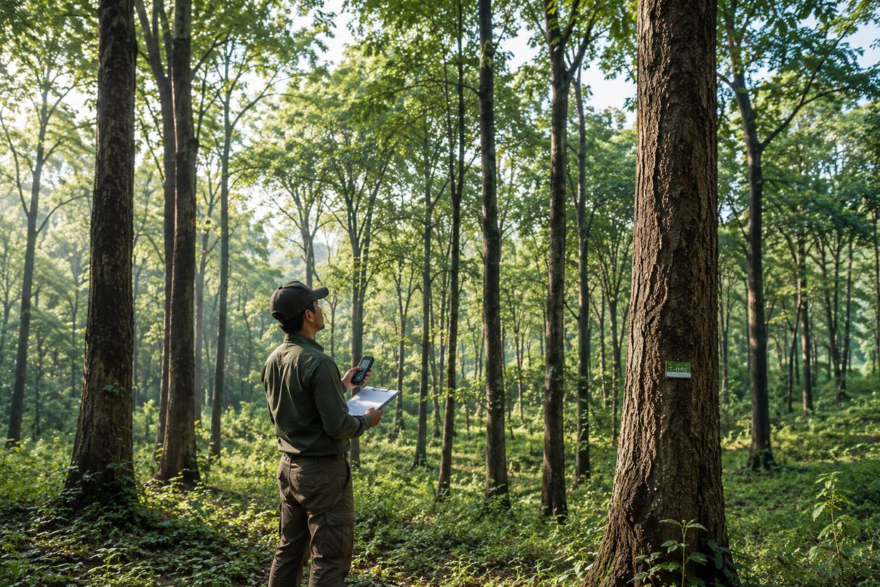
Tree Enumeration Handbook: GBH, GIS Tagging & Field Survey Guide
Everything a field crew or project engineer needs to run an accurate tree enumeration survey, from GBH measurement to GIS-ready deliverables, laid out as a practical reference rather than a theory lecture.
A stand of two hundred trees along a proposed highway corridor looks straightforward from a car window. On the ground, it is two hundred separate decisions: where exactly does the 1.3 metre girth line fall on a leaning trunk, is that sapling above or below the counting threshold, and which GPS reading actually belongs to which tag. Tree enumeration is where forest clearance approvals, compensatory afforestation cost, and project timelines get decided, and it is decided one measurement at a time.
This handbook lays out the practical side of running a tree enumeration survey: the methodology choices, the equipment that actually matters in the field, how girth and height are measured correctly, what data fields a defensible register needs, and how the whole exercise gets turned into a GIS layer a regulator or project engineer can actually use. It draws on the same structured approach we use across large-scale aerial and ground survey projects, where a corridor of any real length needs a repeatable field process, not ad-hoc counting.
Why tree enumeration is a precision task, not a headcount
Tree enumeration is the systematic counting, measurement, and geo-tagging of every tree within a defined project boundary. For roads, railways, transmission lines, and other linear projects, it is the dataset on which forest clearance and compensatory afforestation decisions get made. An undercount means the project runs into statutory trouble later. An overcount inflates compensation cost that did not need to be paid. Neither error is cheap to fix once the survey is closed out.
What makes this different from a casual walk-and-count is the level of consistency required across every tree, every day, every field team member. A girth measured 20 centimetres too high on the trunk, repeated across two hundred trees, is not a rounding error, it is a dataset a reviewer can reject outright.
Where this data gets used
Forest clearance applications, right-of-way assessments for transmission and pipeline corridors, EIA baseline studies, and municipal avenue tree census records all depend on the same underlying register.
What good data looks like
Every stem tagged, girth and species recorded against a fixed field list, and each record tied to a GNSS coordinate that a reviewer can independently verify on a map.
MethodologyAn enumeration register is only as strong as its weakest field. A missing coordinate or an ambiguous species entry can hold up an otherwise complete survey.
Field practice note, Trishunya survey teams
Total count versus sample plots
Two approaches dominate real fieldwork, and the right one depends on why the count is being done. For statutory forest clearance and compensation, a total enumeration, every tree counted and measured, is the standard requirement; an estimate is not acceptable when compensation is calculated per stem. For preliminary feasibility studies or vegetation density mapping over a large forest block, sample plot enumeration, where fixed-radius plots are measured and the density extrapolated, is faster and appropriate.
Every stem inside the defined corridor or boundary is walked, tagged, measured, and geo-referenced. This is the method regulatory authorities expect for forest clearance and compensatory afforestation calculations, since it leaves no ambiguity about how many trees, or which specific trees, are being compensated for. It is labour-intensive and works best on a chainage-based grid where each 100 metre block is closed out before the crew moves on.
Fixed-radius or rectangular plots are laid out at set intervals across a large forest block, and the density measured in those plots is extrapolated across the full area. This is considerably faster and suits early feasibility or vegetation density studies, but it is not a substitute for total enumeration wherever the output feeds into a legal compensation figure.
A repeatable field workflow
| Step | Activity | Field notes |
|---|---|---|
| 1 | Boundary demarcation | Mark the corridor or site limit using GNSS/DGPS reference points |
| 2 | Chainage layout | Divide the corridor into manageable segments, commonly 100 m blocks |
| 3 | Sequential tagging | Assign a unique tree ID as each stem is measured, tied to chainage and offset |
| 4 | Measurement | Record GBH, height class, canopy spread, species, and health condition |
| 5 | Geo-tagging | Capture coordinates with a handheld GNSS or RTK rover at each tree |
| 6 | Cross-verification | Reconcile the ground count against drone orthomosaic canopy count |
Girth at breast height, measured correctly
Girth at Breast Height, GBH, is the standard measurement used across Indian forestry and compensatory afforestation guidelines. It is the circumference of the trunk taken at 1.3 metres above ground level, with a flexible tape wrapped snugly, not stretched, around the bark. The 1.3 metre reference point is where most field errors creep in, particularly on sloped ground or irregular stems, so it is worth building a quick calculator into the daily routine rather than relying on memory.
GBH Diameter & Girth Class Calculator
Enter the tape reading taken at 1.3 m trunk height to get the equivalent diameter and the girth class band used in enumeration registers.
Handling irregular stems
- ✓Multi-stemmed trees: measure each stem separately if the fork is below 1.3 m; record the largest stem's GBH if the fork is above.
- ✓Buttressed or swollen-base trees: shift the measurement point above the buttress and note the adjustment in remarks.
- ✓Leaning trees: measure 1.3 m along the trunk axis, not vertically from the ground.
- ✓Trees on a slope: take the 1.3 m reference from the uphill side of the base.
| Class | GBH range | Growth stage |
|---|---|---|
| Class I | Under 30 cm | Sapling / young growth |
| Class II | 30 to 60 cm | Semi-mature |
| Class III | 60 to 100 cm | Mature |
| Class IV | Above 100 cm | Large / heritage-scale |
Need enumeration data your project can actually submit?
Our field teams pair GNSS-tagged ground survey with drone canopy cross-checks for corridor and site-level projects.
Equipment that earns its place in the bag
Enumeration accuracy is only as good as the instruments recording it. A working field kit balances precision against the pace needed to cover long corridors within a survey window, and it always includes a paper backup register in case a device fails mid-day.
| Equipment | Purpose |
|---|---|
| GNSS/DGPS handheld or RTK rover | Sub-metre to centimetre-level coordinate capture per tree |
| Diameter/girth tape | Measures GBH directly in centimetres at 1.3 m height |
| Hypsometer or clinometer | Estimates tree height without felling or climbing |
| Weatherproof tree tags and nails | Permanent unique ID per stem |
| Rugged tablet or mobile data collector | Digital form entry with offline GIS basemap |
| Drone (canopy cross-check) | Orthomosaic and canopy count validation over the block |
Why the drone cross-check matters
On dense plantation strips or forest patches, ground crews can miss stems hidden behind larger canopies or in difficult terrain. A drone-captured orthomosaic, processed for canopy segmentation, gives an independent overhead count that gets reconciled against the ground register. This is the same orthomosaic processing used across our broader survey work, applied here specifically to validate stem counts rather than terrain models. Discrepancies above a set threshold trigger a re-walk of that segment before the data is finalised.
Data structureWhat a defensible enumeration register contains
Every tree record carries a fixed set of attributes. Missing fields are the single most common reason enumeration data gets sent back during forest department review, so this list is treated as mandatory in the field, not filled in later from memory.
| Field | What to record |
|---|---|
| Tree ID | Unique tag number, tied to chainage/offset or plot ID |
| Species (botanical & local name) | Scientific name where identifiable, plus the regional common name |
| GBH (cm) | Girth at breast height, measured per the standard above |
| Height class | Estimated height band from clinometer sighting |
| Canopy diameter (m) | Average spread from two perpendicular readings |
| Health condition | Healthy, diseased, dead, or dying, with remarks |
| Coordinates | GNSS-captured position, WGS84 |
| Photograph reference | Linked field photo ID for verification |
Where a species cannot be confidently identified in the field, the correct move is to tag it as unidentified with a clear photograph, rather than guess. A wrong species entry is harder to correct later than an honest gap, especially where species identity affects compensation value under forest working plan schedules. On rural and forest-fringe corridors, involving a local forest guard for identification measurably improves accuracy for regional variants that do not match textbook descriptions.
From field to GISTurning the register into a usable GIS layer
Once field data is collected, every tree record is geo-referenced and structured into a GIS layer, which is what turns a paper register into a queryable, mappable asset. This connects directly to broader GIS solutions work, since the tree enumeration layer typically gets overlaid against the project alignment, forest compartment boundaries, or the client's existing GIS infrastructure. Each point feature carries the same fields recorded on the ground: Tree_ID, Species, GBH_cm, Height_Class, Canopy_m, Health, Chainage, Offset, and Photo_Ref, plus the geometry itself.
Download the full field guide
The complete Tree Enumeration Handbook, covering methodology, equipment, GBH and height measurement, species data fields, GIS tagging, digital workflow, reporting deliverables, and common field errors, is available below as a 10-page PDF. Use it as a printed field reference or a training document for new survey team members.
Common errors and the checks that catch them
| Common error | Quality check |
|---|---|
| Missed stems in dense clusters | Cross-check ground count against drone canopy count per segment |
| GBH measured at wrong height | Spot-check a sample of tags mid-survey; retrain if the 1.3 m point drifts |
| Duplicate or skipped tag numbers | Reconcile daily tag log against the digital record count each evening |
| Poor GNSS fix on coordinates | Set a minimum accuracy threshold in the app; flag and re-capture low-confidence points |
| Inconsistent species naming | Maintain a shared species reference list for the whole survey team |
Tree enumeration sits at the intersection of field botany, land surveying, and GIS data management. Done well, it produces a dataset that stands up to regulatory scrutiny and gives project teams a clear, defensible basis for planning around, or compensating for, every tree on site. If your project has a corridor or site boundary that needs this level of documentation, our field and GIS teams can scope the survey against your specific chainage, terrain, and submission requirements.
Planning a tree enumeration survey?
Send us your project corridor or site boundary and we will walk you through the field plan, equipment, and GIS deliverables.
💬 Get a Quote on WhatsApp Trishunya
Back to all articles
Trishunya
Back to all articles